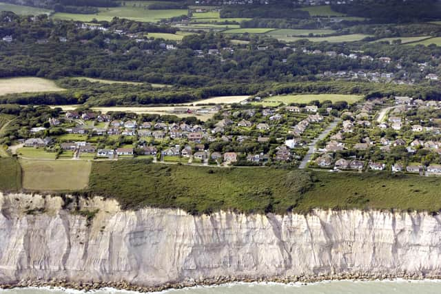
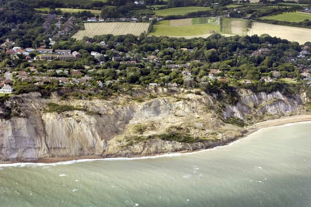
East Sussex area predicted to lose £26m of property due to coastal erosion
and live on Freeview channel 276
The new map of England’s coastline reveals the 21 villages and hamlets that will lose a total of £584 million worth of residential property to coastal erosion by the end of the century.
According to the study, the area around Fairlight Cove and Cliff End is expected to be one of the worst affected. This stretch of coastline is estimated to lose 43 homes collectively worth more than £26 million, it claims.
Advertisement
Hide AdAdvertisement
Hide AdOne Home’s England’s Communities Under Threat interactive map was plotted using existing Environment Agency data and Shoreline Management Plans (SMPs), which outline the risks to an area and whether it will be protected from erosion or not. The coastal communities identified by One Home that will lose the most homes are in Cornwall, Cumbria, Dorset, East Yorkshire, Essex, the Isle of Wight, Kent, Northumberland, Norfolk and East Sussex.

One Home chief executive Angela Terry said: “Sea levels are rising as global temperatures soar and so larger waves batter our coast during severe storms. These irreversible changes mean some cliff faces are crumbling fast.
“We can’t turn the tide or build a wall around the entire coast so we urgently need to help seaside communities to prepare for the damage that will come.
“Shoreline Management Plans (SMPs) are publicly available documents but most people are unaware of their existence. Many homeowners don’t know their properties are at risk or that decisions have been made about whether to protect them or not.
Advertisement
Hide AdAdvertisement
Hide Ad"SMPs are not statutory, so new developments can continue. Funding is not guaranteed so even where communities have been chosen to be ‘saved’ the money might not be there, giving people false hope that their home will be protected long-term.
“One Home’s aim with this map is to explain SMPs in an easy-to-digest way so that homeowners are sufficiently informed to make timely decisions about their properties to reduce future harm. Currently, for those homes at risk, there is no compensation scheme available. Owners might be asked to pay to demolish their homes while still paying their mortgage.”