
West Dorset Pub Walks
A trio of gorgeous countryside walks around the West Dorset villages of Powerstock, Loders and Netherbury…
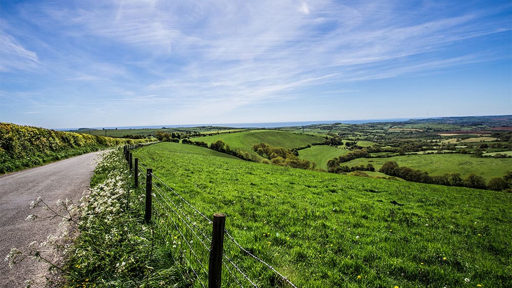
The rolling hills of West Dorset are woven by numerous tracks and trails. Adored by walkers, these green lanes, valley paths and holloways run deep into the countryside, meandering beneath ancient boughs and along sun-dappled riverbanks.
We’ve followed the waymarks and boundary stones to share with you three lovely West Dorset walks, all with cosy country pubs en route…
Powerstock to Eggardon Hill (Approx. 6 miles)
Pick up the footpaths and lanes along this idyllic route that starts and finishes in the picturesque village of Powerstock on the fringes of the Dorset Downs.
Follow Kings Lane out of the village, passing the Kings Lane Orchard, which is filled with wildflowers during the spring and summer months and rounded by a brook where otters are sometimes seen. Continuing down the hill, you’ll encounter a leafy track bound for Castle Mill Farm running around the lower reaches of Castle Hill; the site of a former motte and bailey castle which survives today as a prominent grassy hummock overlooking the valleys of the Mangerton River.
After crossing Mangerton Brook, follow the waymarks (marked Eggardon Hill) to an abandoned railway bridge which will lead you onto a farm track and eventually Castle Lane where the going gets hilly. Expect some spectacular sweeping views on your approach to Eggardon Hill, the leafy clusters of Powerstock Common – a former royal hunting ground – can be admired to the west. A winding bridleway leads you to the lower slopes of this prominent Iron Age hill fort. Eggardon Hill was also the former lair of renowned west country smuggler and gentle giant, Isaac Gulliver, who once used the hill as a landmark bearing for his roving fleet of luggers. Once you’ve reached the summit, you’ll be able to marvel at one of the region’s most stunning panoramas, encompassing the Marshwood Vale, and on a clear day, stretching as far as Lyme Bay.
As you descend the hill, you’ll see to the east North Eggardon farm, Gulliver’s former residence. Follow the hedgy farm track all the way to Spyway Road and the welcome sight of The Spyway Inn, a former smugglers’ haunt just outside the pretty riverside village of Askerswell and the ideal place for some ‘R & R’. From here, we follow the signs back to Powerstock. You’ll pass through the pretty village of Nettlecombe, home to the Marquis of Lorne, a handsome 16th century country inn popular among walkers. Not far from the pub, with the rooftops of Powerstock now in sight, is a stile leading to a wooded path and water meadow. Cross the wooden bridges back into Powerstock, home of the Three Horseshoes, another of the parish’s cosy pubs.
Loders to Eggardon Hill (Approx. 8 miles)
Another of the many circular walks that take in the far-reaching views of Eggardon Hill. The route begins in, and returns to, the charming village of Loders nestled in the valley of the River Asker and sheltered by the hills of Boarsbarrow and Waddon.
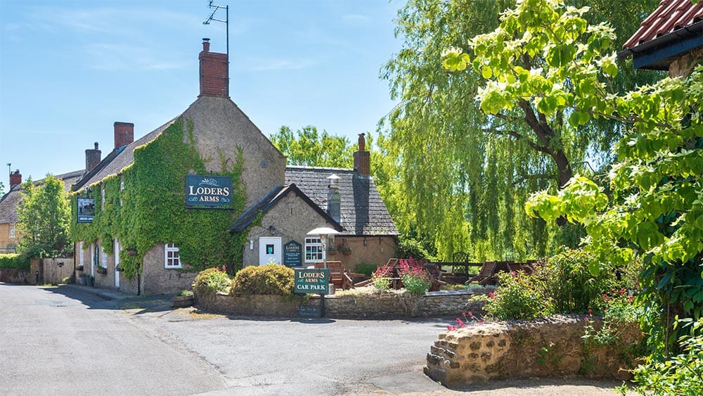
Begin your walk along New Street Lane, setting for the Loders Arms, a traditional countryside pub with a lovely beer garden where you can enjoy beautiful views of the West Dorset hills. When you reach the red telephone box, bear off to the right following the sign to the neighbouring village of Uploders. Continuing past the row of terraced cottages, fork left at the next junction, sticking to New Street Lane which passes under an abandoned railway bridge. The lane becomes a bridleway which meanders alongside the River Asker and cottage gardens of Uploders, home of another favourite ramblers’ pub, the Crown Inn.
This bridleway runs just shy of a mile, feathering out at Upton Manor Farm where you need to bear right down to the road and look out for the public footpath. Crossing farmer’s fields and a country lane, the bridle path passes a cluster of cottages before opening out into fields and reconvening with Spyway Road. Less than 100 yards down the road is The Spyway Inn, a welcome sight for weary walkers.
From the pub, follow a series of footpaths, country lanes and tree-line trails to the Iron Age fort on Eggardon Hill, where you can enjoy some of the most spectacular views in Dorset, a reward worthy of all your hard work.
King’s Lane lies at the northern end of the fort and marks the beginning of your return leg. Follow it westwards until you reach the village of Nettlecombe. Continue along the lane through the village, passing attractive old stone cottages, until you reach a junction marked by a traditional red telephone box. Turning right, you’ll soon encounter the Marquis of Lorne, another of the friendly village pubs that help mark out this trail.
Opposite the pub, a track will lead you down to a road and some farm buildings. Bear right and head for Mappercombe Manor. Stick to the path, travelling in a westerly direction, until you arrive at the fringes of a small wood. Cut across the meadow to the old railway track, and follow the track onto the sloping pastures of the Peascombe Nature Reserve (on the outskirts of Loders) walking beneath the ancient boughs of ash and sweet chestnut trees, and finally picking up a narrow pathway back to the familiar sight of New Street Lane and the beginning of your walk.
Netherbury to Stoke Abbott to Beaminster (Approx. 6.5 miles)
A stunning walk along pretty lanes, hills and valley paths which takes in part of the Wessex Ridgeway and Gerrard’s Hill.
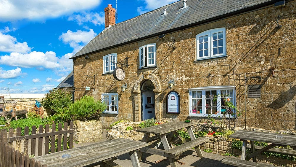
Begin your walk in the West Dorset village of Netherbury set on the banks of the River Brit and characterised by its pretty cottages. Head for Patley Wood on the southern fringes of the village and enjoy a leafy walk to Hingsdon Lane where you’ll pick up a series of footpaths snaking through a woodland and across a babbling brook. Cutting through two grassy meadows, you’ll arrive at a farm track which you should follow for 200 yards before branching off on the trail on your right, headed towards a wooded thicket. Cross the stream and leave the path to follow the farm track to the charming village of Stoke Abbott, home to The New Inn, a handsome 17th century freehouse with a spacious garden.
From The New Inn, continue east along the village’s main thoroughfare for a-couple-of-hundred-yards and then fork left onto Mason’s Lane. Follow the lane for half-a-mile to Chart Knolle farmhouse where you pick up the Wessex Ridgeway. Passing through the gate, you’ll begin your ascent of Gerrard’s Hill, enjoying sweeping views of Dorset’s classic rolling countryside all the way to its summit. Continue east along the ridgeway with the rooftops of Beaminster and St Mary’s Church tower in the distance. Follow the path through the river valley to the broadleaves of Pucketts Wood, entering Beaminster village via Half Acre Lane.
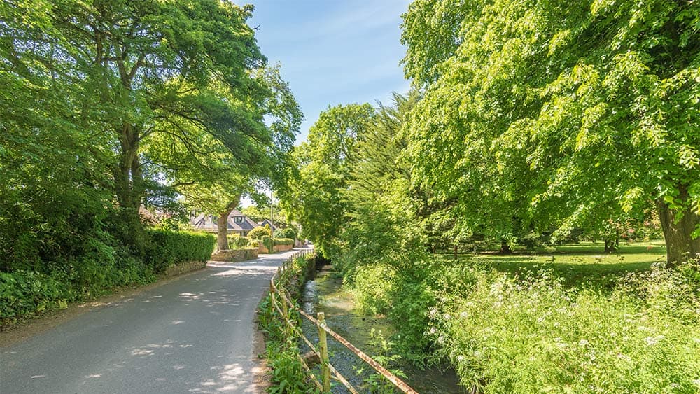
Beaminster lies in the heart of a farmland valley close to the source of the River Brit. Follow Hogshill Street to the village square to find The Red Lion and the opportunity for a lovely pub lunch. The village also plays host to a couple of stylish bistros and a handful of cosy tearooms. From The Square, walk along Church Street and then down St Mary Well Street to pick up the Brit Valley Way. This route runs along the wooded banks of the river for a mile before finding the orchard gardens and lanes of the village of Netherbury, back to where you started.
The nearest local pub, The Hare & Hounds, lies in the neighbouring hamlet of Waytown and can be found by way of Slape Hill or a footpath running from the end of Netherbury’s Hatchlands Lane down to River Cottage and on to Slape Mill.