This hike to the remains of an old coal mining town (located on White River School District property) is relatively easy, albeit often very muddy in all seasons. Depending on the direction you arrive at the town from, there are some ruins left to view along the way, making it a fun adventure for children. The path follows an abandoned rail grade, most of which (from the western approaches) is owned by Pierce County Parks as part of the future Foothills trail.
If you look around the site enough, you can find the remnants of an old bridge abutment where a wagon bridge used to span the river. The old hotel was sited here. Up the hill opposite the obvious townsite field, you will find the remnants of the old school basement. It is interesting to note that much of the original wood from this school structure was recycled in the 20's and used in building the Carbon River Ranch, a building a few more miles down the road towards the Carbon River entrance that will soon be the park's new visitor greeting station and maintenance yard, and eventually, a new campground to replace the lost Ipsut car campground.
Please be respectful of the site when visiting, and treat it as an important historical site. Leave things as you find them for others to enjoy. If you see illegal hunting camps on the townsite, please report them to the White River SD. If you visit the easier to access Fairfax townsite across the river and see any illegal hunting activity, please report it to Pierce County Parks.
Melmont Ghost Town

-
 Length
- 6.0 miles, roundtrip
-
 Elevation Gain
- 100 feet
-
 Highest Point
- 1,360 feet
Mowich Lake Road is closed for the winter season.

Parking Pass/Entry Fee
None
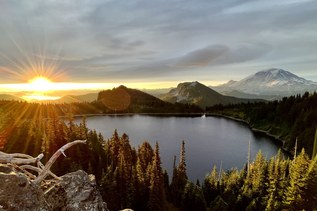
A great exploratory hike to an old coal mining ghost town, with views of the underside of the Fairfax bridge.
Continue reading
Hiking Melmont Ghost Town
Map & Directions
 Trailhead
Before You Go
Mowich Lake Road is closed for the winter season.
Parking Pass/Entry Fee
NoneWTA Pro Tip: Save a copy of our directions before you leave! App-based driving directions aren't always accurate and data connections may be unreliable as you drive to the trailhead.
Getting There
There are three possible approaches to the town site.
Take SR165 from Buckley out past Carbonado: Cross the bridge back to the north side, and you can hop the rail on the east side of the bridge (the side against rock), and you will find a steep, but manageable trail down to the old track bed. Head east, away from Carbonado to get towards Melmont. There is a mud pit just after the dynamite shed as you enter White River SD property. It can be extremely bad most of the year. The best time to go through it is during high summer. The trail splits past the dynamite shed and you take the left trail to access the ghost town.
The second route is a mile back towards Carbonado. As you pass the main town street heading towards Rainier, you will see a series of three pullouts next to the highway, two are marked by white poles, the third with a gate. This is the western end of the abandoned rail line, and it is owned by Pierce County Parks. Park well off the freeway, and enjoy an easy stroll of about a mile towards the bridge, where you will meet up with the first access point. Continue on to Melmont.
From the east: Drive down highway 165 until you come to a turnoff to the Manley-Moore road on the left. Continue down the winding road until you cross a low, one-lane bridge over the Carbon river. You will see a stub road in the left. Park here, out of the way of the gate and road. Walk down to the bridge, and pick up the trail heading down to the river and then to the east. This trail can be rough, and is subject to washouts. Proceed cautiously.