

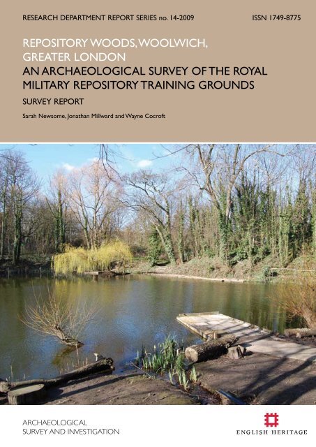
REPOSITORy wOODS, wOOlwICH, gREATER ... - English Heritage
REPOSITORy wOODS, wOOlwICH, gREATER ... - English Heritage
REPOSITORy wOODS, wOOlwICH, gREATER ... - English Heritage
- No tags were found...

You also want an ePaper? Increase the reach of your titles
YUMPU automatically turns print PDFs into web optimized ePapers that Google loves.
Research Department Report Series14- 2009REPOSITORY WOODSWOOLWICHGREATER LONDONAn Archaeological Survey of the Royal Military RepositoryTraining GroundsSarah Newsome, Jonathan Millward and Wayne CocroftNGR: TQ 4255 7814© <strong>English</strong> <strong>Heritage</strong>ISSN 1749-8775The Research Department Report Series incorporates reports from all the specialist teams within the <strong>English</strong><strong>Heritage</strong> Research Department: Archaeological Science; Archaeological Archives; Historic Interiors Research andConservation; Archaeological Projects; Aerial Survey and Investigation; Archaeological Survey and Investigation;Architectural Investigation; Imaging, Graphics and Survey, and the Survey of London. It replaces the formerCentre for Archaeology Reports Series, the Archaeological Investigation Report Series and the ArchitecturalInvestigation Report Series.Many of these are interim reports which make available the results of specialist investigations in advance of fullpublication. They are not usually subject to external refereeing, and their conclusions may sometimes have to bemodified in the light of information not available at the time of the investigation. Where no final project reportis available, readers are advised to consult the author before citing these reports in any publication. Opinionsexpressed in Research Department reports are those of the author(s) and are not necessarily those of <strong>English</strong><strong>Heritage</strong>.Requests for further hard copies, after the initial print run, can be made by emailing:Res.reports@english-heritage.org.ukor by writing to:<strong>English</strong> <strong>Heritage</strong>, Fort Cumberland, Fort Cumberland Road, Eastney, Portsmouth PO4 9LDPlease note that a charge will be made to cover printing and postage.© ENGLISH HERITAGE 14 - 2009
SUMMARYBetween January and April 2008 <strong>English</strong> <strong>Heritage</strong>’s Archaeological Survey and Investigationteam undertook a detailed archaeological survey of Repository Woods and the practicefortification that forms its eastern boundary, both of which were formerly part of the RoyalMilitary Repository, Woolwich. The work was undertaken as part of the research for theSurvey of London’s forthcoming volume on Woolwich parish and complements detailedarchitectural and historical research undertaken by <strong>English</strong> <strong>Heritage</strong> on the WoolwichRotunda, which was moved from Carlton House to its present location, close to theeastern boundary of the Repository, in 1818.The research has revealed the unique role that the Royal Military Repository played intraining soldiers in the mounting and movement of heavy artillery at the start of the19 th century and has shown that the surviving landscape of tracks and ponds, later toprovide a picturesque setting for the Rotunda, was a military creation with both practicaland recreational uses. Concurrent with the re-erection of the Rotunda, a linear practicefortification was constructed along the eastern boundary of the site which, though it clearlyhad a primary practical function, served to enhance the setting of the building. The surveyrecorded the earthwork remains of training batteries and fortifications dating from thestart of the 19 th century onwards as well as slit trenches and evidence of other activitiesfrom the 20 th century, highlighting the area’s continued use as a training facility. RepositoryWoods and the Napier Line compound are the property of the Ministry of Defence andthere is no public access.CONTRIBUTORSSarah Newsome (<strong>English</strong> <strong>Heritage</strong> Archaeological Survey and Investigation – Cambridge),Jonathan Millward (EPPIC student) and Wayne Cocroft (<strong>English</strong> <strong>Heritage</strong> ArchaeologicalSurvey and Investigation - Cambridge) undertook the fieldwork. Sarah Newsome wrotethe report. Derek Kendall took photographs and Deborah Cunliffe completed the surveydrawing.ACKNOWLEDGEMENTS<strong>English</strong> <strong>Heritage</strong> would like to thank the Royal Artillery, particularly Major Mike Gleeson, forgiving access to the restricted areas of the Napier Line compound and Repository Woods.Thanks also go to John Barter and the Dell Angling Society who were so welcoming andprovided useful information. The authors would also like to thank Peter Guillery and SusanSkedd for sharing their background research, Andrew Williams for his useful contributionsand Paul Evans at Firepower for all his kind help.ARCHIVE LOCATIONThe project archive is located at the National Monuments Record, SwindonDATE OF SURVEYThe survey was undertaken between January and April 2008.CONTACT DETAILS<strong>English</strong> <strong>Heritage</strong>, Brooklands, 24 Brooklands Avenue, Cambridge, CB2 8BUSarah Newsome Tel: 01223 582771. Email: sarah.newsome@english-heritage.org.uk© ENGLISH HERITAGE 14 - 2009
CONTENTSINTRODUCTION 1Background to project 1TOPOGRAPHY AND GEOLOGY 3PREVIOUS RESEARCH 4DOCUMENTARY EVIDENCE FOR THE HISTORY OF THE SITE 5The Royal Artillery in Woolwich 5History of the Repository Grounds 5The development of the linear practice fortification 13Repository Grounds complete with fortification and Rotunda 17The decline of the Repository 23Repository Woods in the Second World War and beyond 24DESCRIPTION AND INTERPRETATION OF THE REMAINS 26The 19 th -century Repository 26The 20 th -century Repository 35Later 20 th century training facilities 41DISCUSSION AND CONCLUSIONS 42METHODOLOGY 45REFERENCES 46OTHER SOURCES 48Appendix 1Location details of Royal Artillery Historical Trust photographs 56© ENGLISH HERITAGE 14 - 2009
INTRODUCTIONBackground to projectIn January to April 2008 <strong>English</strong> <strong>Heritage</strong>’s Archaeological Survey and Investigation teamundertook a detailed archaeological survey of an early 19 th -century training fortificationand the nearby training grounds, known as Repository Woods, which were bothoriginally part of the Royal Military Repository, Woolwich. This was undertaken as partof a wider study of the open spaces of Woolwich which will be incorporated into theSurvey of London’s forthcoming volume on the parish. The work also complementsextensive architectural and historical research undertaken by <strong>English</strong> <strong>Heritage</strong> (Cole etal 2009) into the Woolwich Rotunda, which was moved from Carlton House to its siteat the eastern side of Repository Woods in 1818. The departure in 2007 of the RoyalArtillery from Woolwich after nearly 300 years also provided a suitable opportunity toundertake the survey before the new occupiers arrived and any potential changes of useoccurred.Woolwich is located 10km south-east of central London, to the south of the RiverThames. Repository Woods and the training fortification earthwork are situated onthe western side of Woolwich parish on its boundary with Charlton, to the west ofWoolwich Barracks and at the north-west corner of Woolwich Common (Figure 1).Repository Woods is an area of deciduous woodland. Its eastern boundary is definedby the earthwork remains of the training fortification. To the south is the Napier Linecompound, now occupied by units of the household division, but formerly the site ofthe Royal Military Repository buildings. The northern side of the woodland is boundedby Hillreach road which becomes Little Heath as it heads west. The western boundaryis marked by housing and to the south by Charlton Cemetery. The boundary betweenWoolwich and Charlton parishes runs down the western side of the woodland.The aim of the project was to provide an accurate plan of the archaeological featureswithin Repository Woods, and of the training fortification to the east, in order to assessthe survival of features related to the 19 th and 20 th century training activities in the area(Figure 35). As well as contributing to the Survey of London's research, this informationwill allow better understanding and future management of the Repository Grounds andof the landscape context of the grade II* listed Rotunda building. The survey involvedundertaking a detailed measured survey of the all the earthworks and structures withinRepository Woods, as well as of the training fortification earthwork, at 1:1000 scale usingelectronic techniques (see Methodology). The Rotunda compound was not surveyed.The site is currently occupied by the Ministry of Defence and there is no public access toRepository Woods, though the training fortification is visible from the public highway tothe east.The training fortification has sometimes been known as the ‘Napier Line’ but the authorshave not found any historical evidence for the term.© ENGLISH HERITAGE14 - 2009
Figure 1: The location of the survey area. © Crown Copyright. All rights reserved. <strong>English</strong><strong>Heritage</strong> 100019088.2009© ENGLISH HERITAGE14 - 2009
TOPOGRAPHY AND GEOLOGYThe survey area consists of undulating terrain which drops from a height of 45m AODto 25m AOD from south to north, reflecting an underlying change from the BlackheathPebble Beds to the Woolwich Beds across the site (British Geological Survey 1998). Thearea is characterised by a series of long narrow valleys. A now-culverted stream runsinto the southern end of the site and feeds the series of man-made ponds.Figure 2: The incised topography of the Repository Grounds in relation to the location ofthe Rotunda to the east (derived from 5m digital terrain data - areas of lower elevationare shown in darker blues) Height data licensed to <strong>English</strong> <strong>Heritage</strong> for PGA, through NextPerspectives.© ENGLISH HERITAGE14 - 2009
PREVIOUS RESEARCHThe area has been under military control since the Royal Military Repository tookpossession of the land sometime in the late 1700s, though it was accessible to the publicuntil the early 20th century. Subsequent restrictions in access mean that no previousarchaeological research has taken place within the survey area and no archaeologicalremains or finds are recorded on the National Monuments Record or the GreaterLondon Sites and Monuments Record. The Woolwich Rotunda is a Grade II* ListedBuilding (200360) and the Royal Artillery Institute Observatory (200361), Repositorygatehouse (200508) and northern boundary wall (200407) are all Grade II ListedBuildings.Research into the Rotunda over a number of years by <strong>English</strong> <strong>Heritage</strong> staff (Jon Clarke,Emily Cole, Susan Skedd) has highlighted a great deal of documentary material relating tothe Royal Military Repository and its grounds and a report drawing together this work isforthcoming (Cole et al 2009).© ENGLISH HERITAGE14 - 2009
DOCUMENTARY EVIDENCE FOR THE HISTORY OF THE SITEThe broader military presence in Woolwich has a long and established history of whichonly a brief resume will be provided in this report.This section draws on extensive background research undertaken by Susan Skedd andEmily Cole (2008) into the Rotunda’s history at Woolwich.The Royal Artillery in WoolwichThe establishment of the Royal Artillery in Woolwich was preceded by the RoyalDockyard, established in 1512 (Skedd 2008, 3), and the transfer to Woolwich of fireworkand munitions activities in the mid 17 th century. During Henry VIII’s reign the ordnanceand artillery activities which were to later become the Royal Arsenal were established ona site known as the Warren (Skedd 2008, 3) close to the river. The Royal Artillery wascreated by Royal Warrant in 1716 in order to provide to two companies of professionalartillerymen and thereby alleviating the problems and expenses of having to recruit andtrain gunners as and when conflict arose (Timbers 2008, 22). The training and educationof these soldiers then became an issue and in 1741 the Board of Ordnance formed amilitary academy in Woolwich (Timbers 2008, 25) based at the Warren. Howevertowards the end of the 18 th century, the expansion of the Board’s manufacturing activitieswas putting pressure on space at the Warren and plans were made to move the cadetssouth to the edge of the Common. This move instigated the construction of an arrayof new buildings, including the New Barracks, completed 1777, and the Royal MilitaryAcademy, built 1806 (Timbers 2008, 62).History of the Repository GroundsBefore the Royal Military RepositorySmall-scale maps from the mid-18 th century show that the area of the future RepositoryGrounds was on the eastern edge of a large woodland called Hanging Wood whichencompassed parts of Woolwich and Charlton parishes (e.g. Andrews, Drury andHerbert 1769). Immediately to the east of Hanging Wood were a cluster of buildings,identified on later maps (e.g. TNA:PRO MPHH 1/571) as Bowater’s Farm, located at thecross roads where Artillery Place and Repository Road now meet (Figure 3).The Board of Ordnance began to lease land from the Bowaters in or around 1773 buta map which may have been produced to accompany these transactions (TNA:PROMPH 1/562) shows the land where the barracks were later built, rather than the futureRepository Grounds to the east. Interestingly this map also shows Mulgrave Pond, withthe land between it and Mr Bowater’s Farm to the west being labelled ‘Part of the Park’.It seems more likely that one of two maps of the future Repository Grounds apparentlydating to or after 1788, one surveyed by Lt Peter Couture RE (Figure 3) and one by‘gentlemen cadets’ (TNA:PRO MPHH 1/571; TNA:PRO MPH 1/235), relate to the area’sacquisition by the Board of Ordnance particularly as the survey was undertaken by aRoyal Engineer, though the title ‘An Accurate Survey of the Ground adjoining to the© ENGLISH HERITAGE14 - 2009
Barrack Field at Woolwich, on which the Royal Artillery was reviewed the 9 th July 1788’leaves a question mark over the exact date of the survey.Figure 3: Map from circa 1788 showing the area that was later to become the site of theRoyal Military Repository. NB North is to the bottom of the image. The National Archives:Public Record Office MPHH 1/571 (1)Despite suggestions that the Repository Grounds were formerly part of Bowater Park(Anon. 1913, 64) the 1788 map shows hedged fields, some of which contain light treecover (TNA:PRO MPHH 1/571). This suggests a mixed landscape of arable cultivationand pasture. The land may have been attached to ‘Mr Bowater’s Farm’, which asmentioned above, is marked on the same plan. It is worth noting that the ponds shownon this 1788 plan are not those which were constructed and survive in the Repository,© ENGLISH HERITAGE14 - 2009
ut historic Ordnance Survey maps (3rd edition 25 inch 1916) suggest that the largest,located immediately to the west of the gun park, survived into the 20 th century. It hadbeen infilled by 1946 when aerial photographs show it had been in use as allotmentgardens for some time (RAF CPE/UK1803 5290 25-OCT-46).The development of the Royal Military RepositoryThe Royal Military Repository at Woolwich was developed by William Congreve theelder (1743-1814) as a ‘school of methods of mounting and dismounting ordnance’(Marsh 1986, 413). He had been heavily influenced by his experiences whilst a Captainin the Royal Artillery and by the difficulties in manoeuvring heavy ordnance that hehad encountered in Canada during the Seven Years’ War (1756-63) (Skedd 2008, 5).Consequently in 1774, Congreve devised an illustrated programme of exercises whichinvolved manoeuvring:Field Pieces over Ditches, Ravines, Inclosures or Lines … To mountor dismount heavy Guns, when no Gyn is at hand; to get the Guns onBatteries with a far less number of Men than are usually employed indrawing them upon their platforms by bodily strength only. To raiseany Carriages that may be overset on a march etc. (RAHT CollectionRA/20) (Skedd 2008, 6),and which became compulsory at the end of 1778 (Skedd 2008, 6).Figure 4: Cadets undertaking ‘Field gun drill’ for an ‘Armstrong 12 pound breech loader’ atthe eastern end of the northern-most Repository shed. Though not signed the photographis probably one of the series taken by John Spiller around 1858 to illustrate the RepositoryExercises (see RAHT Collection AL 933). Courtesy of the Royal Artillery Historical Trust (RAHTCollection AL27/10)© ENGLISH HERITAGE14 - 2009
The Repository exercises have been described as, ‘a school of ingenuity in the applicationof mechanical principles’ in the effective use of ‘ropes, pulleys, levers and gravity’ tomanoeuvre heavy ordnance (Kaestlin, JP in Skedd 2008,6). This is an observation thatwas certainly backed up by General James Pattison in a letter dated 23 Jan 1775 wherehe says of Congreve's work ‘he soon reduced the business to a much greater simplicitythan we before had any idea of’ (RAHT Collection MD939/16) and later illustrated bythe series of photographs taken by John Spiller in and around 1858 which document theexercises (RAHT Collection Albums 933 and 27, e.g. Figure 4). Congreve’s innovativetraining programme was highly successful and was not followed until 1812 by a similarprogramme for the Royal Engineers (Skedd 2008, 7).Though the Royal Military Repository as an institution was created in 1778 (Duncan1872, 307) (the same year that Congreve was made ‘Superintendent of the MilitaryMachines’ (TNA:PRO WO 47/91)), it is not clear at exactly what date the RepositoryGrounds were acquired as the institution was initially established at the Warren. Theland, which closely resembled the terrain that which Congreve had encountered inCanada (Skedd 2008, 5), may have first become available as part of the part of theBowater Estate that was leased by the Board of Ordnance in 1773 (Timbers 2008, 30)but, as previsouly stated, the Repository Grounds are not included in what appears tobe the associated survey (TNA:PRO MPH 1/562). Two years later, General Pattisonoffered some sand pits in Woolwich, owned by his brother, for the Repository exercises,stating that there was ‘a great variety of unequal broken ground, furnishing many differentinclined plans, even to perpendicular ones, or precipes, as also some suitable ravines, orhollow ways, where we might have an opportunity of trying many Experiments’ (RAHTCollection RA/20). This might suggest that the area that later became known as theRepository Grounds was not available for these exercises until at least 1775. The sandpitswere located to the east side of the barracks (P Guillery, pers comm) but it is not knownwhether Pattison attempted Congreve’s exercises there. The land appears to havebecome the property of the Board of Ordnance between 1802 and 1804, transferredas part of a number of Acts of Parliament (Vincent 1888, 391-392) though, regardlessof what exact date the grounds were first purchased or leased, it is clear that this wasa phased process as correspondence in the Engineers’ papers shows moves were beingmade to purchase pieces of land to ‘complete’ the Repository in 1809, some years afterthe first buildings were constructed (TNA:PRO WO 55/756).In his 1872 History of the Royal Regiment of Artillery, Duncan notes that the RepositoryGrounds were later (though no date is specified) given over ‘solely for instruction inthe management of heavy ordnance but when it was first opened, the sharp turns andsteep inclines of the Repository Grounds were made use of in training the drivers to turnand manage their horses’ (Duncan 1872, 307). The 1788 maps do not show evidenceof any immediate alterations to the landscape in these early days of the Royal MilitaryRepository, though it is possible that they had little impact on the area as the main focusof activity seems to have remained at the Warren in this period.Plans of new Repository buildings were given royal approval in May 1781 (TNA:PROMPH 1/752) but Kaestlin (RAHT Collection MD939/16) implies these were at theArsenal, where the Repository was originally established. This seems likely as buildings© ENGLISH HERITAGE14 - 2009
shown on the Sandby view dating to the late 18th century (British Museum) are differentto those shown on later photographs and described in later Ordnance Statementsof Lands and Buildings (TNA:PRO WO55) on the later site of the Repository. Mapevidence shows that the four Repository Sheds had been built by 1804 (TNA:PROMPHH 1/244/1/4). A 1799 map (British Library Online OSD 130/6) also shows thebuildings but these may be later additions to the map base as the move to the sitewest of Barrack Field was probably prompted by the availability of £80,000 which hadbeen provided to replace buildings lost in a fire at the Warren in 1802 (Skedd 2008,14; TNA:PRO WO 47/2,573, p.1047; Kaestlin RAHT Collection MD939/16). Three ofthe buildings were used for ‘travelling guns, carriages and stores’ and the fourth wasused as offices (TNA:PRO WO 55/2449). By 1804 the field boundaries had also beenremoved, presumably to facilitate the use of the area for the Repository exercises. Theguard house to the far south close to the ha-ha at the original entrance to the RepositoryGrounds was built in 1806 (NMR WORK 43/747) by which date the eastern boundaryand approach road had also been built (TNA:PRO WO 55/2355). It is worth noting thatthe rest of the boundary to the Repository was defined by 1811 (TNA:PRO MPH 1/32/1)and that the modern boundary to the site still largely follows this line. Whether the brickwall that survives on the northern and western sides of the grounds is as early as 1811is difficult to asertain from the map evidence but Board of Ordnance correspondencediscussing the building of a wall at the northern boundary of the site in the period 1807-1809 seems to suggest that this is possible (TNA: PRO WO 55/756).Map evidence appears to suggest that major landscaping in the Repository Grounds,such as the creation of ponds, took place at some time between 1806 and 1808, underthe auspices of the Royal Military Repository, presumably for the specific purposeof recreating the type of terrain over which the heavy ordnance might need to betransported. By 1808 the largest pond had been created as well as two smaller pondsto the south (TNA:PRO MPHH 1/189/4), though these are not the two smaller pondsthat now exist on the site but were located further south in the south-western corner ofthe survey area (Figure 5). A bridge is apparent crossing the largest pond and the islandis also visible. By 1815 a process of enlarging the main pond was in progress (TNA:PROMPH 1/507/3-4) and between 1815 and 1827 (ibid; WO 55/2703) the two smaller pondsvisible today were probably constructed. These are described as the ‘SummerhousePond’ and the ‘Lower Pond’ in later documents (RAHT Collection MD93). By 1932it appears that the pond located at the northern end of the Repository, known as the‘Barrier Pond’ (RAHT Collection MD93) was probably built but it was short-lived andhad been infilled by the late 1860s. There is an early reference to the ponds being usedfor military exercises in E. W. Brayley’s The beauties of England and Wales (1808), in whichhe states that ‘on the west side of the Barracks is a piece of water where experimentswith gunboats, &c., are occasionally made’. It seems unlikely that these would haveoccurred on the pond ‘left in reserve for Mr Bowater’ so it is likely that the piece ofwater referred to is the largest of the Repository Ground ponds (TNA:PRO MPHH1/180/2). The shed for the carriages of the Royal Horse Artillery had also been built by1815 (TNA:PRO MPH 1/507/3-4).The 1808 and 1815 maps (TNA:PRO MPHH 1/189/4; MPH 1/507/3-4) show othersignificant developments such as the construction of a complex network of paths and© ENGLISH HERITAGE14 - 2009
tracks around the grounds and features which may represent batteries or other artillerytraining structures (Figure 5), such as the earth and wood casemate construction shownon later photographs (RAHT Collection AL27/40-48; Figure 6) and the structuresdescribed as the ‘West batteries’ in later lists of the exercises (RAHT Collection MD 93).Figure 5: Map of 1808 showing the Royal Military Repository with sheds, guardhouse, steppedboundary, ponds, paths and what appear to be training batteries. The National Archives:Public Record Office MPHH 1/189/4.Though the particular location is not specified, experiments with ‘traversing platforms’seem to have been undertaken as early as May 1805 and by 1807 evidence exists ofCongreve’s wish to create purpose-built training structures in the Repository, such as abrick tower for teaching ‘several modes of escalading works’ (TNA WO 55/756). Plansof this tower survive (RAHT Collection MD213/13) though it is not clear if it was everbuilt. Of particular note from the map evidence (TNA:PRO MPHH 1/189/4 – Figure5; MPH 1/507/3-4) is the section of ditch and bank presumably constructed for theRepository exercises located immediately to the south-west of the largest pond, whichsurvives today (below). Lists of the Repository exercises from the 1820s to 1840s detailthat this earthwork (identified as the ‘Fieldwork near Summerhouse Pond’) was used forbuilding bridges in order to assault it, to roll shells from the parapet and ‘To throw handgrenades’ (RAHT Collection MD93). Later maps depict various training earthworksin a very similar manner to the later training fortification and one of these may be the© ENGLISH HERITAGE1014 - 2009
experimental work with earthen ‘piste’ that Congreve the younger mentions (NMR MD96/124; TNA:PRO WO 44/642).Also noteworthy is the stepped boundary to the east of the Repository Groundswhich is depicted differently to other boundaries on both the 1808 map (TNA:PROMPHH 1/189/4) and the map of 1810 (Greenwich History Centre). It is suggestive ofan earlier fortified boundary pre-dating the later training fortification particularly aspossible embrasures and artillery pieces are shown on certain faces in the same way asthe earthworks created for the Repository exercises within the woodland are drawn.This is certainly a possibility as it seems that the idea of building practice fortificationshas existed since the mid- 18 th century (Anon. 1892, 3). However if this were thecase there is no mention of a pre-existing structure in Congreve’s letter asking for thepractice fortification to be constructed (TNA:PRO WO 44/642) and it is likely to havebeen buried by later developments of the Rotunda compound. Unfortunately theboundary itself as it did not stretch as far as the less disturbed northern end of the laterfortification.Figure 6: Earth and wood casemate probably located on the site of the ‘dog kennels’ in themodern Napier Line compound. The photograph is probably one of a series taken by JohnSpiller in 1858 to illustrate the Repository exercises. The same structure may be shown inthis location on maps as early as 1808 and is depicted in detail on the Bayly map of 1867.Courtesy of the Royal Artillery Historical Trust (RAHT Collection AL27/42)© ENGLISH HERITAGE1114 - 2009
The arrival of the RotundaBy the end of 1818 when the dismantled building now known as the Rotunda arrived inWoolwich (Figure 7), a purpose-built military training landscape already existed to thewest of the new barracks, where an agricultural landscape which had existed just 30years previously. The Rotunda was originally constructed by the Prince Regent as a semipermanentballroom in the grounds of Carlton House in 1814 (Clarke 2007, 8) as part ofthe celebrations held there for the visit Allied Sovereigns after the defeat of Napoleon atthe battle of Leipzig.In 1818 the Prince Regent requested that the building be moved to Woolwich and SirWilliam Congreve the younger (who had succeeded to his father’s positions after hisdeath) was keen to make use of it in the Royal Military Repository, perhaps in partbecause the Rotunda’s military and royal associations would reaffirm the connectionsthat Woolwich already had with the Napoleonic victory. The acquisition by theRepository of many battle trophies from the conflict necessitated the provision of furtheraccommodation for these items. The weapons became part of the historical teachingcollection pioneered by the elder Congreve (Skedd 2008, 7-9) and which continued togrow under the younger Congreve and his successors (Skedd 2008, 18). Despite variousdiscussions over costs and alterations, the Rotunda was re-erected during 1819 and wascompleted by May 1820 (Skedd 2008, 11-12).Figure 7: The Woolwich Rotunda from the south. Photograph: Sarah Newsome (5 March2008) © <strong>English</strong> <strong>Heritage</strong>© ENGLISH HERITAGE1214 - 2009
The Rotunda’s locationThe Rotunda’s new location at Woolwich was not only chosen because of the practicaluse to which the building was to be put within the Royal Military Repository but alsobecause, as Congreve the younger wrote in a letter of 7 December 1818, that spot was‘the most convenient as well as the most picturesque situation for it’ (TNA:PRO WO44/642, f.358). The prominent location provided views north to the Thames and of thebarracks and the Royal Military Academy to the east and south respectively and allowedinter-visibility between these three high-status buildings (see Figures 1 and 2). Anyonelooking towards the Rotunda would have seen the picturesque Repository Grounds asits backdrop. The later addition of the Royal Artillery Institution’s domed observatorybuilding to the east of the Rotunda during the late 1830s may have added to rather thandetracted from the views to and from the Rotunda (see RAHT Collection AL933/2).The development of the linear practice fortificationIn late 1818 Sir William Congreve requested by letter both the construction of a trainingfortification and the re-assembly of the Rotunda building in the Repository (Skedd 2008,14). In the letter to the Board of Ordnance (7 Dec 1818) he details how the fortificationshould be built with ‘with Scarp and Counterscarp, Wet Ditch, Glacis and approaches inthe Bottom of the Repository Ground, with such additions as may be found necessaryto carry on a complete course of instructions in all that relates to the practice involvedin the defence and attack of such a work, passing the Ditch, escalading etc.’ (TNA:PRO WO 44/642 ff. 358-9). That Congreve considered the fortification a fundamentalcomponent of the Repository is in no doubt as he states that the fortification was ‘theonly thing wanting to make this Establishment the most complete school of practicalmilitary instruction, that does exist – or, I believe I may venture to say, that can possiblybe devised’.He continues to suggest that the fortification should not cost more that £500 (Skedd2008, 16) and that it should be built out of ‘Piste, or rammed earth, instead of Brick,agreeably to an experiment lately tried in the Repository’, perhaps the origin of someof the Repository Ground earthworks described below. This construction method isvisible on the Campion watercolour from circa 1850 (RAI A/C 8405/22), where earthsods are shown laid carefully like bricks, and on a later photograph apparently taken in1858 (RAHT Collection AL933/6). All the images examined show the internal face of theearthwork and its embrasures revetted in brick although it is technically possible, albeitvery unlikely, that the brick was not part of the original construction (RAHT CollectionAL112/7).The construction of the line was approved on 9 December 1818 (Skedd 2008, 16) but ina letter of 18 June 1819 Congreve states that ‘the erection of the Rotunda at Woolwichbe proceeded upon but that the section of fortifications be postponed until the nextyear’ (TNA:PRO WO44/642) presumably due to mounting costs. By the time theOrdnance buildings at Woolwich were surveyed in 1821, the northern stretch of thepre-existing boundary has been removed to accommodate the Rotunda and though thestretch to the south may be part of a remaining pre-existing boundary as it appears in adifferent position to the later line (TNA:PRO MFQ1/1274). The picture of the Rotunda© ENGLISH HERITAGE1314 - 2009
from 1820 by RW Lucas shows guns arranged along a wall immediately to the east of theRotunda though this could be the pre-Rotunda boundary (Royal Collection: RCIN/PLS:701653).However Board of Ordnance correspondence suggests that the fortifications were underconstruction by 1824 (TNA:PRO WO 55/757) and the list of exercises detailed for 1830(RAHT Collection MD93) mention the ‘South Bastion’, ‘East Bastion’ and ‘Main GateCurtain’. A map of the same date (TNA:PRO WO 55/2703) confirms (as far as thescale allows) that the line was complete and that it roughly followed the original boundarywall of the Repository Grounds to the east and the south. It also indicates the relativecomplexity of the southern section compared to the northern section, as do many latermaps and contemporary photographs (Figures 8 and 9 and 36A and B). The fortificationsmay also have differed in scale between the two sections, as seen on an 1844 etching(GHC Vincent scrapbook i, 82) and the Rock and Co drawing from circa 1830 (Coleet al, nd), and later photographs show that, by 1858 at least, the parapet was lower insome places to accommodate certain types of ordnance (RAHT Collection AL933/15).Later photographs and maps show that the number of embrasures is the most notabledifference between the two areas. This difference may reflect the primarily aestheticrole of the earthwork very close to the Rotunda or perhaps, more mundanely, the needto accommodate different types of ordnance.Figure 8: Cadets practising drill with a ‘Triangle Gyn’ in the southern-most bastion of thepractice fortification. The photograph is probably one of a series taken by John Spiller in1858 to illustrate the Repository exercises. Guns are visible mounted on fixed and travellingcarriages and the buildings originally used as the gatehouse and for the horse artillery arevisible in the background. Courtesy of the Royal Artillery Historical Trust (RAHT CollectionAL27/26)© ENGLISH HERITAGE1414 - 2009
to the approaches to the fortification are likely to have been significantly affected bythe construction of the road immediately to the east of the Rotunda between the mid-1840s and 1869 though there is no evidence to suggest any features to the east of thefortification itself. By this date the entrance close to the Rotunda has been constructedand there is scrub growing in the ditch. Earlier maps show tree or scrub cover on theapproaches (e.g. NMR MD 96/124 dated 1839) perhaps reflecting the importance of theearthwork in practising the Repository exercises rather than for attack practice (thoughCongreve did intented a tower to be built so escalading could be taught as part of theexercises (TNA:PRO WO 55/756)). The proximity of the vegetation to the Rotundamight suggest it that it was allowed to grow for aesthetic reasons.ABC?0 Feet50NB Profile interpreted from 19th century maps and photographs.Depth of ditch not known.Figure 10: Original profiles of the fortification as interpreted from documentary sources (NBnot surveyed). Profiles A and B both represent sections through the now demolished 'SouthernBastion', one where the possible firing step is evident and one where it is not, and Profile Crepresent a section through the very northern end of the fortification where the ditch is muchnarrower. There are no photographs to show the western side of the fortification at this pointso the height of the parapet has been estimated.Photographs taken from 1858 onwards (held within the collections of the Royal ArtilleryHistorical Trust – Albums 933, 27 and 112, Figures 8 and 9), along with the 1867 Baylymap (Figure 36A and B), show the internal faces of the fortification and the types ofartillery mounted along the line in great detail. The various gun positions including hardstandings without embrasures for mortars, hard standings with embrasures for guns ongarrison carriages, arcs for guns on traversing carriages and positions at each apex of thetwo regular bastions which were for guns on traversing carriages but which, rather thanhaving embrasures, were positioned to fire over the parapet (Figure 11).© ENGLISH HERITAGE1614 - 2009
Figure 11: A photograph taken in 1858 by John Spiller showing a "10 inch gun 87 cwt on navalslide" positioned at the point of the Southern Bastion. The ground has been raised in thislocation in order to enable the gun to clear the parapet. The Rotunda is just visible to the leftof the photograph. Courtesy of the Royal Artillery Historical Trust (RAHT Collection AL 933/15)The positions for traversing carriages, located within the 'South bastion' on theBayly map of 1867 (Figure 36A), were later additions to the fortification, probably toaccomodate new mountings developed after the Crimean War (1854-56). Positions forgarrison carriages are shown in the same location on earlier maps (e.g. Figure 15) andphotographs from around 1858 show where the existing embrasures have been reducedin depth by the insertion of a brick panel in which a pivot pin was embedded (RAHTCollection AL112, AL112/3)..Repository Grounds complete with fortification and RotundaWith the re-erection of the Rotunda in the Repository the recreational values that thegrounds had started to develop were firmly established; on the one hand the landscapewas part of a practical training facility for the manoeuvring of heavy ordnance and onthe other a pleasure grounds and attractive backdrop to the striking Rotunda building.The Repository Ground's primary function remained the training of artillerymen in themovement of heavy ordnance and it was this original aim of the elder William Congrevethat lead to the creation, as a by-product, of the Repository Ground’s picturesquelandscape. After the re-erection of the Rotunda, William Congreve (junior) continued toemphasise the primarily educational role of the establishment (Skedd 2008, 18).In the 1822 Rotunda catalogue the founding aims of the Repository were reiterated andexpanded on by the younger Congreve:© ENGLISH HERITAGE1714 - 2009
The immediate objects of the instruction of this Institution are thedifferent modes of passing Rivers, Ravines, Ditches, Narrow Roads,Precipes, Morasses, and other such obstacles, by Field Artillery; withthe embarkation and disembarkation, the mounting and dismounting,both Light and Heavy Ordnance; shewing all the various expedientsby which the heaviest Guns and Mortars may be landed and moved,where Cranes, Gyns, or other regular mechanical means are not to beobtained. To this also is added the Construction and Laying of MilitaryBridges, Scaling Ladders, and in short everything that can occur in themost difficult service, and which does not fall within the regular Field orGarrison Practice of Artillery. (Congreve 1822, 1-2)From 1820 to 1859 the Repository was ‘used exactly as intended by the elder Congreve’(Skedd 2008, 20) and the Bayly map of 1867 shows in great detail the point to which thefacility had developed over this period (Figures 36A and B). In December 1838 the RoyalMilitary Repository was described as having:all the requisite for the instruction of the artillery in the practice oftheir formidable mode of warfare. Here are model rooms containingdrawings and models of implements of war, workshops in whichexperiments are made and new models constructed, and in the openair different kinds of fortification are erected by the students, and allthe details of the management of artillery are put in practice for thepurpose of instruction, near an artificial fortification constructed ofearth. ……. The ground near this spot is beautifully diversified andunequal in its surface, and interspersed with several pieces of water;this condition of the ground affords excellent practice to the men, indragging the guns up steep acclivities, or lowering them down rapiddescents, turning pontoon bridges to transport them over water, andimitating all the operations of actual war.(Saturday Magazine 1838)Contemporary training manuals demonstrate the continuing importance of WilliamCongreve the elder’s Repository exercises well into the 19th century, a fact underlinedby the lengthy and detailed lists of exercises demonstrated “at the various visits andinspections of the Masters General and Lieutenants General of the Ordnance’ throughthe 1820s, 30s and 40s (RAHT Collection MD93). These detailed lists describe not onlythe types of exercise being undertaken but also the locations that these exercises werebeing carried out within the Repository. Additionally it is worth noting that they alsodescribe not only the exercises undertaken on specific structures or ponds within theRepository but also in open areas in between these structures, such as the ‘Ground inrear of West Batteries’ (ibid). These exercises are wonderfully illustrated by the work ofthe pioneering photographer John Spiller (1833-1921), a chemist at the Arsenal (Skedd2008, 18). As an important addition to the training manuals, he was commissioned toproduce a series of photographs to illustrate the Repository exercises (Skedd 2008, 18;Crookes 1858, 184). A photograph album held in the collections of the Royal ArtilleryHistorical Trust (RAHT Collection AL933) is described as containing:‘Photographs illustrative of Instruction given to the Selected Non-© ENGLISH HERITAGE1814 - 2009
Commissioned Officers, Royal Artillery in the Royal Military Repositoryduring the summer of 1858, Photographed by John Spiller ACS.’These photographs have extensive captions describing such exercises as ‘Gun drill 32Pounder 56 hundred weight on dwarf platform’, ‘Sling wagon exercise’ and ‘Heavygun raft formed of 28 casks’ (RAHT Collection AL933/9,10,22). Two other albums ofphotographs held in the collections also contain Spiller’s images, some of which are notsigned (RAHT Collection AL27 and AL112), whilst one group are not attributed to Spillerbut seem to show steps involved in the Repository exercises, showing the various stagesof “Field gun drill: Armstrong 12 pounder BL” or “Rocket Drill” for example (Figures4, 6, 8 and 9). The images show cadets in the process of mounting ordnance next tothe training line, manoeuvring ordnance using sheerlegs, gyns and derricks, crossingthe ponds using bridges and pontoons and how to build temporary bridges. Most ofthe photographs can be located on the ground today (see Appendix 1), though it isinteresting to note that few of the photographs in these particular albums show theRotunda, perhaps reflecting their practical focus (see Figure 12).Figure 12: Cadets practising drill in the southernmost of the two bastions with the Rotundavisible in the background to the north. Courtesy of the Royal Artillery Historical Trust (RAHTCollection AL44/90).The 1826 watercolour by George Scharf depicts some of these Repository exercisesbeing carried out (Figure 13). Cadets can be seen in the process of mounting cannon,marching, and hauling an artillery piece across the large pond, an activity which apparentlyclaimed the life of one cadet in 1830 (Anon. 1892, 91). The main bridge across the pondappears to be a pontoon-style construction whilst two smaller bridges are visible, one atthe north-eastern corner of the largest pond where the modern dam/sluice is and one tothe south-east corner over a channel carrying water into the pond.© ENGLISH HERITAGE1914 - 2009
Figure 13: Watercolour by George Scharf, dating to 1826 demonstrating the dual roles of theRepository Grounds as training area and pleasure grounds. AN192836001 © Trustees of theBritish MuseumPhotographs of various types of bridge construction were also taken by Spiller such astrestle, slot and pontoon bridges (RAHT Collection AL933 and Figures 14 and 16) andthey were probably dismantled and reconstructed regularly, hence the need for the‘Bridge Store’ marked on the 1867 Bayly map (Figure 36B). By 1839 a second bridgehad been constructed and the pontoon style bridge shown on the Scharf watercolourremoved by 1869 (NMR MD 96/124; Ordnance Survey 25 inch 1 st edition 1869). Thestone foundations of an earlier bridge or dam appear to be visible at the eastern side ofthe lake, though this may the wharf shown on later photographs and maps, which wasused for lowering gun with a ‘crane formed of a 24 pounder on a travelling carriage’(RAHT Collection AL933/36).Figure 14: Cadets constructing a pontoon bridge across the north-western corner of thelargest Repository pond circa 1858. A caption on a similar photograph, possibly taken at thesame time, by Spiller described the components as ‘Blanchard’s cylindrical pontoons’ (RAHTCollection AL28/12). The building marked ‘Boat Store’ on Bayly’s 1867 map was locatedjust out of shot to the left and houses located on Hillreach can be seen in the background.Courtesy of the Royal Artillery Historical Trust (RAHT Collection AL112 – no image number).It appears that in addition to the Repository exercises themselves the Repositorylandscape may also have provided the ideal terrain for teaching survey techniques as© ENGLISH HERITAGE2014 - 2009
demonstrated by the coloured map drawn ‘by aid of the Pocket Sextant’ by C. Stratfordof the Royal Military Academy (Figure 15). Comparison with documentary and mapevidence suggests that the undated sketch must have been executed between 1845,when the Dickerson memorial was erected, and 1861 (Skedd 2008, 18). It also seemsthat one of the ponds near the Repository was designated the ‘Cadets’ pond’ forswimming in the mid-19th century (Guggisberg 1900, 93) though it is possible that thiswas one of the other ponds to the east of the Repository.Figure 15: Undated map of the Royal Military Repository probably undertaken in the late1840s or 1850s. The contours and profile depict the topography in great detail and the use ofthe ‘Pocket Sextant’ mentioned in the title suggests the area was used for surveying exercises.© <strong>English</strong> <strong>Heritage</strong>© ENGLISH HERITAGE2114 - 2009
The secondary role of the Repository landscape, that of a picturesque pleasure groundswhich, like the Rotunda, were open to the public is demonstrated by a number ofcontemporary paintings, sketches and written accounts (e.g. Skedd 2008, 19-21). TheLucas print of 1820 (RCIN/PLS: 701653) shows soldiers and couples strolling up throughthe Repository grounds to the newly opened Rotunda (Skedd 2008, 17). The publicaccessibility of the grounds in this period was important in order to demonstrate thegrowing professionalism and military might of the army (Skedd 2008, 35). Thoughboth views are to the east, rather than in the Repository Grounds, the 1822 and 1823engravings by TM Baynes emphasize the picturesque nature of the Rotunda’s locationwith views to the Thames beyond (Collage 23485 and 23484) as do later photographs(RAHT Collection Albums 44 and 112, Figure 16). The people are probably strollingpast the earlier pond to the east of the site near the gun park, rather than the mainRepository pond and it seems likely that the building shown on that engraving is theoctagonal building that was known to exist to the west of that earlier pond (NMR MD96/921 but also shown on the pre-Repository map of 1788 – TNA: PRO MPH 1/235).The cheveux de frise boundary seen to the right of engraving is probably enclosing themortar battery.Figure 16: A picturesque view, looking west across the southern end of the largest Repositorypond showing a temporary bridge in the foreground and the semi-circular summerhouse to thefar left-hand side of the frame. The photograph was almost certainly taken by John Spiller in1858. Courtesy of the Royal Artillery Historical Trust (RAHT Album AL112/23)As well as demonstrating how the Repository grounds were used for exercises, the 1826watercolour by George Scharf also demonstrates the landscape’s recreational role, aswell as its use as grazing for cattle (Figure 13) – the Superintendent of the RMR also had© ENGLISH HERITAGE2214 - 2009
the right to cut hay in the grounds (TNA:PRO WO55/2864 1841) and a piggery was laterconstructed (Figure 36B). Couples sit on benches and stroll along paths; the one whichleads up to the Rotunda may be that seen emerging on the Lucas 1820 view (RCIN/PLS:701653). It is also worth noting the semi-circular summerhouse to the south of themain pond on the Scharf view, yet another indicator of the dual use of the RepositoryGrounds (Figures 13 and 16).The Royal Military Repository became part of the regular tour of the Woolwich facilitieswhich was offered to British and foreign dignitaries alike (Skedd 2008, 24-28). Thepicturesque nature of the Repository Grounds would have provided an important andpleasant backdrop against which to show important visitors the Rotunda and RoyalMilitary Repository. Visitors from the British Royal family included William IV and QueenAdelaide in 1830 and 1835 and Victoria on her accession in 1837. Royal visitors fromother countries included the Prince and Princess of Orange and their sons in 1836, in1842 Frederick William IV (1795-1861), King of Prussia, and Duke Ferdinand of SaxeCoburg, Grand Duke Michael of Russia in 1843 and in July 1853 there was a review forthe King and Queen of Hanover (Skedd 2008, 34-36).The construction of the Royal Artillery Institution’s observatory building to the east ofthe Rotunda in 1839 added yet another important element to the suite of training andeducational facilities that had developed in the Royal Military Repository. It is not clearexactly why the observatory was located next to the Rotunda, but given the Institution’swish to ‘generally further the education of artillery officers’ (Richards 2008, 58-59), thisjuxtaposition with the Rotunda may have been intentional. Trees may have screenedit visual impact on the Rotunda’s setting. Skedd (2008, 17) notes that a few years laterChantrey’s square stone memorial to Major-General Sir Alexander Dickson (d. 1840),Wellington’s right-hand man during the Peninsular Campaign, was erected almost duesouth of the Rotunda in June 1845 (Timbers 2008 says 1847).The decline of the RepositoryIn 1859 a School of Gunnery was established at Shoeburyness, Essex and it has beensuggested that the Royal Military Repository was no longer in use as a formal trainingfacility for the Artillery after this date (Skedd 2008, 22). It is not clear, however, howquickly or to what extent the establishment of the training facilities at Shoeburynessaffected the way the Repository grounds were being used. The series of Repositoryexercise photographs (by Spiller) demonstrates that it remained in active use as a trainingfacility at least until the late 1850s (RAHT Collection Album 933, 27 and 112) though thatthe last entry in the lists of exercises for annual inspection (RAHT Collection MD 93) is1858 may be of some significance. It has been stated that the ‘RMA Repository closed in1900’ with the Repository exercises moving to Shoeburyness at that date (Maurice-Jones1959, 176), though photographs show that Repository exercises were taking place atShoeburyness in the mid to late 19th century (RAHT Collection AL 61).Though the use of the Repository Grounds as the main training area for the practice ofartillery exercises may have been declining in the late 19th century, the area continuedto have some military training uses and photographs from the earlier 20th century© ENGLISH HERITAGE2314 - 2009
show well-kept grounds (RAHT Collection AL932/19) suggesting its continuing use as arecreational amentity at least not many years before these photographs were taken. Thisis supported by Lady Lefroy’s comment: ‘The band of the Royal Artillery plays frequently,in the Repository Grounds or on the common, about 5 p.m, from May to October(Dickens 1879, 29). It is worth noting that an earlier reference from 1868 suggests thegrounds were private and for the use of officers only (Skedd 2008, 23).Also in 1859 the Rotunda and its contents became the responsibility of the OrdnanceSelect Committee (TNA:PRO WO 33/9, 238) separating its administration from therest of the Repository and perhaps suggesting that there was less need for a historicalteaching collection in the context of training. Despite the changes that were taking placein this period the Rotunda was still managed as a museum and teaching collection (Skedd2008, 22). Skedd (2008, 22) notes how the Common and the Repository Groundswere still being used for training and drill, though their value was declining. Larger gunswere beginning to necessitate larger ranges and many activities were transferred toPlumstead and Shoeburyness during the 1850s and 1860s (Anon 1895, 143-4). Howeverthe mortar battery between the Barracks and the Rotunda was in use until 1873 (Skedd2008, 22). It is not clear whether the construction of the practice battery behind theRoyal Military Academy sometime after 1851 (TNA:PRO WO55/3034), apparentlyaround 1855 (Guggisberg 1900, 95), reflected a change in the way the Repository wasbeing used at this time.Though the Rotunda was still functioning as a museum during the first half of the 20 thcentury (Skedd 2008, 25) it is not clear what status the Repository Grounds held at thistime. The memories of a Woolwich resident seem to suggest that it was still occasionallyaccessible to the public, albeit on a restricted basis, with the lake being used for iceskating(Peters 2008, 115). A photograph of cadets digging trenches in what appear tobe the Repository Grounds in the early 20 th century (RAHT Collection AL932/18 and19; Figure 29) suggest a move to more prosaic training activities in Woolwich, with the‘science’ of artillery manoeuvres being taught at Shoeburyness and elsewhere. Clearlyby the time practice trenches were being dug the recreational role of the grounds wasdiminishing in significance. The Ordnance Survey 25 inch maps of the area appear toshow that a boundary was erected to the west of the Rotunda between the 2 nd (1896)and 3 rd (1916) editions which may suggest that the Repository Grounds had beendivorced from the Rotunda Museum at this point, though there is nothing to suggestthere would not have been access through a gate. It is possible that the access to theRepository Grounds from Hillreach was also blocked around this date. The corrugatediron sheds within the Rotunda compound, one to the north of the Rotunda and two onthe western boundary of the Rotunda compound, also appear to have been constructedbetween these dates in the early part of the 20th century. In the inter-war years, thedevelopment of married accommodation on the slopes of Greenhill to the east of theRepository further emphasises the changing role of the area.Repository Woods in the Second World War and beyondAerial photographs taken by the RAF in the 1940s show that the Repository Groundswere in active use during the Second World War with trenches, dispersed storage andvarious other structures visible at this time, many of which left earthworks and traces© ENGLISH HERITAGE2414 - 2009
of structures that are discussed in more detail below. The woodland experienced anintense period of activity between (and possibly before) early August 1944 and October1945 when a tented camp can be seen on gently sloping ground to the far west ofthe survey area beyond the two smaller ponds (RAF LA33 4083 14-AUG-1944). Thefunction of the tented camp is unknown. It is also worth noting that the roof of theRotunda was given a camouflage paint scheme during the Second World War (RAF106G/UK/916 6112 11-OCT-1945). The area immediately to the east of the currententrance into Repository Woods at the northern end of the linear fortification was alsoin use as allotments during this period (RAF 106G/UK/916 6181 11-OCT-1945).Figure 17: The Repository grounds in October 1945. A tented camp can be seen between thelargest pond and Hillreach whilst to the east the Rotunda’s camouflage paint scheme is visible.Storage huts can be seen between the pond and the Rotunda. RAF 106G/UK/916 6112<strong>English</strong> <strong>Heritage</strong> (NMR) RAF PhotographyBy 1945 much alteration had also been undertaken to the southern end of the RoyalMilitary Repository though the three northmost of the four original single-storey 19thcentury sheds survived at this date (RAF 106G/UK/1365 7309 02-APR-2009) as well asthe mid-19th century drill shed shown on the Bayley map of 1867 (Figure 36A). By themid 1960s all the original Repository buildings from the start of the 19th century hadbeen removed, with exception of the gatehouse and the later drill shed (FSL 975/5 664123-JUL-1966).The Repository Grounds have maintained a similar training function throughout thelater 20 th century and have been used for physical training and ‘’command task’ training’(Timbers 2008, 36). A small portion of the grounds in the northwestern corner of thesite was used to build housing in the 1950s but the original area of the Royal MilitaryRepository essentially survives as the modern army depot. The recreational nature ofthe Repository Grounds also survives to some extent within the Dell Angling Society,whose access is restricted to area around the largest pond.© ENGLISH HERITAGE2514 - 2009
DESCRIPTION AND INTERPRETATION OF THE REMAINSThe 19 th -century Repository (Figures 35 and 37)The linear fortificationOnly the northern half of the fortified line survives as an earthwork above ground. Itdefines the eastern boundary to the Napier Line compound, Rotunda compound andRepository Woods. It stretches for 366m from the modern entrance into the NapierLine compound (TQ 4273 7801), on a roughly north-south alignment, to the modernentrance to Repository Woods (also known as the Dell Gate, TQ 4263 7831), the pointat which the earthwork originally terminated.Between the entrance to the Napier Line compound and the Rotunda compound, theremains of one of the larger bastion sections (the ‘North Bastion’ on the 1867 Baylymap/Figure 36B) of the fortification is preserved as an earthwork platform, along with asection of curtain in the form of an east-facing scarp (Figure 18). Slight earthworks onthe top of the platform may relate to the buried remains of the numerous embrasuresand emplacements depicted in this section of the line on historic maps (Ordnance Survey1 st edition 25 inch map of 1869) and photographs (RAHT Collection Album 27).Figure 18: The earthwork platform which defines the remains of the northern-most bastionof the two original bastions, looking south towards Woolwich Common. Photograph: SarahNewsome 2008 © <strong>English</strong> <strong>Heritage</strong>To the north of the bastion the Rotunda compound is defined by a stock brick walltopped by an iron fence. The wall may be a surviving part of the original revetment, asuggestion that is supported by its sloping angle close to the Rotunda compound, and© ENGLISH HERITAGE2614 - 2009
it may now appear perched on top of the earthwork due to erosion of the outer bank(which may have been deliberately slighted in order to fill in the ditch). The earthworkevidence indicates that this section of the practice fortification was constructed after,though perhaps not very long after, the bastion was constructed to the south. This couldrelate to different construction phases (possibly supported by the depiction on the 1821map - TNA:PRO MFQ 1/1274) but this should be treated with caution as many changeshave occurred in this area, including the insertion of the current access into the Rotundacompound between 1839 and 1869 (NMR MD 96/124; Ordnance Survey 1 st edition 25inch map 1869).Figure 19: The eastern (external) face of the practice fortification north of the Rotunda.Photograph: Sarah Newsome 2008 © <strong>English</strong> <strong>Heritage</strong>To the north of the entrance to the Rotunda compound the earthwork is defined by aneast-facing scarp which turns through a number of different angles to create a variety offlanks, salients, spurs and demi-bastions of different angles and lengths which are muchmore irregular than the two large regular bastions that existed to the south (Figure19). It is possible that this irregularity was purposeful but it may have been influencedeither by the location of the Rotunda and possibly the earlier stepped boundary tothe Repository described above. The stock brick wall and iron fence continue alongthis section of the earthwork though it is clear that some sections of wall, such as thatdefining the northern boundary to the Rotunda compound, have been rebuilt with 20 thcentury brick. Again later erosion has given the impression that the wall sits on top ofthe earthwork but the difference in ground level to the west and east of the boundarywall suggests that it is probably original (Figure 20). It is likely that the berm or stepsuggested by the depiction of the earthwork on the 1869 Ordnance Survey map (1 stedition 25 inch) has been lost because of the earthen sod material eroding and slumping.The earthwork is probably most substantial on the spur which is located immediately tothe east of the Rotunda, framing the building and reaching a height of 5m, and this maybe no coincidence though erosion in other areas must be considered (Figure 21). If theearthwork were constructed after the building was relocated here then this stretch ofthe line probably had more of an aesthetic than a practical training function.© ENGLISH HERITAGE2714 - 2009
Figure 20: Profiles through fortification. See Figure 35 for profile locations.Figure 21: The Rotunda building from the east, framed by a large spur of the practicefortification. Photograph: Derek Kendall DP049765 © <strong>English</strong> <strong>Heritage</strong>It is worth noting at this point that though the Rotunda compound itself was notsurveyed, the Rotunda building appears to sit on a large platform which is as high as thefortification earthwork and appears to sit on top of the reverse (western flank) of theearthwork which is visible inside the Rotunda compound but this has probably beencaused by modern developments and alterations.Continuing northwards, beyond the Rotunda compound, the height of the earthworkdiminishes and the very slight remains of an outer ditch around 4m wide can be seen© ENGLISH HERITAGE2814 - 2009
(Figure 22). The ditch appears to disappear at the southern end under the main scarpof the line close to the northern end of the Rotunda compound. It may be that theearthwork in this section was disturbed and rebuilt to a slightly different line. Theearthwork evidence suggest possible phasing at one of the angle changes (TQ 42647825) where the northern section of the ditch appears to cut the southern sectionsuggesting it was constructed at a later date. The main bank scarp phasing contradictsthis relationship and it is not clear whether it was the bank or ditch that had been rebuilt.Figure 22: The slight remains of the ditch which is still visible at the northern end of thepractice fortification. Photograph: Sarah Newsome 2008 © <strong>English</strong> <strong>Heritage</strong>On the western side of the boundary wall the earthwork has been disturbed by laterSecond World War trench digging but short stretches of the reverse flank can beidentified (Figure 37). This is also true within the Rotunda compound but again it is notclear how much the earthworks in this area have been remodelled. A number of linearearthworks are visible on the ground that slopes away to the east of the fortification.Apart from later drainage features one possible track was identified as two small parallelscarps and other earthworks may relate to later 19 th -century or 20 th -century landscaping.© ENGLISH HERITAGE2914 - 2009
Other 19 th century military remainsA large trench nearly 30m in length and well over 2m in depth is located immediately tothe west of the middle of the three ponds (Figure 23). It is angled towards its easternend from which access is gained, and it has an accompanying bank of spoil on its southernside. The earthwork was constructed for training purposes (see Documentary Evidencefor the History of the Site), and is described in a later list of exercises (RAHT CollectionMD93) as the 'Fieldwork near Summerhouse Pond', is depicted on a map of 1808 (Figure5). A map from 1839 (NMR MD 96/124) depicts the earthwork in a very similar mannerto the rest of the Napier Line and it is tempting the seen this as the experimentalwork that Congreve mentions (TNA:PRO WO 44/642). This map also shows a smalldetached stretch of earthwork but this may have been destroyed by a later track(Ordnance Survey 3 rd edition 25 inch map 1916). The fact that the trench is not depictedon the mid-19 th century colour tinted plan (Figure 15) might suggest it had gone out ofuse by that date but the Bayly map of 1867 (Figure 36B) shows it in great detail withevenly spaced (possibly deliberately planted) trees depicted within the base of the trenchand a step or berm in the accompanying bank.Figure 23: The 'Fieldwork near Summerhouse Pond' (RAHT Collection MD93) dating to theearly 19 th century located to the west of the middle pond, viewed from the west. The trenchis shown on a map of 1808. NB Figure stood on northern bank for scale. Photograph: SarahNewsome 2008 © <strong>English</strong> <strong>Heritage</strong>A large irregular earthwork mound exists at the northern end of the large pond,measuring roughly 72m by 40m, probably material from the excavation of the pond itself(Figure 24). Earthworks are shown in this location on maps dating from 1815 onwards(TNA:PRO MPH 1/507/3-4) but the mid-19 th century colour-tinted plan (Figure 15) andthe 1867 Bayly map (Figure 36B) shows this series of strangely shaped earthworks in© ENGLISH HERITAGE3014 - 2009
particular detail. Photographs from around 1860 show that these earthwork clearlyfunction in the Repository exercises, with one photograph showing that the earthworkwas used for ‘parbuckling’ which involved lowering a cannon down a steep slope on toa raft below using a system of ropes and pulleys (RAHT Collection AL933/33). Thesurviving earthwork has been substantially modified, probably in the later 20 th century, bythe dumping of large amounts of rubble, which may be related to the infilling of an earliernorth-western spur of the pond.Figure 24: The heavily modified mound at the northern end of the largest pond. The materialfor this mound was probably excavated from the pond but the earthworks were part of theRepository training facilities and this supported by a Spiller photograph from 1858 (RAHTCollection AL933/33) which appears to show this mound being used to lower cannon down viaa system of ropes and pulleys. Photograph: Sarah Newsome 2008 © <strong>English</strong> <strong>Heritage</strong>On the eastern side of the largest pond, between the pond and the assault course,the locations of four or possibly five small buildings were identified as much disturbedrectangular hollows roughly 4m in width dug into the hill slope (Figure 25). Althoughmost of these buildings appear to be 20 th century in date (see below), the front of onehollow is defined by brick foundations and appears to relate to a structure recorded ona photograph of around 1858 (RAHT Collection AL112) and on the 1867 Bayly map as a‘Spring Well’ (Figure 36B). The structure appears to consist of low building with a brickfaçade which has been dug into the hill slope.It should also be noted that whilst the earthworks to the south-east of the respiratortraining room (below) are very much disturbed and partially buried by the dumping ofrubble, some may relate to the training battery shown in this location on historic mapsfrom the mid-1840s onwards and in great detail on the Bayly map of 1867 (Figure 36B).© ENGLISH HERITAGE3114 - 2009
Figure 25: Brick-built structure, possibly protecting a spring source, whose foundations are stillvisible on the ground. Photograph circa 1858. Courtesy of the Royal Artillery Historical Trust(RAHT Album AL112 – no number)LandscapingTracks and paths around the woodland which date to the first half of the 19 th century,and in some case probably to the initial use of the area for Repository exercises, areeither still in use as modern tracks, or are visible as earthworks running through thewoodland. One particularly clear example is a terraced track cut into the hill slope onthe western side of the lake that runs towards the now blocked entrance to the groundswhich can be seen on the undated colour-tint plan of the grounds from the mid-19 thcentury (Figure 15) and in detail on the Bayly map of 1867 (Figure 36B).The earthwork remains of two ponds survive in the south-western corner of the sitewhere ponds are marked on a number of early 19 th -century maps (Figure 5; TNA:PRO WO 55/2449; MPH 1/507). The ponds are visible as the wide and deep troughthrough which the modern stream runs. The pond at the northern end of the practicefortification had been infilled by the mid-19 th century (Figure 36B) but is now visible as aslight depression at the northern end of the survey area, which is cut by the boundary tothe site.As the Repository Grounds were clearly functioning as a recreational space and providingan important picturesque backdrop to the Rotunda, it is likely that planting schemeswere instigated. It is not entirely clear what form these may have taken, though the1860s maps and many of the photographs show more formal planting closer to theRepository Sheds and the Rotunda and a more naturalistic landscape further to the westaround the ponds (OS 1 st Ed 25 inch; RAHT Collection Albums 27 and 112). The formalplanting is particularly evident at either end of Number 2 and 3 sheds of the RMR close© ENGLISH HERITAGE3214 - 2009
to the Field Officers’ and Staff Sergeant’s quarters (Figure 36A) and the grounds closeto the buildings are described as being ‘tastefully laid out in formal walks and parterres’(Saturday Magazine 1838). However some evidence of formal planting can be seen inthe form of earthwork terraces that survive along the northern and western boundaryto the site. The 1839 and 1860s maps show lines of trees planted in these locations,presumably on the terraces (e.g. NMR MD 96/124; Figure 36B; Ordnance Survey 1 stEdition 25 inch 1869). Surviving trees show that these were horse chestnut.Other remnants of the possible planting scheme only survive in the form of individualestablished trees within the Repository Grounds or as large tree stumps. These treesinclude oak, horse and sweet chestnut, some of which may be survivals from thewoodland that existed here prior to the establishment of the Repository. Any patternwithin these fragmentary survivals is difficult to discern but there appears to be a possibleline of oaks along the eastern side of the stream in the southern part of the groundsand also a concentration of oaks and sweet chestnut where a number of paths formerlyconverged to the south of the large pond. In addition to this the 1869 map also showsformal planting around the ponds and a tree-line (possibly an avenue) to the north of thelarge pond (Ordnance Survey 1 st Edition 25 inch).Figure 26: Charlton parish boundary marker. Photograph: Sarah Newsome 2008 © <strong>English</strong><strong>Heritage</strong>RecreationTo the east of the large pond, two rectangular levelled platforms roughly 52m by 16m arevisible terraced into the slope. These levelled areas are marked as a ‘Croquet Ground’© ENGLISH HERITAGE3314 - 2009
on the Bayly map of 1867 (Figure 36B). A small L-shaped scarp in the northern cornerof the northern-most platform suggests the site of small structure. The croquet lawnswere constructed sometime after 1845 and before the colour-tinted plan of the mid-19 thcentury was surveyed (Figure 15).Boundary MarkerA parish boundary marker is located at TQ 42507793 at the southern end of thewatercourse where it becomes culverted. It marks the boundary between Charlton andWoolwich parishes and is inscribed ‘C.P. 1827’, C.P. being Charlton Parish (Figure 26). Atleast three others were originally situated within the Repository grounds but these werenot located during the survey (Figures 36A and B).DrainageFigure 27: Dressed stone circular structure, probably related to 19 th century drainage of thesite, located at the southern end of the survey area. Photograph: Sarah Newsome 2008 ©<strong>English</strong> <strong>Heritage</strong>© ENGLISH HERITAGE3414 - 2009
A structure related to the drainage of the area, possibly to the 19 th century Repositoryto the east, is located at TQ 42527794 on the west-facing slope above the culvertedsouthern end of the watercourse. It consists of a circular dressed stone structure,approximately 1m in diameter and 2m in height, which is built into the hill slope (Figure27). At the base of the structure the top of a stock brick arch is visible, possibly inserted,which suggests that it is related to 19 th century or earlier 20 th century drainage. A smallsquare structure is visible on Bayly’s 1867 map (Figure 36A) in the same position but itdoes not appear to be linked to any of the surface gutters or drains recorded on thesurvey.At the southern end of the watercourse the foundations of a brick structure 3.5m by4.5m overall are visible covered in thick ivy. The structure appears to have had at leastone internal division. The Bayly survey of 1867 (Figure 36A) suggests that these are theremains of a cluster of small structures or buildings which, given their location astride thewatercourse, almost certainly relate to water-management in the Repository grounds.The 20 th -century Repository (Figures 35 and 38)TrenchesThere are over 20 military practice trenches within the survey area which can be foundin three distinct groups, those to the north-east of the site dug into the back, or westernside, of the linear fortification (centred on TQ 4263 7826), those to the south of the sitedug into the heavily disturbed area of ground (centred on TQ 4260 7803) and those thatare dispersed along the western boundary of the survey area (Figure 38).The trenches are either linear slit trenches or dug in an L-shape (Figure 28) and varygreatly in length and depth, the smallest being only a matter of 1.5m in length and thelargest being 16m in length. However they tend to fall into two broad categories, thesmaller type that would have accommodated a single man, and the larger type thataverage around 8m in length and would have presumably accommodated more thanone man. It is likely that the size of the trenches is directly related to the nature ofthe warfare being practiced. The cluster in the north-eastern side of the survey areasuggests the 19 th century linear fortification may itself have been used as a defensiveposition during this practice.Photographs of cadets digging trenches (Figure 29) in the Repository (RAHT CollectionAL932/18; AL27/64) demonstrate that at least some of the remains date to the early20 th century (Timbers (2008, 63) suggests circa 1905 for photograph RAHT CollectionAL932/19). The form of the trenches follows pre-First World War practice, though theycould easily date from the inter-war period. None of them appear to be the complexartillery trenches that were in use during the First World War (Brown and Field 2007).The cluster dug into the linear fortification, the few on the southern disturbed groundand those towards the northern end of the western boundary to the site are mostlyvisible by 1946 (RAF 106G/UK/1356 5097, 7309, 7310 02-APR-1946). The remainingtrenches may be obscured by tree cover or, in the case of those located to the southernend of the western boundary, are probably slightly later as this area appears to be undercultivation as an allotment or garden as late as 1951 (RAF 58/774 5004 21-AUG-1951).© ENGLISH HERITAGE3514 - 2009
Figure 28: L-shaped trench located at the western side of the stream in the southern halfof the survey area. The trench is probably mid-20 th century in date. Photograph: SarahNewsome 2008 © <strong>English</strong> <strong>Heritage</strong>Figure 29: Cadets digging trenches in the Repository grounds at the western side of the smallponds some time in the early 20 th century. Photograph taken looking north-west. Courtesy ofthe Royal Artillery Historical Trust (RAHT AL27/64)© ENGLISH HERITAGE3614 - 2009
Figure 30: Zigzag trench which is still visible as an earthwork in the same general area asFigure 29. Photograph: Sarah Newsome 2008 © <strong>English</strong> <strong>Heritage</strong>Dispersed storageAlongside the modern footpath between the largest pond and the assault course thelocations of four or possibly five small buildings were identified as much disturbedrectangular hollows roughly 4m in width dug into the hill slope (Figure 35; 38). In one ofthe hollows part of a concrete plinth was noted. Aerial photographs from 1945 and 1946show small nissen-type huts in these locations (RAF 106G/UK/916 6182 11-OCT-1945;RAF 106G/UK/1356 5080 02-APR-1946). Though one of the buildings appears to dateto the mid-19 th century (above), the rest of the huts probably represent some form ofdispersed storage within the woodland, perhaps of flammable materials that need to bestored away from the main military buildings in case of a direct hit during a bombing raid.The aerial photographs also show two low, flat roofed huts located parallel to the northwesternboundary to the site (RAF 106G/UK/916 6183 11-OCT-1945), situated on anearthwork terrace that runs parallel to the wall and is probably of earlier date. Thesebuildings were removed by May 1947 which suggests they may also have had a SecondWorld War function, becoming redundant at the end of the hostilities.Allotments or gardensIn a well-defined area to the west of the watercourse at the southern end of the sitea number of very slight linear banks and scarps were recorded (Figure 35, 38) whichseem to form small square or rectangular enclosures in the order of 10m in width andof varying length. In the late 19 th century the northern end of this area was used as apiggery (Figure 36B) some of the scarps may relate this small building which was located© ENGLISH HERITAGE3714 - 2009
in its own small square enclosure. The earthworks to the south have the appearance ofgarden or allotment boundaries and this interpretation is support by the historic aerialphotographs which appear to show allotments or small garden plots being cultivated inthis area in the late 1940s (RAF 106G/UK/1356 5078 02-APR-1946; RAF 58/774 500421-AUG-1951). 19 th century maps (Figure 36B; Ordnance Survey 1 st edition 25 inch1869) also depict what appear to be paths and boundaries which may also relate to someof the earthwork remains.Rifle rangeIn the centre of the woodland to the south of the largest pond is the area named on themodern Ordnance Survey map as the ‘Rifle range’. It consists of a fenced area in theshape of an irregular pentagon which sits on a level terrace. In the south east corner ofthe site is a single storey rectangular brick building 3.5m by 11.7m with a flat concreteroof (Figure 31). The building has three bays, two of which are open to the west, andone which has been infilled with brick to create a small room at the southern end.Immediately to the north of the building is a low brick wall 6m in length and around 10courses high and slightly angled to its northern end. Due to tree cover on the availableaerial photographs it is not clear when the building was constructed but it was in place by1971 (MAL 71074/197 21-MAY-1971).Figure 31: The rifle-range building viewed from the west. Photograph: Derek KendalllDP049806 © <strong>English</strong> <strong>Heritage</strong>Immediately to the west, outside of the fence, is a substantial north-south scarp up to3m high in places and over 35m in length which has been cut into the rising ground tothe east. Historic aerial photographs show that the fence around the complex is a much© ENGLISH HERITAGE3814 - 2009
later addition and that the scarp is related to the former location of a substantial wallwith angles at each which turn to the east (RAF 106G/UK/1356 7310 02-APR-1946)which is probably a butt. To the east of the butt is a structure which may have heldtargets and an iron rail which remains in situ may relate to this structure. The historicaerial photographs also show a small flat roofed rectangular building in the entrance tothe modern compound just to the north of the one that presumably replaced it.The range appears to have been constructed some time between 1916 and 1945 andseems to have involved shooting at targets placed in front of the protective wall to thewest from a position to the east, close to the buildings which were presumably built forshelter. It seems likely that the range was used for small-bore rifle or pistol practice asthe length of the range must only have been in the region of 50m at the most.Respirator Training RoomLocated on high ground immediately to the west of the ‘rifle range’ is a small rectangularstock brick building 6.6m by 7.7m with a double-pitched roof which becomes steepertowards the apex (Figure 32). The roof overhangs the main walls at each side and issupported by wooden columns, creating a porch area which originally surrounded thebuilding. The western and eastern sides contain two rectangular metal framed windows.At some point the northern, eastern and southern sides of the building were modifiedby infilling some of the bays with red brick. This was presumably in order to make thebuilding suitable for its current, or most recent, function as a respirator training building.Figure 32: 20 th century pavilion-type building now in use as a ‘Respirator Training Room’.Photograph: Sarah Newsome 2008 © <strong>English</strong> <strong>Heritage</strong>© ENGLISH HERITAGE3914 - 2009
The original function and date of construction of this building is unclear but it wascertainly in place by 1945 (RAF 106G/UK/916 6112 11-OCT-1945). It is not depictedon the Ordnance Survey 3 rd edition 25 inch map of 1916 and a structure marked as‘Platform’ on the 1867 Bayly map (Figure 36B) appears to be located a little further tothe east, in the vicinity of the rifle range targets. The porch and decorative pitched roofsuggest that its function may have had a recreational rather than training function andits location would have commanded impressive views to the north when the scrub waslower. Its juxtaposition with the rifle range appears to be coincidental as there wouldhave been no view of the targets to be gained from the building as it was immediatelyabove them.TrenchAn underground trench or shelter is located at TQ 42527812 between the largest pondand the rifle range (Figure 33). This appears to be very narrow and L-shaped (as far as itcould be explored) and is revetted with corrugated iron sheets. It purpose is unclear butit probably dates to around the Second World War.Figure 33: The entrance to the narrow buried trench which probably dates to the SecondWorld War. Photograph: Sarah Newsome 2008 © <strong>English</strong> <strong>Heritage</strong>It is also worth noting that a slit trench or trench shelter is visible to the east of the 19 thcentury linear fortification at TQ 42657327 but it is not clear whether this is representedby the earthworks in this location.© ENGLISH HERITAGE4014 - 2009
Later 20 th century training facilitiesThough all of the woodland has been used as a training facility throughout the 20 thcentury, later activity appears to focus on two particular areas, the area of disturbedground at the southern end of the survey area and the assault course (Figure 34) whichis located on a man-made terrace on sloping ground between the largest pond and theRotunda compound. The assault course consists of walls to scale, water traps and otherobstacles and had been constructed by 1971 (MAL 71074/196 21-MAY-1971). In the areaof disturbed ground at the southern end of the site various earthworks and structuresare related to the continuing training of troops, perhaps for ‘command task’ training(Timbers 2008, 36). A concrete sewer pipe located to the west of the smaller pondsmay also have been used for training purposes.Figure 34: Modern assault course. Photograph: Derek Kendall DP049783 © <strong>English</strong> <strong>Heritage</strong>© ENGLISH HERITAGE4114 - 2009
DISCUSSION AND CONCLUSIONSThe training grounds of the Royal Military Repository were laid out at a critical time inthe evolution of the British armed forces. During the 18th century, through the efforts ofgentleman scholars, military science had emerged as a new discipline, questioning earlierassumptions and analysing the profession of arms. Foremost amongst these scholarswas the elder William Congreve, whose achievements included transforming practicaltraining, improving gun carriages and, through his scientific enquires, revolutionisingBritish gunpowder production (Cocroft 2000, 30-66). Crucially, his official positionsenabled him to enact change, and this is reflected in the training grounds of the RoyalMilitary Repository, where he identified the need for an establishment to address thetheory of the Repository exercises through a teaching collection, but also groundswhere this theory could be put into practice. Congreve's work was spurred on by thecontemporary threats to Britain's security by revolutionary France, threats which werealso reflected in the rapid expansion of the royal powder works and the protectionof the south and east coasts by Martello towers and other coastal fortifications.The development of the Repository and its grounds also represents the growingprofessionalism of the British army during the 19th century, at a time when amateurgentlemen were being replaced skilled professionals, especially in the highly technical fieldof artillery. The Royal Military Academy was also established at the start of the 19thcentury, where young men were educated by some of the leading mathematicians andscientists of the day, in a structure paralleled in France by their academy system.The Royal Military Repository itself appears to have moved from the Warren to the siteto the west of Barrack Field at the start of the 19 th century. This move was probablyprompted by a number of factors, including the need to house a growing teachingcollection of models and historic weaponry and the fire at the Warren in 1802. Perhapsmost significant was the usefulness of the natural topography of the area, with its cliffsand gullies, for teaching the Repository exercises that William Congreve had devisedsome years earlier in 1774. The Repository sheds were constructed by 1804 and by1808 the natural topography had been enhanced by the construction of a series ofponds and training batteries where, as well as learning techiniques for the manoeuvre ofheavy ordnance, cadets could also be trained in the crossing of water bodies and bridgeconstruction. Debates regarding a planned northern boundary wall to the Repositoryrestricting the public’s view of the exercises, and royal visits in 1814, show the regard inwhich the innovative Repository training school was held at this early date. This alsohighlights a level of public accessibility to military training and military landscapes which israrely seen today.In 1818 the decision was taken to move the tent-like Rotunda, previously located in thegrounds of Carlton House, to the eastern side of the Repository which was felt to be anideal picturesque location for the building, with its pleasant woodland and water bodies,albeit artificial ones that had been created for training purposes. The move was part ofa series of developments undertaken by Congreve’s son, also William, when he first tookcharge of the Repository after his father died in 1814. By moving the Rotunda to theRepository the younger Congreve could exploit not only its connection with the recentvictory over Napoleon but also house the spoils of war from the conflict that had been© ENGLISH HERITAGE4214 - 2009
added to the Repository’s teaching collection and take advantage of the publicity that theeye-catching and high-profile building would bring to the Repository.At the same time Congreve also requested that a fortification should be constructedat the Repository, which he felt was the final item required to make the training facilitycomplete. The construction of the fortification was postponed until at least 1820 whenthe re-erection of the Rotunda was finally finished, but it seems to have been on-going in1824 and complete with a variety of bastions and different gun emplacements by 1830.The fortification was located along the eastern boundary to the Repository, in the sameposition as an earlier boundary which may also have been fortified, though Congrevemakes no mention of this when he requests the construction of the later fortified line.Public pride in the defeat of Napoleon was reflected in the opening of the Rotunda tothe general public as a museum in 1820. With the completion of the fortification (which,perhaps fortuitously, framed the building when viewed from the east), the state-of-thearttraining grounds also became a pleasure grounds, providing a picturesque backdropfor the royal and state visits to the Repository and a landscape that could be enjoyedby general public. Subsequently numerous training structures within the Repositorywere joined by such things as croquet lawns and a summerhouse. As early as 1808 theRepository had been laid out with tracks and by the mid 19 th century there was formallandscaping close to the sheds and Rotunda and more naturalistic planting around theponds. This type of landscaping is also seen in the later 19th century at Chatham wherepromonades and walks were created along the sections of the Inner Lines (P Kendall,pers comm). In 1838 the Royal Artillery Institution built its new observatory immediatelyto the east of the Rotunda to be used for the general learning and improvement of thesoldier. Its juxtaposition complemented, perhaps intentionally, the aims of the rest of thefacilities.The establishment of a new school of gunnery at Shoeburyness in 1859 appears to haveheralded the beginnings of a decline in the status of the Repository and the separationof the Rotunda from the rest of the training grounds, perhaps reflecting the decliningimportance of the teaching collections in practical training. However, it is clear that theRepository grounds were still used for training by the cadets from the Royal MilitaryAcademy, though perhaps in a less formal way than had originally been envisaged byCongreve. The digging of trenches in the Repository in the early 20 th century indicateshowever that the grounds were not being maintained for recreational purposes by thisdate and could suggest that the days of wider access to military training grounds werenumbered, if not over. Though access to the Repository Grounds by the public wasrestricted in the 20 th century, the use of the grounds for military training continued, withtrench digging, a rifle range, assault course and various other facilities being constructedduring this time. Tented camps were also erected in the woodland during the SecondWorld War. At the time of writing the area is still used for training, continuing a 200 yearold tradition on the site.The archaeological survey of the landscape around the former Repository Groundshas recorded a surviving landscape of paths, terraces, ponds, training earthworks andformal planting much of which dates to the first half of the 19 th century and which, in© ENGLISH HERITAGE4314 - 2009
combination with the substantial surviving remains of the practice fortification and theRotunda, represent a significant proportion of the unique training facility that was theRoyal Military Repository. It is possible that buried remains may also survive in the areasof the Repository that have been redeveloped. In addition to the surviving elements ofthe 19 th -century landscape, a number of 20 th -century practice trenches survive as well asother training facilities, evidence of a not always well-documented aspect of the modernBritish army.The Repository Grounds with their designed landscape and training facilities, the Rotundabuilding, the linear fortification and even the observatory building represent a uniquecollection of buildings, structures and spaces whose history is intimately linked. TheRepository Grounds are in their particular location because of the topography, theRotunda and the linear fortification are in their location because of the Repository,and the observatory building may be located close by in order to take advantage of aclose association with the Repository or the topography. The surviving archaeologicalremains and buildings, when combined with the excellent photographic, cartographicand documentary evidence for the Repository enable the building of a detailed narrativeabout a site which was at the heart of the growing professionalism of the British army,which began at the start of the 19 th century as a consequence of the Napoleonicconflicts. Excellent documentary evidence gives an exceptional understanding of howdifferent parts of the landscape were used in the Repository training, as well as the rolesof specific structures.A tradition of building military practice fortifcations was beginning to develop by thelate 18th century (e.g. Smith 1995, 423) and surviving 19th century structures areknown from other military establishments such as Sandhurst (A Johnson, pers comm).However none of these were designed for the specific practice of Repository exercisesand appear to largely relate to infantry training. In summary, the Repository Groundsprobably represent one of the earliest purpose-built training landscapes in England, if notin Western Europe, a landscape which appears to have stayed in use as some form oftraining area until the present day. Established at a time of increasing professionalism, thetraining grounds of the Repository embody both the Congreves' visions of the trainingneeds of the artillery at this time and the essentially empiric British approach to militarytraining.© ENGLISH HERITAGE4414 - 2009
METHODOLOGYTotal StationDetail was surveyed using a Trimble 5600 Total Station theodolite by taking radiatingreadings from each station on a network of 47 stations. The stations were surveyed insequence to form a closed traverse of 23 stations with 6 link traverses of 6, 5, 5, 4, 2 and2 stations. The traverses were adjusted for errors using Korec’s Geosite software. Afteradjustment the data was transformed to Ordnance Survey National Grid by adjustingthe positions of station numbers 4, 21 and 100 to the National Grid TransformationOSTN02 by use of a Trimble R8 survey grade GNSS receiver.Permanent points2 permanent and intervisible stations (1 and 2) were established on the site to allowfuture work with conventional survey equipment. The positions of the stations aremarked by nails hammered into concrete and their positions are 542690.88, 178119.33and 542703.71, 178199.29.Graphical TechniquesIn areas of dense vegetation detail was supplied using standard graphical techniques ofoffset and radiation from a temporary network of plastic pegs previously located with theTotal Station theodolite and plotted on to polyester drawing film at the elected scale of1:1000 for use in the field.PublicationThe survey plan was completed at 1: 1000 scale using pen and ink on plastic drawing film.Additional report illustrations were prepared using AutoCad and Adobe CS2 software.The report was prepared for publication using Adobe InDesign software.ArchiveThe survey data has been archived in compliance with <strong>English</strong> <strong>Heritage</strong> RADF guidelinesand deposited at the NMR.© ENGLISH HERITAGE4514 - 2009
REFERENCESAnon 1838 Saturday Magazine, 22 December 1838Anon 1895 Records of the Royal Military Academy, 1741-1892. 2 nd Edn. London: FJCattermoleAnon 1913 'The Woolwich Bowaters'. Woolwich and District Antiquarian Society Report 19,64Brayley, EW 1808 The beauties of England and Wales. Vol 3 [Kent]. London: Various.British Geological Survey 1998 Dartford. England and Wales Sheet 271. Solid and DriftGeology. 1:50,000. Keyworth, Nottingham: British Geological Survey.Brown, G and Field, D 2007 'Training trenches on Salisbury Plain: archaeological evidencefor battle training in the Great War'. Wiltshire Archaeological and Natural History Magazine100, 170-80Clarke, J 2007 ‘The Woolwich Rotunda’. <strong>English</strong> <strong>Heritage</strong> Research News 6, Spring 2007,8-11Cocroft, W D 2000 Dangerous Energy: The archaeology of gunpowder and militaryexplosives manufacture. Swindon: <strong>English</strong> <strong>Heritage</strong>Cole, E, Clarke, J and Skedd, S nd The Rotunda at Woolwich. <strong>English</strong> <strong>Heritage</strong>(unpublished report)Cole, E, Skedd, S, Clarke, J and Newsome, S 2009 The Woolwich Rotunda. <strong>English</strong> <strong>Heritage</strong>Research Department April 2009 (draft)Congreve, W 1822 Detail of the Different Models, Arms, Trophies and Military Machines ofevery description contained in the Rotunda and the Grounds of the Royal Military Repository atWoolwich. LondonCrookes, W (ed) 1858 'Photography Applied to Military Purposes’, in The PhotographicNews 24 Dec 1858, 184Duncan, F 1872 History of the Royal Regiment of Artillery Vol 1. 1 st edn. LondonGuggisberg, FG 1900 ‘The Shop’ – The story of the Royal Military Academy. London: CassellLady Lefroy (ed) circa 1895 Autobiography of General Sir John Henry Lefroy, C.B., KCMG, FRS,etc. Colonel Commandant of the Royal Artillery. LondonMarsh, S 1986 ‘Woolwich’ in Dietz, P Garrison: Ten British Military Towns. London:Brassey’s Defence Publishers© ENGLISH HERITAGE4614 - 2009
Maurice-Jones, RA 1959 The History of Coast Artillery in the British Army. London: RoyalArtillery Institute.Peters, J 2008 ‘Civilian Memories’ in Timbers, K (ed) The Royal Artillery, Woolwich: Acelebration. London: Third MillenniumRichards, MJN in Timbers, K 2008 The Royal Artillery Woolwich: A Celebration. London:Third Millennium 58-59Smith, N 1995 'Military Training Earthworks in Crowthorne Wood, Berkshire: A Surveyby the Royal Commission on the Historical Monuments of England'. Archaeological Journal152, 422-440Skedd, S 2008 The Woolwich Rotunda: Its History in the Repository Grounds, Woolwich.<strong>English</strong> <strong>Heritage</strong> (unpublished draft, expanded and revised by Emily Cole February 2009)Timbers, K ed 2008 The Royal Artillery, Woolwich: A celebration. London: Third MillenniumVincent, WT 1888 The records of the Woolwich District. Woolwich, JP Jackson© ENGLISH HERITAGE4714 - 2009
OTHER SOURCESBritish Library1799 map of south bank of Thames from Deptford to Erith (British Library Online OSD130/6)British MuseumSandby, P nd 'Royal Arsenal, Woolwich Repository' Binyon (144 AN213841001watercolour)Scharf, G 1826 ‘Royal Military Repository Grounds, Woolwich’ (1862-6-14-210AN192836001 watercolour on paper)City of London Libraries and Guildhall Art Gallery Online Collection (Collage)Baynes, TM 1822 'View near the Rotunda, Woolwich'. Lysons' Environs of London(q9517087 Collage record 23484)Baynes, TM 1823 'Woolwich from the Rotunda'. Lysons' Environs of London (q9517093Collage record 23485)<strong>English</strong> <strong>Heritage</strong>Stratford, C circa 1850 Sketch in RM Repository by aid of the Pocket Sextant.Greenwich History Centre (GHC):Andrews, J, Dury, A and Herbert, W 1769 A topographical-map of the county of Kent(Published by H Margard 1969)Plan shewing the Ordnance Ground and parts adjacent at Woolwich March 1810Vincent WT - ScrapbookNational Archives/Public Record Office (TNA:PRO):MFQ 1/1274, Plan explanatory of the Return ‘of all the Lands & Buildings belonging tothe Ordnance at Woolwich’ made in Compliance with the Master General’s andBoard’s order, dated 6 June 1821MPH 1/32/1 Plan of proposed regimental huts on Woolwich Common, Kent. 1811MPH 1/235 Survey made by some of the Gentlemen Cadets of the Upper Academyunder the Direction of Mr. [Isaac] Landman, Professor of Fortification to the RoyalMilitary Academy’ 1788MPH 1/562 Plan entitled ‘Survey of Several Fields belonging to Edw d Bowater Esq r ByOrder of the Right Hon ble the Board of Ordnance 1 st March 1773’.1773MPH 1/507/3-4 ‘Plan shewing the Buildings wherein the Quick Travelling Mortar Brigadeswere recently deposited…..’ Signed by Robert Pilkington, Lt Col RE, 8 April 1815.MPH 1/752 ‘Plans of the different Apartments of the Royal Military Repository which HisMajesty was pleased to approve of the 21 st of May 1781MPHH 1/180/2 Sections of Woolwich and Charlton Commons. 1803MPHH 1/189/4 Rough Plan of Ground in the Vicinity of the Barrack Field Woolwich 1808MPHH 1/244/1 Map of the Ordnance ground showing the barracks, the Royal Arsenal,Charlton and Woolwich Commons, marshland to the east and land on the Essexbank of the River Thames. 1804MPHH 1/362/4-5 Royal Military Repository Woolwich: Sheet 1 and Sheet 2 Scale:© ENGLISH HERITAGE4814 - 2009
1 inch to 10 feet. Surveyed under direction of Lieutenant Colonel John Bayly, REby the Ordnance Survey. 1867MPHH 1/571 An Accurate Survey of the Ground adjoining to the Barrack Field atWoolwich, on which the Royal Artillery was Reviewed the 9 th July 1788WO 44/642, Ordnance Correspondence, letter of 14 June 1819 from Sir WilliamCongreve to R. H. CreweWO 44/642, f. 358, Ordnance Correspondence, letter from Sir William Congreve toR.H. Crewe, 7 Dec 1818WO 33/9, p. 238, Ordnance Select Committee minutes, 19 November 1859WO 47/2,573, p.1047, Extracts of Minutes of the Board of Ordnance, 16 Sept. 1802WO 47/91 Board of Ordnance Minutes (Minutes-Surveyor-General) Jan – June 1778WO 55/756 Ordnance Office – Engineer Papers 1788-1810WO 55/757 Ordnance Office - Engineer Papers 1811-1812WO 55/2355 Ordnance Statements of Lands and Buildings 1805WO 55/2449 Ordnance Statements of Lands and Buildings 1811WO 55/2703 Ordnance Statements of Lands and Buildings 1830WO 55/2864 Ordnance Statements of Lands and Buildings 1841WO 55/3034 Ordnance Statements of Lands and Buildings 1851National Monuments Record (NMR)NMR MD 96/124 Plan of Royal Artillery Barracks, Woolwich by CG Grey 1839NMR WORK 43/747 – Plan of Ordnance Lands and Buildings Woolwich July 1806Aerial photographsRAF CPE/UK1803 5290 25-OCT-46RAF LA33 4083 14-AUG-1944RAF 106G/UK/916 6112, 6181, 6182, 6183 11-OCT-1945RAF 106G/UK/1356 5078, 5080,5097, 7309, 7310 02-APR-1946RAF 58/774 5004 21-AUG-1951FSL 975/5 6641 23-JUL-1966MAL 71074/196, 197 21-MAY-1971Ordnance Survey mapsOrdnance Survey 1st edition 25 inch map 1869Ordnance Survey 2nd edition 25 inch map 1896Ordnance Survey 3rd edition 25 inch map 1916Royal Artillery Historical Trust/Firepower Collection (RAHT)Album 27 – ‘Photograph album by Duncan, Lt HL RA relating to service 1868 – 1929’Album 28 - photographsAlbum 44- photographsAlbum 61- photographsAlbum 112 – ‘Album of photographs of RMR and RMA Woolwich c.1858’Album 932 – ‘Blacker, General George Patrick Domaine CBE ?1930s’Album 933 - 'Photographs illustrative of the Instruction given to the selected noncommissionedofficers, Royal Artillery in the Royal Military Repository during thesummer of 1858, Photographed by John Spiller ACS'© ENGLISH HERITAGE4914 - 2009
MD 93 - List of exercises exhibited at the Royal Military Repository at the various visitsand inspections of the Masters General and Lieutenants General of the Ordnance.MD213/13 - 'A brick tower proposed to be built in the grounds belonging to the RoyalMilitary Repository' 1807MD939/16 - Kaestlin JP - unpublished typescript and notes for book on CongreveRA/20 - Letter from James Pattison to the Board of Ordnance 23 Jan 1775, letter of 25Jan 1775 from General James Pattison to the Board of Ordnance, in 'Manuscript book ofcollected military papers on artillery matters. Vol II 1780-1800'.Watercolour by George Bryant Campion showing the Rotunda from the south-east, withramparts and monument. Royal Artillery Institution (RAI): A/C 8405/22 circa 1850The Royal CollectionLucas, RW 1 June 1820 ‘The Rotunda or New Model Room, built in the Royal MilitaryRepository at Woolwich’, Colour print RCIN/PLS: 701653.© ENGLISH HERITAGE5014 - 2009
© ENGLISH HERITAGE 5114-2009Figure 35: Archaeological remains, visible as earthworks and structures, in the former grounds of the Royal Military Repository, Woolwich based on a1:1000 scale survey undertaken in 2008. (NB The survey drawing has been reduced for inclusion in this report and is therefore not to scale)This map is based upon Ordnance Survey material with permission of Ordnance Survey on behalf of the Controller of Her Majesty’s Stationery Office © Crown Copyright. Unauthorised reproductioninfringes Crown Copyright and may lead to prosecution or criminal proceedings. <strong>English</strong> <strong>Heritage</strong> 100019088.2009FORMER ARTILLERYINSTITUTION
Figure 36A: 1867 survey by Lt. Col. Bayly and Col. Sir H James, Superintendent of the Ordnance Surveys, showing the southern section of the Royal Military Repository. NB North is to the right of the image© The National Archives: Public Record Office MPHH 1/362© ENGLISH HERITAGE 52 14-2009
Figure 36B: 1867 survey by Lt. Col. Bayly and Col. Sir H James, Superintendent of the Ordnance Surveys, showing the northern section of the Royal Military Repository. NB North is to the right of the image.© The National Archives: Public Record Office MPHH 1/362© ENGLISH HERITAGE 53 14-2009
© ENGLISH HERITAGE 5414-2009Pump/sluice?Figure 37: 19th century archaeological remains, visible as earthworksand structures, in the grounds of the former Royal Military Repository,Woolwich based on a 1:1000 scale survey undertaken in 2008. (Not toscale)This map is based upon Ordnance Survey material with permission of Ordnance Survey on behalfof the Controller of Her Majesty’s Stationery Office © Crown Copyright. Unauthorised reproductioninfringes Crown Copyright and may lead to prosecution or criminal proceedings. <strong>English</strong><strong>Heritage</strong> 100019088.2009XParish boundary markerStone drainKeyCongreve’s linear training fortificationFormer continuation of fortificationLarge training earthworkOther training earthworksBlocked entranceExtant pondsFormer pondsTerraced tracks or pathsTree-planting terracesFORMER ARTILLERYINSTITUTIONX
© ENGLISH HERITAGE 5514-2009Figure 37: 20th century archaeological remains and training facilities,visible as earthworks and structures, in the grounds of the former RoyalMilitary Repository, Woolwich based on a 1:1000 scale survey undertakenin 2008. (Not to scale)This map is based upon Ordnance Survey material with permission of Ordnance Survey on behalfof the Controller of Her Majesty’s Stationery Office © Crown Copyright. Unauthorised reproductioninfringes Crown Copyright and may lead to prosecution or criminal proceedings. <strong>English</strong><strong>Heritage</strong> 100019088.2009XTKeyBuried trenchRespirator training roomRifle rangeModern training structuresTBlocked entrancePractice trenchesPossible allotmentsDispersed structuresAssault courseFORMER ARTILLERYINSTITUTIONX
Appendix 1Location details for a selection of Royal Artillery Historical Trust (Firepower)photographs of the Royal Military RepositoryNB This is not a comprehensive gazetteer but is intended to provide detailed locationalinformation for some of the historic photographs held in Firepower that the authorswere able to relate to either the modern landscape (Figure A1) or the 1867 Bayly map(Figures 36A and B / The National Archives: Public Record Office MPHH 1/362).ReferenceNumberAL2/1/15AL27/2AL27/2 (a)AL27/4AL27/5AL27/7AL27/8AL27/10AL27/12AL27/14AL27/17AL27/23AL27/25AL27/26AL27/30AL27/34AL27/35AL27/37AL27/40AL27/41DescriptionPlatform on E side of main pond close to ‘TrestleBridge’ shown on 1867 Bayly map (Figure 36B)Drill on path to W of linear fortification with RoyalArtillery Institute building visible in backgroundDrill on path to W of linear fortification with RoyalArtillery Institute building visible in backgroundDrill on path to W of linear fortification with RoyalArtillery Institute building visible in backgroundDrill on path to W of linear fortification with RoyalArtillery Institute building visible in backgroundDrill on path to W of linear fortification with RoyalArtillery Institute building visible in backgroundDrill on path to W of linear fortification with RoyalArtillery Institute building visible in backgroundGun drill at the E end of Repository Shed No 4(see 1867 Bayly map / Figure 36A)Wooden casemate in most southerly of twobatteries shown on 1867 Bayly map (Figure 36B)Armstrong 7 inch Breech Loader at apex of ‘SouthBastion’ shown on 1867 Bayly map (Figure 36A)Sling wagon drill in area immediately north of theRotunda (see 1867 Bayly map / Figure 36B)Sling wagon drill in area immediately north of theRotunda (see 1867 Bayly map / Figure 36B)Triangle Gyn drill in ‘South Bastion’ with ‘Gun Shed’shown on 1867 Bayly map (Figure 36A) inbackgroundTriangle Gyn drill in ‘South Bastion’ with ‘Store’,‘Gun Shed’ and gatehouse shown on 1867 Baylymap (Figure 36A) in backgroundTriangle Gyn in ‘South Bastion’ with mortarpositions and ‘Gun Shed’ (shown on 1867 Baylymap / Figure 36A) in backgroundRocket drill next to linear fortification north ofRotunda with mortar positions and Green Hill inbackground (also see Figure 36B)Rocket drill next to linear fortification north ofRotunda with mortar positions and Green Hill inbackground (also see Figure 36B)‘Three legged sheers’ on E side of main pondlooking past the island towards the ‘Shed’ and ‘BoatStore’ shown on 1869 Bayly map (Figure 36B)Wooden casemate in most southerly of twobatteries shown on 1867 Bayly map (Figure 36B)Wooden casemate in most southerly of twobatteries shown on 1867 Bayly map (Figure 36B)Wooden casemate in most southerly of twobatteries shown on 1867 Bayly map (Figure 36B)Wooden casemate in most southerly of twobatteries shown on 1867 Bayly map (Figure 36B)Derrick at wooden casemate in most southerly ofDirection ofviewLocated ondiagram?© ENGLISH HERITAGE5614 - 2009AL27/42AL27/46SEEEEEEEWNWSENENESESWWESENWWNENENEYesYesYesYesYesYesYesNoNoNoYesYesNoNoNoYesYesYesNoNoNoNo
ReferenceNumberDescriptionDirection ofviewLocated ondiagram?AL27/40Wooden casemate in most southerly of twobatteries shown on 1867 Bayly map (Figure 36B)WNoAL27/41Wooden casemate in most southerly of twobatteries shown on 1867 Bayly map (Figure 36B)NENoAL27/42Wooden casemate in most southerly of twobatteries shown on 1867 Bayly map (Figure 36B)NENoAL27/46Wooden casemate in most southerly of twobatteries shown on 1867 Bayly map (Figure 36B)NENoAL27/48Derrick at wooden casemate in most southerly oftwo batteries shown on 1867 Bayly map (FigureNNo36B)AL27/64 Trench digging at W side of Repository NW YesAL44/90Repository drill in ‘North Bastion’ as marked on1867 Bayly map (Figure 36B) with Rotunda inNYesbackgroundCadet construction bridge with cylindrical pontoonsAL112 no framein NW corner of main pond with houses onref (a)Hillreach in backgroundNYesAL112 no frameref (b)AL112 no framerefAL112 no framerefAL112/3AL112/7AL112/9AL112/10AL112/11AL112/12AL112/16AL112/20AL112/19AL112/21AL112/22AL112/23Temporary bridge in SE corner of main pond with‘Spring Well’ marked on 1867 Bayly map (Figure36B) in backgroundGuns on traversing carriages in ‘South Bastion’ asshown on 1867 Bayly map (Figure 36A)Gun on garrison carriage possibly in NE corner of‘South Bastion’ (see 1867 Bayly map / Figure 36A)Guns on garrison carriages at the W side of the‘South Bastion’ (see 1867 Bayly map / Figure 36A)Linear fortification just to the north of the entrancelocated in the flank between the ‘North Bastion’and the ‘South Bastion’ as shown on the 1867 Baylymap (Figure 36A). The dome of the Royal ArtilleryInstitute observatory is visible in the backgroundGuns on garrison carriages to the north of theentrance through the linear fortification in the flankbetween the ‘North Bastion’ and ‘South Bastion’(see 1867 Bayly map / Figure 36A)Raft on main pond with island, path to RMR shedsand ‘Platform’ shown on 1867 Bayly map (Figure36B) in backgroundRaft on main pond with ‘Bridge Store’ marked on1867 Bayly map (Figure 36B) in backgroundRaft on main pond looking towards the ‘BridgeStore’ shown on 1867 Bayly map (Figure 36B)Boat and sheer legs at E side of main pond close to‘Trestle Bridge’ and ‘Platform’ shown on 1867 Baylymap (Figure 36B)Temporary bridge in NW corner of main pond,across spur shown on 1867 Bayly map (Figure 36B).Houses on Hillreach in backgroundMain pond with island and ‘Platform’ shown on1867 Bayly map (Figure 36B)Temporary bridge to island from E side of mainpondTemporary bridge on E side of main pond withisland in backgroundTemporary bridge in SE corner of main pond with‘Summerhouse’ shown on 1867 Bayly map (Figure36B) just visible in background© ENGLISH HERITAGE5714 - 2009NESWENNESESEWNWNNSSWWWYesNoNoNoNoNoYesYesYesYesYesYesYesYesYes
ReferenceNumberAL112/23AL933/15AL933/19DescriptionTemporary bridge in SE corner of main pond with‘Summerhouse’ shown on 1867 Bayly map (Figure36B) just visible in background’10 inch gun 87 cwt on naval slide’ at apex of‘North Bastion’ as marked on the 1867 Bayly map(Figure 36B) which Rotunda visible in backgroundPossibly northern-most of two batteries shown on1867 Bayly map (Figure 36B) with ‘Platform’ inbackgroundDirection ofviewWNELocated ondiagram?YesYesYes© ENGLISH HERITAGE5814 - 2009
© ENGLISH HERITAGE 5914-2009AL27/64AL112/11AL112/12AL112/19AL112/22AL112/23AL112 no ref (b)AL933/19AL112/20AL112 no ref (a)AL112/16AL2/1/15AL112/10AL27/37AL112/21AL27/17, 23AL27/34, 35AL44/90AL27/2, 2a, 4, 5, 7, 8AL933/15Figure A1: Location details for a selection of Royal Artillery Historical Trust (Firepower) photographs of the Royal Military Repository (Not to scale)NB The numbers are archive references and the arrows indicate the direction in which the photograph was taken.This map is based upon Ordnance Survey material with permission of Ordnance Survey on behalf of the Controller of Her Majesty’s Stationery Office © Crown Copyright. Unauthorised reproductioninfringes Crown Copyright and may lead to prosecution or criminal proceedings. <strong>English</strong> <strong>Heritage</strong> 100019088.2008FORMER ARTILLERYINSTITUTION


