

Geology and Resource Assessment of the Venezuelan ... - USGS
Geology and Resource Assessment of the Venezuelan ... - USGS
Geology and Resource Assessment of the Venezuelan ... - USGS

You also want an ePaper? Increase the reach of your titles
YUMPU automatically turns print PDFs into web optimized ePapers that Google loves.
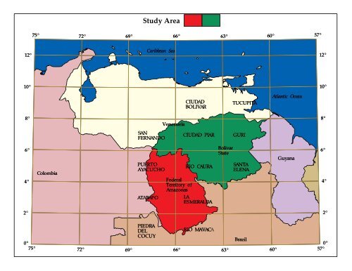
Study Area
Click here for more detailed map
U.S. GEOLOGICAL SURVEY DIGITAL DATA SERIES DDS-46<br />
<strong>Geology</strong> <strong>and</strong> <strong>Resource</strong> <strong>Assessment</strong> <strong>of</strong> <strong>the</strong> <strong>Venezuelan</strong> Guayana Shield at<br />
1:500,000 scale--A Digital Representation <strong>of</strong> Maps published by <strong>the</strong> U.S.<br />
Geological Survey<br />
By Paul G. Schruben(1), Jeffrey C. Wynn(1), Floyd Gray(2), Dennis P. Cox(3),<br />
John H. Stewart(3), <strong>and</strong> William E. Brooks(3)<br />
(1) U.S. Geological Survey<br />
920 National Center<br />
12201 Sunrise Valley Drive<br />
Reston, VA 22092-9998<br />
(2) U.S. Geological Survey<br />
210 E. 7th St<br />
Tucson, AZ 85705-8454<br />
(3) Formerly with U.S. Geological Survey<br />
U.S. DEPARTMENT OF THE INTERIOR<br />
BRUCE BABBITT, Secretary<br />
U.S. GEOLOGICAL SURVEY<br />
Gordon P. Eaton, Director<br />
For sale by U.S. Geological Survey, Map Distribution<br />
Box 25286, Building 810, Federal Center<br />
Denver, CO 80225<br />
Prepared in <strong>the</strong> Eastern Region, Reston, Va.<br />
Manuscript approved for publication .<br />
1997
Title Page<br />
Disclaimer<br />
System Requirements<br />
Acknowledgments<br />
Contacts<br />
User Registration<br />
Disc Contents<br />
Project Overview<br />
History <strong>of</strong> <strong>the</strong> Maps<br />
Bulletin 2062 Text <strong>and</strong> Figures Files<br />
References for this Disc<br />
Digital Production Techniques<br />
Map Projection<br />
Cautions Relating to <strong>the</strong> Use <strong>of</strong> <strong>the</strong> Maps<br />
Online Files<br />
Graphics Formats Available on <strong>the</strong> Disc<br />
ARCVIEW 1 <strong>and</strong> ARC/INFO Files<br />
Export Files<br />
Raw UNIX Coverages<br />
PC ARCVIEW 1 Coverages<br />
Running <strong>the</strong> Plot Programs<br />
Installing ARCVIEW 1<br />
Using ARCVIEW 1<br />
ARCVIEW 1 Files<br />
ARCVIEW 3 Files<br />
Coverage Data Definition<br />
DLG Optional Format<br />
Descripton <strong>of</strong> Map Units<br />
TABLE OF CONTENTS
DISCLAIMER<br />
This Compact Disc-Read Only Memory (CD-ROM) publication was prepared<br />
by an agency <strong>of</strong> <strong>the</strong> United States Government. Nei<strong>the</strong>r <strong>the</strong> United States<br />
Government nor any agency <strong>the</strong>re<strong>of</strong>, nor any <strong>of</strong> <strong>the</strong>ir employees, makes any warranty,<br />
expressed or implied, or assumes any legal liability or responsibility for <strong>the</strong> accuracy,<br />
completeness, or usefulness <strong>of</strong> any information, apparatus, product, or process<br />
disclosed in this report, or represents that its use would not infringe privately owned<br />
rights. Reference <strong>the</strong>rein to any specific commercial product, process, or service by<br />
trade name, trademark, manufacturer, or o<strong>the</strong>rwise does not necessarily constitute or<br />
imply its endorsement, recommendation, or favoring by <strong>the</strong> United States<br />
Government or any agency <strong>the</strong>re<strong>of</strong>. Any views <strong>and</strong> opinions <strong>of</strong> authors expressed<br />
herein do not necessarily state or reflect those <strong>of</strong> <strong>the</strong> United States Government or any<br />
agency <strong>the</strong>re<strong>of</strong>.<br />
Although all data <strong>and</strong> s<strong>of</strong>tware published on this CD-ROM have been used by<br />
<strong>the</strong> <strong>USGS</strong>, no warranty, expressed or implied, is made by <strong>the</strong> U.S. Geological Survey<br />
as to <strong>the</strong> accuracy <strong>of</strong> <strong>the</strong> data <strong>and</strong> related materials <strong>and</strong>/or <strong>the</strong> functioning <strong>of</strong> <strong>the</strong><br />
s<strong>of</strong>tware. The act <strong>of</strong> distribution shall not constitute any such warranty, <strong>and</strong> no<br />
responsibility is assumed by <strong>the</strong> <strong>USGS</strong> in <strong>the</strong> use <strong>of</strong> <strong>the</strong>se data, s<strong>of</strong>tware, or related<br />
materials.<br />
Graphical map depictions on this disc are intended to be used within <strong>the</strong> map<br />
scale limits applicable to <strong>the</strong> source data. Although s<strong>of</strong>tware enables <strong>the</strong> user to show<br />
images on <strong>the</strong> disc at various scales, <strong>the</strong> user is cautioned to refer to <strong>the</strong> source<br />
documentation for <strong>the</strong> appropriate map scale limitations.
SYSTEM REQUIREMENTS<br />
This CD-ROM was produced in accordance with <strong>the</strong> ISO 9660 st<strong>and</strong>ard <strong>and</strong><br />
thus allows access to <strong>the</strong> disc files by computers with ISO 9660 s<strong>of</strong>tware drivers. The<br />
disc contains Adobe Acrobat Reader s<strong>of</strong>tware for DOS, Macintosh, UNIX, <strong>and</strong><br />
Windows. as well as a graphics display program, ArcView 1, for Windows 3.x.<br />
ARCVIEW 1 REQUIREMENTS<br />
80386 or better CPU<br />
Math coprocessor recommended<br />
Windows 3.0 or higher but not Windows 95<br />
4 Mb <strong>of</strong> RAM, 8 Mb strongly recommended<br />
15 Mb <strong>of</strong> disk space<br />
Super VGA graphics system, 256 colors, 640x480 pixels minimum,<br />
1024x768 pixels strongly recommended<br />
Micros<strong>of</strong>t-compatible mouse<br />
Windows-supported printer<br />
ARCVIEW 3 REQUIREMENTS<br />
or<br />
80486 or better CPU<br />
Windows 3.x, 95, or NT<br />
12-16 Mb <strong>of</strong> RAM<br />
Super VGA graphics system, 256 colors, 640x480 pixels minimum,<br />
1024x768 pixels strongly recommended<br />
Micros<strong>of</strong>t-compatible mouse<br />
Power Macintosh or 68040 processor with FPU<br />
System 7.1 or higher<br />
16-18 Mb <strong>of</strong> RAM
ADOBE ACROBAT READER REQUIREMENTS:<br />
A color display monitor is strongly recommended with all platforms.<br />
Windows 95 - rs32e30.exe<br />
Minimum<br />
i386(TM), i486(TM), Pentium(R), or<br />
Pentium Pro processor-based personal computer<br />
Micros<strong>of</strong>t Windows 95, or Windows NT(R) 3.51 or later<br />
8 MB <strong>of</strong> RAM (16 MB for Windows NT) for Acrobat Reader<br />
10 MB <strong>of</strong> available hard-disk space<br />
Recommended<br />
Pentium processor-based personal computer<br />
Windows 95 or Windows NT<br />
16 MB <strong>of</strong> RAM (24 for Windows NT)<br />
10 MB <strong>of</strong> available hard-disk space<br />
Windows NT - rs32e30.exe<br />
Minimum<br />
i386(TM), i486(TM), Pentium(R), or Pentium Pro processor<br />
Windows NT(R) 3.51 or later<br />
8 MB <strong>of</strong> RAM (16 MB for Windows NT) for Acrobat Reader<br />
10 MB <strong>of</strong> available hard-disk space<br />
Recommended<br />
Pentium processor-based personal<br />
computer<br />
Windows 95 or Windows NT<br />
16 MB <strong>of</strong> RAM (24 for Windows NT)<br />
10 MB <strong>of</strong> available hard-disk space
Windows 3.1 <strong>and</strong> 3.11 for Workgroups - rs16e30.exe<br />
Minimum<br />
i386(TM), i486(TM), Pentium(R), or Pentium Pro processor<br />
Micros<strong>of</strong>t Windows 3.1 or Windows 3.11 or later<br />
8 MB <strong>of</strong> RAM for Acrobat Reader<br />
5 MB <strong>of</strong> available hard-disk space<br />
Recommended<br />
Pentium processor-based personal computer<br />
Micros<strong>of</strong>t Windows 3.1 or Windows 3.11 or later<br />
12 MB <strong>of</strong> available hard-disk space<br />
Macintosh <strong>and</strong> Power Macintosh - Install Acrobat Reader 3.0, Search Installer<br />
Minimum<br />
Macintosh with a 68020 or greater processor, or Power Macintosh<br />
3.5 MB <strong>of</strong> RAM (5 MB for Power Macintosh) available to Acrobat Reader<br />
Apple(R) System S<strong>of</strong>tware version 7.1 or later<br />
Recommended<br />
8 MB <strong>of</strong> available RAM<br />
Apple System S<strong>of</strong>tware version 7.1.2 or later<br />
12.5 MB <strong>of</strong> available hard-disk space<br />
UNIX<br />
UNIX system requirements<br />
12 MB <strong>of</strong> disk space for Acrobat Reader<br />
System with 32 MB <strong>of</strong> RAM<br />
Sun SPARCstation(R) - acroread_sunos_30.tar.gz, acroread_solaris_30.tar.gz<br />
SunOS 4.1.3 or 4.1.4 or Solaris 2.3, 2.4, or 2.5<br />
OpenWindows(TM) (version 3.0 or later),<br />
Motif(TM) window manager (1.2.3 or later),<br />
OpenLook version 3.0, or<br />
Common Desktop Environment (CDE) 1.0 <strong>and</strong> above<br />
HP Series 9000 workstation, model 700 or greater - acroread_hpux_30.tar.gz<br />
HP-UX 9.0.3 or later<br />
X Window System(TM) X11R5 with HP-VUE or CDE 1.0<br />
12 megabytes <strong>of</strong> available hard disk space<br />
A 32 megabyte machine
IBM(R) RS/6000(TM) workstation - acroread_aix_30.tar.gz<br />
AIX 4.1 or later operating system<br />
Common Desktop Environment (CDE) or <strong>the</strong> Motif window manager<br />
Silicon Graphics workstation - acroread_irix_30.tar.gz<br />
IRIX(TM) 5.3 or later operating system s<strong>of</strong>tware<br />
12 megabytes <strong>of</strong> available hard disk space<br />
A 32 megabyte machine<br />
Linux workstation - acroread_linux_30.tar.gz<br />
LINUX 5.3 or later operating system s<strong>of</strong>tware<br />
12 megabytes <strong>of</strong> available hard disk space<br />
A 32 megabyte machine<br />
OS/2 - aro2e30.exe<br />
Minimum<br />
i386, i486, Pentium, or Pentium Pro processor<br />
IBM OS/2 Warp or Warp Connect 3.0 or later<br />
4 MB application RAM available to Acrobat Reader<br />
8 MB RAM for system<br />
5 MB hard-disk space, plus 5 MB temporary space for installation<br />
Recommended<br />
Pentium processor<br />
IBM OS/2 Warp 4.0<br />
Adobe Acrobat Reader 1.0 for DOS - rdrdos10.zip<br />
Minimum<br />
i386(TM), i486(TM) processor<br />
Micros<strong>of</strong>t DOS 3.3 or later<br />
2 MB <strong>of</strong> RAM for Acrobat Reader.<br />
5 MB <strong>of</strong> available hard-disk space<br />
Recommended<br />
486 or Pentium processor<br />
Micros<strong>of</strong>t DOS 3.3 or later<br />
4 MB <strong>of</strong> application RAM<br />
5 MB <strong>of</strong> available hard-disk space
ACKNOWLEDGEMENTS<br />
Development <strong>of</strong> <strong>the</strong> graphics files on this CD-ROM spanned many years <strong>and</strong><br />
involved <strong>the</strong> efforts <strong>of</strong> many organizations <strong>and</strong> individuals. Most <strong>of</strong> <strong>the</strong> digitizing<br />
was done in GSMAP by Jeff Wynn (<strong>USGS</strong>) <strong>and</strong> o<strong>the</strong>rs. The nor<strong>the</strong>rn quadrangles<br />
were scanned from tracings created by <strong>the</strong> geologists. Thanks to <strong>the</strong> following<br />
authors for those materials:<br />
John H. Stewart (<strong>USGS</strong>)<br />
Dennis P. Cox (<strong>USGS</strong>)<br />
Floyd Gray (<strong>USGS</strong>)<br />
W. E. Brooks (<strong>USGS</strong>)<br />
Thanks to Corporación Venezolana de Guayana, Técnica Minera C.A. <strong>and</strong> <strong>the</strong><br />
following authors <strong>of</strong> Venezuela maps <strong>and</strong> reports for <strong>the</strong>ir help in <strong>the</strong> preparation <strong>of</strong><br />
<strong>the</strong> digital files:<br />
Juan Acosta<br />
Jesús Arespón<br />
Yasmin Estanga<br />
Luis Franco<br />
Andrés García<br />
Yol<strong>and</strong>a Lopez<br />
Elis Lugo<br />
Iris Marcano<br />
Félix Martínez<br />
Vicente Mendoza-S.<br />
Stephen D. Olmore<br />
Inés Rendón<br />
Haydée Rincón<br />
Nelson Rivero<br />
Edixon Salazar<br />
Gary B. Sidder (formerly <strong>USGS</strong>, now Golden Star <strong>Resource</strong>s)<br />
Frank Tovar<br />
Thanks to David K. Traudt, <strong>USGS</strong>, who assembled <strong>the</strong> files <strong>and</strong> directories<br />
from tape to master CD-ROM. Thanks to <strong>the</strong> following personnel in <strong>the</strong> <strong>USGS</strong> who<br />
provided disk files <strong>of</strong> Bulletin 2062 text <strong>and</strong> figures as well as many thoughtful<br />
suggestions for improvements to <strong>the</strong> maps <strong>and</strong> text on <strong>the</strong> CD-ROM.<br />
Frederick C. Brunstein<br />
David A. Emery<br />
Will Stettner<br />
Judith W. Stoeser
CONTACTS<br />
Questions about <strong>the</strong> digital map files should be directed to:<br />
Paul Schruben Telephone (703) 648-6142<br />
FAX (703) 648-6383<br />
E-mail pschrube@usgs.gov<br />
U.S. Geological Survey, 954 National Center, Reston, VA 22092-9998.<br />
Technical help with ArcView 1 is available via CompuServe by typing GO ESRI.<br />
Copies <strong>of</strong> <strong>the</strong> original <strong>USGS</strong> 1993 Bulletin 2062, MF maps cited in <strong>the</strong> Documentation<br />
<strong>of</strong> Map Units, <strong>and</strong> this CD-ROM are available from:<br />
U.S. Geological Survey, Map Distribution<br />
Box 25286, Building 810<br />
Federal Center<br />
Denver, CO 80225<br />
Tel: (888) ASK-<strong>USGS</strong> or for overseas access<br />
(703) 648-6045.
DISC CONTENTS<br />
1readme.doc description <strong>of</strong> this disc, Micros<strong>of</strong>t Word 6 file<br />
1readme.mac.text description <strong>of</strong> this disc, Macintosh/OS plain text file<br />
1readme.pdf description <strong>of</strong> this disc, Adobe Acrobat Reader file<br />
1readmet.dos description <strong>of</strong> this disc, MS/DOS plain text file<br />
1readmew.dos description <strong>of</strong> this disc, Micros<strong>of</strong>t Word for Windows 1.0<br />
acrobat directory containing Acrobat Reader installer programs<br />
arcview1 directory containing ArcView 1 installer program<br />
arcpc directory containing PC ArcView 1 <strong>and</strong> ARC/INFO directories.<br />
Same as arcunix6 directory below<br />
arcunix6 directory containing ArcView 1 <strong>and</strong> ARC/INFO 6.1.2 directories<br />
at directory containing files for Atabapo 2°x3° quadrangle<br />
(Venezuela part)<br />
at.aml ARC/PLOT program for 44" Versatec plotter<br />
at.av ArcView 1 file<br />
at.gra ARC/PLOT plot file for 44" Versatec plotter<br />
atanno5 geographic place name annotation<br />
atcor correlation <strong>of</strong> map units<br />
atft faults<br />
atge geology<br />
atlab rock unit label annotation<br />
atleg map legend<br />
atma buried magnetic bodies<br />
atout quadrangle outline <strong>and</strong> lat/long numbers<br />
atpl political boundaries<br />
atscale 1:500,000 scale bar, title, & citation<br />
atst single-line tributaries<br />
attc latitude/longitude tics for this quadrangle<br />
grid lat/long grid lines for index map<br />
index index map showing quadrangle names <strong>and</strong> surrounding<br />
countries<br />
vztc latitude/longitude numbers <strong>and</strong> tics for index map<br />
ay directory containing Puerto Ayacucho 2°x3° quadrangle<br />
(Venezuela part) files<br />
ay.aml ARC/PLOT program for 44" Versatec plotter<br />
ay.av ArcView 1 file<br />
ay.gra ARC/PLOT plot file for 44" Versatec plotter<br />
ayanno5 geographic place name annotation<br />
aycor correlation <strong>of</strong> map units<br />
aycrlbm crossection geology rock unit labels<br />
aycrm crossection geology polygons<br />
ayft faults<br />
ayge geology<br />
aylab rock unit label annotation<br />
aylabcr crossection line <strong>and</strong> annotation on map<br />
ayleg map legend<br />
aylegpt map legend points<br />
ayma buried magnetic bodies<br />
aymalab buried magnetic bodies<br />
ayout quadrangle outline <strong>and</strong> lat/long numbers<br />
aypl political boundaries<br />
ayrd roads
ayscale 1:500,000 scale bar, title, & citation<br />
ayst single-line tributaries<br />
aytc latitude/longitude tics for this quadrangle<br />
grid lat/long grid lines for index map<br />
index index map showing quadrangle names <strong>and</strong> surrounding<br />
countries<br />
vztc latitude/longitude numbers <strong>and</strong> tics for index map<br />
ca directory containing Río Caura 2° by 3° quadrangle files<br />
ca.aml ARC/PLOT program for 44" Versatec plotter<br />
ca.av ArcView 1 file<br />
ca.gra ARC/PLOT plot file for 44" Versatec plotter<br />
caanno5 geographic place name annotation<br />
cacor correlation <strong>of</strong> map units<br />
caft faults<br />
cage geology<br />
calab rock unit label annotation<br />
caleg map legend<br />
calegpt map legend points<br />
cama buried magnetic bodies<br />
caout quadrangle outline <strong>and</strong> lat/long numbers<br />
capl political boundaries<br />
cascale 1:500,000 scale bar, title, & citation<br />
cast single-line tributaries<br />
catc latitude/longitude tics for this quadrangle<br />
grid lat/long grid lines for index map<br />
index index map showing quadrangle names <strong>and</strong> surrounding<br />
countries<br />
vztc latitude/longitude numbers <strong>and</strong> tics for index map<br />
es directory containing La Esmeralda 2°x3° quadrangle<br />
(Venezuela part) files<br />
es.aml ARC/PLOT program for 44" Versatec plotter<br />
es.av ArcView 1 file<br />
es.gra ARC/PLOT plot file for 44" Versatec plotter<br />
esanno5 geographic place name annotation<br />
escor correlation <strong>of</strong> map units<br />
esft faults<br />
esge geology<br />
eslab rock unit label annotation<br />
esleg map legend<br />
eslegpt map legend points<br />
esma buried magnetic bodies<br />
esout quadrangle outline <strong>and</strong> lat/long numbers<br />
espl political boundaries<br />
esscale 1:500,000 scale bar, title, & citation<br />
esst single-line tributaries<br />
estc latitude/longitude tics for this quadrangle<br />
grid lat/long grid lines for index map<br />
index index map showing quadrangle names <strong>and</strong> surrounding<br />
countries<br />
vztc latitude/longitude numbers <strong>and</strong> tics for index map<br />
gu directory containing Guri <strong>and</strong> sou<strong>the</strong>rn part <strong>of</strong> <strong>the</strong> Tucupita<br />
2°x3° quadrangles files<br />
grid lat/long grid lines for index map<br />
gu.aml ARC/PLOT program for 44" Versatec plotter
gu.av ArcView 1 file<br />
gu.gra ARC/PLOT plot file for 44" Versatec plotter<br />
guanno5 geographic place name annotation<br />
gucor correlation <strong>of</strong> map units<br />
guft faults<br />
guge geology<br />
gulab rock unit label annotation<br />
guleg map legend<br />
gulegpt map legend points<br />
guout quadrangle outline <strong>and</strong> lat/long numbers<br />
gupl political boundaries<br />
gurd roads<br />
guscale 1:500,000 scale bar, title, & citation<br />
gust single-line tributaries<br />
gutc latitude/longitude tics for this quadrangle<br />
index index map showing quadrangle names <strong>and</strong> surrounding<br />
countries<br />
vztc latitude/longitude numbers <strong>and</strong> tics for index map<br />
ma directory containing Río Mavaca 2°x3° quadrangle (Venezuela<br />
part)<br />
grid lat/long grid lines for index map<br />
index index map showing quadrangle names <strong>and</strong> surrounding<br />
countries<br />
ma.aml ARC/PLOT program for 44" Versatec plotter<br />
ma.av ArcView 1 file<br />
ma.gra ARC/PLOT plot file for 44" Versatec plotter<br />
maanno5 geographic place name annotation<br />
macor correlation <strong>of</strong> map units<br />
maft faults<br />
mage geology<br />
malab rock unit label annotation<br />
maleg map legend<br />
mama buried magnetic bodies<br />
maout quadrangle outline <strong>and</strong> lat/long numbers<br />
mascale 1:500,000 scale bar, title, & citation<br />
mast single-line tributaries<br />
matc latitude/longitude tics for this quadrangle<br />
vztc latitude/longitude numbers <strong>and</strong> tics for index map<br />
pc directory containing Piedra de Cocuy 2°x3° quadrangle<br />
(Venezuela part) files<br />
grid lat/long grid lines for index map<br />
index index map showing quadrangle names <strong>and</strong> surrounding<br />
countries<br />
pc.aml ARC/PLOT program for 44" Versatec plotter<br />
pc.av ArcView 1 file<br />
pc.gra ARC/PLOT plot file for 44" Versatec plotter<br />
pcanno5 geographic place name annotation<br />
pccor correlation <strong>of</strong> map units<br />
pcft faults<br />
pcge geology<br />
pclab rock unit label annotation<br />
pcleg map legend<br />
pclegpt map legend points<br />
pcma buried magnetic bodies
pcout quadrangle outline <strong>and</strong> lat/long numbers<br />
pcpl political boundaries<br />
pcscale 1:500,000 scale bar, title, & citation<br />
pcst single-line tributaries<br />
pctc latitude/longitude tics for this quadrangle<br />
vztc latitude/longitude numbers <strong>and</strong> tics for index map<br />
pi directory containing Ciudad Piar <strong>and</strong> part <strong>of</strong> <strong>the</strong> Ciudad<br />
Bolivar 2°x3° quadrangles files<br />
fnt040 ARC/INFO font file necessary for sag fault line symbol<br />
grid lat/long grid lines for index map<br />
index index map showing quadrangle names <strong>and</strong> surrounding<br />
countries<br />
pi.aml ARC/PLOT program for 44" Versatec plotter<br />
pi.av ArcView 1 file<br />
pi.gra ARC/PLOT plot file for 44" Versatec plotter<br />
pianno5 geographic place name annotation<br />
picor correlation <strong>of</strong> map units<br />
pift faults<br />
pige geology<br />
pilab rock unit label annotation<br />
pileg map legend<br />
pilegpt map legend points<br />
pima kimberlite area<br />
piout quadrangle outline <strong>and</strong> lat/long numbers<br />
pipl political boundaries<br />
pird roads<br />
piscale 1:500,000 scale bar, title, & citation<br />
pisr structural lines from SLAR<br />
pist single-line tributaries<br />
pitc latitude/longitude tics for this quadrangle<br />
vztc latitude/longitude numbers <strong>and</strong> tics for index map<br />
se directory containing Santa Elena 2°x3° quadrangle (Venezuela<br />
part) files<br />
grid lat/long grid lines for index map<br />
index index map showing quadrangle names <strong>and</strong> surrounding<br />
countries<br />
se.aml ARC/PLOT program for 44" Versatec plotter<br />
se.av ArcView 1 file<br />
se.gra ARC/PLOT plot file for 44" Versatec plotter<br />
seanno5 geographic place name annotation<br />
secor correlation <strong>of</strong> map units<br />
seft faults<br />
sege geology<br />
selab rock unit label annotation<br />
seleg map legend<br />
selegpt map legend points<br />
seout quadrangle outline <strong>and</strong> lat/long numbers<br />
sepl political boundaries<br />
serd roads<br />
sescale 1:500,000 scale bar, title, & citation<br />
sest single-line tributaries<br />
setc latitude/longitude tics for this quadrangle<br />
vztc latitude/longitude numbers <strong>and</strong> tics for index map<br />
sf directory containing San Fern<strong>and</strong>o de Apure 2°x3° quadrangle
(Bolivar part) files<br />
grid lat/long grid lines for index map<br />
index index map showing quadrangle names <strong>and</strong> surrounding<br />
countries<br />
sf.aml ARC/PLOT program for 44" Versatec plotter<br />
sf.av ArcView 1 file<br />
sf.gra ARC/PLOT plot file for 44" Versatec plotter<br />
sfanno5 geographic place name annotation<br />
sfcor correlation <strong>of</strong> map units<br />
sfft faults<br />
sfge geology<br />
sflab rock unit label annotation<br />
sfleg map legend<br />
sflegpt map legend points<br />
sfout quadrangle outline <strong>and</strong> lat/long numbers for ArcView<br />
sfpl political boundaries<br />
sfscale 1:500,000 scale bar, title, & citation<br />
sfst single-line tributaries<br />
sftc latitude/longitude tics for this quadrangle<br />
vztc latitude/longitude numbers <strong>and</strong> tics for index map<br />
vz directory containing combined map coverages for <strong>Venezuelan</strong><br />
Guayana Shield, all quadrangles<br />
av.mrk ArcView markerset to be copied to <strong>the</strong> ARCHOME directory<br />
av.txt ArcView textset to be copied to <strong>the</strong> ARCHOME directory<br />
deposit mineral deposits, prospects <strong>and</strong> occurrences<br />
equi2geo.prj projection file for converting equidistant conic to<br />
decimal degrees<br />
fnt040 ARC/INFO font file necessary for sag fault line symbol<br />
ge.ai Illustrator 6.0 version <strong>of</strong> ge.eps<br />
ge.eps ARC/PLOT Postscript plot file for 44" Versatec plotter<br />
ge.gra ARC/PLOT plot file for 44" Versatec plotter<br />
geo2equi.prj projection file for converting decimal degrees to<br />
equidistant conic<br />
grid lat/long grid lines for index map<br />
index index map showing quadrangle names <strong>and</strong> surrounding<br />
countries<br />
mrdsek.mrk ARC/PLOT markerset for o<strong>the</strong>r point symbols<br />
myalcgeol.mrk ARC/PLOT markerset for cities, bedding, joint symbols<br />
myplotter.shd ARC/PLOT shadeset for geology patterns<br />
myplt.lin ARC/PLOT lineset for faults, roads, political boundaries<br />
places geographic place names<br />
ra mineral resource permissive areas map A<br />
raanno mineral resource permissive areas map A annotation<br />
rb mineral resource permissive areas map B<br />
rbanno mineral resource permissive areas map B annotation<br />
rbstruct mineral resource permissive areas map B structural<br />
features<br />
scale scalebar <strong>and</strong> projection information<br />
vz.aml ARC/PLOT program for 44" Versatec plotter<br />
vz.av ArcView 1 view file<br />
vz.apr ArcView 3 project file<br />
vzcor correlation <strong>of</strong> map units<br />
vzctry Nor<strong>the</strong>ast South America country borders<br />
vzft faults, annotation, joints, <strong>and</strong> bedding
vzge geology<br />
vzlab rock unit annotation <strong>and</strong> leaders<br />
vzma buried magnetic bodies<br />
vzout outer edge <strong>of</strong> combined quadrangles in study area<br />
vzpl study area political boundaries<br />
vzprov Venezuela province boundaries for index map<br />
vzrd roads<br />
vzst single-line tributaries <strong>and</strong> annotation<br />
vztc latitude/longitude numbers <strong>and</strong> tics for index map<br />
arcunix7 directory containing ArcView 3 <strong>and</strong> ARC/INFO 7 directory<br />
vz directory containing combined map coverages for <strong>Venezuelan</strong><br />
Guayana Shield, all quadrangles. Same as in<br />
arcunix6/vz.<br />
bull2062 directory containing text <strong>and</strong> figures from Bulletin 2062<br />
doc<br />
tables.doc Word 5.1 tables 1-2, 4-11<br />
tabside.doc Word 5.1 table 3<br />
mif<br />
b2062con.mif framemaker 3.0p1b table <strong>of</strong> contents<br />
b2062fnt.mif framemaker 3.0p1b cover 1, cover 2, i, ii, iii<br />
b2062txt.mif framemaker 3.0p1b main body, p. 1-120<br />
rtf<br />
b2062con.rtf rich text (RTF) table <strong>of</strong> contents<br />
b2062txt.rtf rich text (RTF) main body, p. 3-5<br />
tif<br />
vzget.tif TIF Plate 2, geology, key part<br />
vzge.tif TIF Plate 2, geologic map part<br />
vzmin.tif TIF Plate 6, mineral deposits<br />
txt<br />
b2062con.txt text table <strong>of</strong> contents<br />
b2062fnt.txt text i, ii<br />
b2062txt.txt text main body, p. 1-72<br />
dlg directory containing Digital Line Graph (DLG) Optional files<br />
cor.dlg correlation <strong>of</strong> map units in Equidistant Conic projection<br />
cordd.dlg correlation <strong>of</strong> map units in decimal degrees<br />
ft.dlg faults in Equidistant Conic projection<br />
ftdd.dlg faults in decimal degrees<br />
ge.dlg geology in Equidistant Conic projection<br />
gedd.dlg geology in decimal degrees<br />
ptype.unl rock unit names, descriptions, colors for Versatec<br />
plotter<br />
scale.dlg scale bar in Equidistant Conic projection<br />
scaledd.dlg scale bar in decimal degrees<br />
vzline.unl fault <strong>and</strong> contact line types<br />
export directory containing directories <strong>of</strong> ARC/INFO export files <strong>and</strong><br />
programs<br />
at directory containing Atabapo quadrangle files<br />
at.aml ARC/PLOT program for 44" Versatec plotter<br />
at.av ArcView 1 file<br />
at.gra ARC/PLOT 1040 plot file for 44" Versatec plotter.<br />
This a binary file<br />
atanno5.e00 geographic place name annotation<br />
atcor.e00 correlation <strong>of</strong> map units<br />
atft.e00 faults
atge.e00 geology<br />
atlab.e00 rock unit label annotation<br />
atleg.e00 map legend<br />
atma.e00 buried magnetic bodies<br />
atout.e00 quadrangle outline <strong>and</strong> lat/long numbers<br />
atpl.e00 political boundaries<br />
atscale.e00 1:500,000 scale bar, title, & citation<br />
atst.e00 single-line tributaries<br />
attc.e00 latitude longitude tics for this quadrangle<br />
grid.e00 lat/long grid lines for index map<br />
import.aml ARC program for importing coverage<br />
index.e0* index map showing quadrangle names <strong>and</strong> surrounding<br />
countries, files 0-1<br />
vztc.e00 latitude longitude tics for index map<br />
ay directory containing Puerto Ayacucho quadrangle files<br />
ay.aml ARC/PLOT program for 44" Versatec plotter<br />
ay.av ArcView 1 file<br />
ay.gra ARC/PLOT 1040 plot file for 44" Versatec plotter.<br />
This a binary file<br />
ayanno5.e00 geographic place name annotation<br />
aycor.e00 correlation <strong>of</strong> map units<br />
aycrlbm.e00 cross section labels<br />
aycrm.e00 cross section arcs<br />
ayft.e00 faults<br />
ayge.e00 geology<br />
aylab.e00 rock unit label annotation<br />
aylabcr.e00 rock unit label annotation for cross section<br />
ayleg.e00 map legend<br />
aylegpt.e00 map legend points<br />
ayma.e00 buried magnetic bodies<br />
aymalab.e00 buried magnetic bodies labels<br />
ayout.e00 quadrangle outline <strong>and</strong> lat/long numbers<br />
aypl.e00 political boundaries<br />
ayrd.e00 roads<br />
ayscale.e00 1:500,000 scale bar, title, & citation<br />
ayst.e00 single-line tributaries<br />
aytc.e00 latitude longitude tics for this quadrangle<br />
grid.e00 lat/long grid lines for index map<br />
import.aml ARC program for importing coverage<br />
index.e0* index map showing quadrangle names <strong>and</strong> surrounding<br />
countries, files 0-1<br />
vztc.e00 latitude longitude tics for index map<br />
ca directory containing Río Caura quadrangle files<br />
ca.aml ARC/PLOT program for 44" Versatec plotter<br />
ca.av ArcView 1 file<br />
ca.gra ARC/PLOT 1040 plot file for 44" Versatec plotter.<br />
This a binary file<br />
caanno5.e00 geographic place name annotation<br />
cacor.e00 correlation <strong>of</strong> map units<br />
caft.e00 faults<br />
cage.e00 geology<br />
calab.e00 rock unit label annotation<br />
caleg.e00 map legend<br />
calegpt.e00 map legend points
cama.e00 buried magnetic bodies<br />
caout.e00 quadrangle outline <strong>and</strong> lat/long numbers<br />
capl.e00 political boundaries<br />
cascale.e00 1:500,000 scale bar, title, & citation<br />
cast.e00 single-line tributaries<br />
catc.e00 latitude longitude tics for this quadrangle<br />
grid.e00 lat/long grid lines for index map<br />
import.aml ARC program for importing coverage<br />
index.e0* index map showing quadrangle names <strong>and</strong> surrounding<br />
countries, files 0-1<br />
vztc.e00 latitude longitude tics for index map<br />
es directory containing La Esmeralda quadrangle files<br />
es.aml ARC/PLOT program for 44" Versatec plotter<br />
es.av ArcView 1 file<br />
es.gra ARC/PLOT 1040 plot file for 44" Versatec plotter.<br />
This a binary file<br />
esanno5.e00 geographic place name annotation<br />
escor.e00 correlation <strong>of</strong> map units<br />
esft.e00 faults<br />
esge.e00 geology<br />
eslab.e00 rock unit label annotation<br />
esleg.e00 map legend<br />
eslegpt.e00 map legend points<br />
esma.e00 buried magnetic bodies<br />
esout.e00 quadrangle outline <strong>and</strong> lat/long numbers<br />
espl.e00 political boundaries<br />
esscale.e00 1:500,000 scale bar, title, & citation<br />
esst.e00 single-line tributaries<br />
estc.e00 latitude longitude tics for this quadrangle<br />
grid.e00 lat/long grid lines for index map<br />
import.aml ARC program for importing coverage<br />
index.e0* index map showing quadrangle names <strong>and</strong> surrounding<br />
countries, files 0-1<br />
vztc.e00 latitude longitude tics for index map<br />
gu directory containing Guri <strong>and</strong> Tucupita quadrangle files<br />
grid.e00 lat/long grid lines for index map<br />
gu.aml ARC/PLOT program for 44" Versatec plotter<br />
gu.av ArcView 1 file<br />
gu.gra ARC/PLOT 1040 plot file for 44" Versatec plotter.<br />
This a binary file<br />
guanno5.e00 geographic place name annotation<br />
gucor.e00 correlation <strong>of</strong> map units<br />
guft.e00 faults<br />
guge.e0* geology files, 0-2<br />
gulab.e00 rock unit label annotation<br />
guleg.e00 map legend<br />
gulegpt.e00 map legend points<br />
guout.e00 quadrangle outline <strong>and</strong> lat/long numbers<br />
gupl.e00 political boundaries<br />
gurd.e00 roads<br />
guscale.e00 1:500,000 scale bar, title, & citation<br />
gust.e00 single-line tributaries<br />
gutc.e00 latitude longitude tics for this quadrangle<br />
import.aml ARC program for importing coverage
index.e0* index map showing quadrangle names <strong>and</strong> surrounding<br />
countries, files 0-1<br />
vztc.e00 latitude longitude tics for index map<br />
ma directory containing Río Mavaca quadrangle files<br />
grid.e00 lat/long grid lines for index map<br />
import.aml ARC program for importing coverage<br />
index.e0* index map showing quadrangle names <strong>and</strong> surrounding<br />
countries, files 0-1<br />
ma.aml ARC/PLOT program for 44" Versatec plotter<br />
ma.av ArcView 1 file<br />
ma.gra ARC/PLOT 1040 plot file for 44" Versatec plotter.<br />
This a binary file<br />
maanno5.e00 geographic place name annotation<br />
macor.e00 correlation <strong>of</strong> map units<br />
maft.e00 faults<br />
mage.e00 geology<br />
malab.e00 rock unit label annotation<br />
maleg.e00 map legend<br />
mama.e00 buried magnetic bodies<br />
maout.e00 quadrangle outline <strong>and</strong> lat/long numbers<br />
mascale.e00 1:500,000 scale bar, title, & citation<br />
mast.e00 single-line tributaries<br />
matc.e00 latitude longitude tics for this quadrangle<br />
vztc.e00 latitude longitude tics for index map<br />
pc directory containing Piedra de Cocuy quadrangle files<br />
grid.e00 lat/long grid lines for index map<br />
import.aml ARC program for importing coverage<br />
index.e0* index map showing quadrangle names <strong>and</strong> surrounding<br />
countries, files 0-1<br />
pc.aml ARC/PLOT program for 44" Versatec plotter<br />
pc.av ArcView 1 file<br />
pc.gra ARC/PLOT 1040 plot file for 44" Versatec plotter.<br />
This a binary file<br />
pcanno5.e00 geographic place name annotation<br />
pccor.e00 correlation <strong>of</strong> map units<br />
pcft.e00 faults<br />
pcge.e00 geology<br />
pclab.e00 rock unit label annotation<br />
pcleg.e00 map legend<br />
pclegpt.e00 map legend points<br />
pcma.e00 buried magnetic bodies<br />
pcout.e00 quadrangle outline <strong>and</strong> lat/long numbers<br />
pcpl.e00 political boundaries<br />
pcscale.e00 1:500,000 scale bar, title, & citation<br />
pcst.e00 single-line tributaries<br />
pctc.e00 latitude longitude tics for this quadrangle<br />
vztc.e00 latitude longitude tics for index map<br />
pi directory containing Ciudad Piar <strong>and</strong> Ciudad Bolivar<br />
quadrangle files<br />
fnt040 ARC/INFO font file necessary for sag fault line symbol<br />
grid.e00 lat/long grid lines for index map<br />
import.aml ARC program for importing coverage<br />
index.e0* index map showing quadrangle names <strong>and</strong> surrounding<br />
countries, files 0-1
pi.aml ARC/PLOT program for 44" Versatec plotter<br />
pi.av ArcView 1 file<br />
pi.gra ARC/PLOT 1040 plot file for 44" Versatec plotter.<br />
This a binary file.<br />
pianno5.e00 geographic place name annotation<br />
picor.e00 correlation <strong>of</strong> map units<br />
pift.e00 faults<br />
pige.e0* geology, 0-2<br />
pilab.e00 rock unit label annotation<br />
pileg.e00 map legend<br />
pilegpt.e00 map legend points<br />
pima.e00 buried magnetic bodies<br />
piout.e00 quadrangle outline <strong>and</strong> lat/long numbers<br />
pipl.e00 political boundaries<br />
pird.e00 roads<br />
piscale.e00 1:500,000 scale bar, title, & citation<br />
pisr.e00 structural lines from SLAR<br />
pist.e00 single-line tributaries<br />
pitc.e00 latitude longitude tics for this quadrangle<br />
vztc.e00 latitude longitude tics for index map<br />
se directory containing Santa Elena quadrangle files<br />
grid.e00 lat/long grid lines for index map<br />
import.aml ARC program for importing coverage<br />
index.e0* index map showing quadrangle names <strong>and</strong> surrounding<br />
countries, files 0-1<br />
se.aml ARC/PLOT program for 44" Versatec plotter<br />
se.av ArcView 1 file<br />
se.gra ARC/PLOT 1040 plot file for 44" Versatec plotter.<br />
This a binary file<br />
seanno5.e00 geographic place name annotation<br />
secor.e00 correlation <strong>of</strong> map units<br />
seft.e00 faults<br />
sege.e0* geology, 0-1<br />
selab.e00 rock unit label annotation<br />
seleg.e00 map legend<br />
selegpt.e00 map legend points<br />
seout.e00 quadrangle outline <strong>and</strong> lat/long numbers<br />
sepl.e00 political boundaries<br />
serd.e00 roads<br />
sescale.e00 1:500,000 scale bar, title, & citation<br />
sest.e00 single-line tributaries<br />
setc.e00 latitude longitude tics for this quadrangle<br />
vztc.e00 latitude longitude tics for index map<br />
sf directory containing San Fern<strong>and</strong>o quadrangle files<br />
grid.e00 lat/long grid lines for index map<br />
import.aml ARC program for importing coverage<br />
index.e0* index map showing quadrangle names <strong>and</strong> surrounding<br />
countries, files 0-1<br />
sf.aml ARC/PLOT program for 44" Versatec plotter<br />
sf.av ArcView 1 file<br />
sf.gra ARC/PLOT 1040 plot file for 44" Versatec plotter.<br />
This a binary file<br />
sfanno5.e00 geographic place name annotation<br />
sfcor.e00 correlation <strong>of</strong> map units
sfft.e00 faults<br />
sfge.e00 geology<br />
sflab.e00 rock unit label annotation<br />
sfleg.e00 map legend<br />
sflegpt.e00 map legend points<br />
sfout.e00 quadrangle outline <strong>and</strong> lat/long numbers<br />
sfpl.e00 political boundaries<br />
sfscale.e00 1:500,000 scale bar, title, & citation<br />
sfst.e00 single-line tributaries<br />
sftc.e00 latitude longitude tics for this quadrangle<br />
vztc.e00 latitude longitude tics for index map<br />
vz directory containing export files for combined coverages<br />
avmrk.e00 ArcView markerset to be copied to <strong>the</strong> ARC HOME directory<br />
avtxt.e00 ArcView textset to be copied to <strong>the</strong> ARC HOME directory<br />
deposit.e0* mineral deposits, prospects <strong>and</strong> occurrences, files 0-2<br />
equi2geo.prj projection file for converting equidistant conic to<br />
decimal degrees<br />
fnt040 ARC/INFO font file necessary for sag fault line symbol<br />
ge.gra ARC/PLOT 1040 plot file for 44" Versatec plotter.<br />
This a binary file<br />
geo2equi.prj projection file for converting decimal degrees to<br />
equidistant conic<br />
grid.e00 lat/long grid lines for index map<br />
import.aml ARC script for importing all coverages<br />
index.e0* index map showing quadrangle names <strong>and</strong> surrounding<br />
countries, files 0-1<br />
mrdsek.e00 ARC/PLOT markerset for o<strong>the</strong>r point symbols<br />
myalcgeol.e00 ARC/PLOT markerset for cities, bedding, joint symbols<br />
myplotter.e00 ARC/PLOT shadeset for geology patterns<br />
myplt.e00 ARC/PLOT lineset for faults, roads, political boundaries<br />
places.e00 geographic place names<br />
ptpat.e00 geology polygon lookup table, plotter patterns<br />
ptpl.e00 point symbol lookup table<br />
ptype.e00 geology polygon lookup table, Versatec colors<br />
ra.e0* mineral resource permissive areas map A<br />
raanno.e00 mineral resource permissive areas map A annotation<br />
rb.e0* mineral resource permissive areas map B files, 0-1<br />
rbanno.e00 mineral resource permissive areas map B annotation<br />
rbstruct.e00 mineral resource permissive areas map B structural<br />
features<br />
scale.e00 scalebar <strong>and</strong> projection information<br />
vz.aml ARC/PLOT program for 44" Versatec plotter<br />
vz.av ArcView 1 view file<br />
vz.apr ArcView 3 project file<br />
vzcor.e00 correlation <strong>of</strong> map units<br />
vzctry.e0* Nor<strong>the</strong>ast South America country borders, 0-1<br />
vzft.e00 faults, annotation, joints <strong>and</strong> bedding<br />
vzge.e00 geology files, 0-9<br />
vzlab.e0* rock unit annotation <strong>and</strong> leaders files, 0-2<br />
vzline.e00 lineset for Arc/Edit, Arc/Plot, Versatec plots<br />
vzma.e00 buried magnetic bodies<br />
vzout.e00 outer edge <strong>of</strong> combined quadrangles in study area<br />
vzpl.e00 study area political boundaries<br />
vzprov.e00 Venezuela province boundaries for index map
vzrd.e00 roads<br />
vzst.e0* single-line tributaries <strong>and</strong> annotation files, 0-2<br />
vztc.e00 latitude/longitude numbers <strong>and</strong> tics for index map
PROJECT OVERVIEW<br />
Conversion <strong>of</strong> <strong>the</strong> Venezuela maps to a computerized digital format was<br />
undertaken for <strong>the</strong> following reasons:<br />
1) The digital format facilitates <strong>the</strong> presentation <strong>and</strong> analysis <strong>of</strong> earth-science data.<br />
Digital maps can be displayed at any scale or projection, whereas a paper map has a<br />
fixed scale <strong>and</strong> projection. However, <strong>the</strong> maps on this disc are not intended to be used<br />
at any scale more detailed than 1:500,000.<br />
A geographic information system (GIS) allows combining <strong>and</strong> overlaying <strong>of</strong><br />
layers for analysis <strong>of</strong> spatial relations not readily apparent in <strong>the</strong> st<strong>and</strong>ard paper<br />
publication. Digital data on geology, geophysics, <strong>and</strong> geochemistry can be combined<br />
to create useful derivative products.<br />
2) The digital format was used to facilitate publication in both paper <strong>and</strong> electronic<br />
form. For <strong>the</strong> Río Caura paper map publication (Brooks <strong>and</strong> o<strong>the</strong>rs, 1995), digital<br />
images were sent to <strong>the</strong> Gerber plotter, a vector-to-film processor. The o<strong>the</strong>r<br />
1:500,000-scale MF maps were reproduced photographically from electrostatic plotter<br />
output on clear mylar. The published digital formats include this CD-ROM <strong>and</strong><br />
ARC/INFO Export files to be located on <strong>the</strong> World Wide Web on <strong>the</strong> Internet.
HISTORY OF THE MAPS<br />
The data in this CD-ROM are based on a mineral resource assessment <strong>of</strong> <strong>the</strong><br />
<strong>Venezuelan</strong> Guayana Shield, conducted between 1987 <strong>and</strong> 1991 by <strong>the</strong> U.S. Geological<br />
Survey <strong>and</strong> Corporación Venezolana de Guayana, Técnica Minera, (<strong>USGS</strong>, 1993). The<br />
<strong>Venezuelan</strong> Shield occupies about 415,000 sq km in <strong>the</strong> south <strong>and</strong> east part <strong>of</strong><br />
Venezuela. The study area is bounded on <strong>the</strong> north by <strong>the</strong> Río Orinoco. It includes all<br />
<strong>of</strong> <strong>the</strong> Territorio Federal Amazonas, Estado Bolívar, <strong>and</strong> part <strong>of</strong> Estado Delta<br />
Amacuro. The original resource assessment publication <strong>USGS</strong> Bulletin 2062 consists<br />
<strong>of</strong> 121 pages <strong>of</strong> text <strong>and</strong> figures as well as eight full-color maps:<br />
Geographic<br />
Geologic <strong>and</strong> tectonic<br />
Bouguer gravity<br />
Two mineral-occurrence maps<br />
Side-looking airborne radar image<br />
Two permissive domain maps<br />
The side-looking airborne radar image <strong>and</strong> <strong>the</strong> Bouguer gravity map are not<br />
included in this CD-ROM. The geology layer from <strong>the</strong> 1993 Bulletin was revised <strong>and</strong><br />
published as a series <strong>of</strong> MF <strong>and</strong> I maps:<br />
Quadrangles Map Authors<br />
--------------------------------------------------------------------<br />
Guri + Tucupita MF-2242 Cox <strong>and</strong> o<strong>the</strong>rs, 1993<br />
Ciudad Piar + MF-2246 Stewart <strong>and</strong> o<strong>the</strong>rs, 1994<br />
Ciudad Bolivar<br />
San Fern<strong>and</strong>o de MF-2247 Stewart, 1994<br />
Apure<br />
Santa Elena unpublished data Floyd Gray <strong>and</strong> o<strong>the</strong>rs, 1995<br />
Río Caura I-2537 Brooks <strong>and</strong> o<strong>the</strong>rs, 1995<br />
Puerto Ayacucho MF-2245 Wynn <strong>and</strong> o<strong>the</strong>rs, 1994<br />
La Esmeralda MF-2244 Wynn <strong>and</strong> o<strong>the</strong>rs, 1994<br />
Atabapo MF-2240 Wynn <strong>and</strong> o<strong>the</strong>rs, 1994<br />
Río Mavaca MF-2241 Wynn <strong>and</strong> o<strong>the</strong>rs, 1994<br />
Piedra de Cocuy MF-2243 Wynn <strong>and</strong> o<strong>the</strong>rs, 1994<br />
The digital map files on this CD-ROM were used to create <strong>the</strong> above<br />
publications. They subsequently underwent minor revisions to reconcile conflicting<br />
rock unit names <strong>and</strong> to view correctly in ArcView 1.
<strong>USGS</strong> BULLETIN 2062 TEXT AND FIGURES FILES<br />
The text <strong>of</strong> <strong>the</strong> 1993 <strong>USGS</strong> Bulletin 2062 is available in several Framemaker,<br />
Rich Text Word, <strong>and</strong> TIF files on <strong>the</strong> CD-ROM. The text in <strong>the</strong> following files may<br />
vary slightly from <strong>the</strong> final publication. Some <strong>of</strong> <strong>the</strong> files listed below duplicate parts<br />
<strong>of</strong> each o<strong>the</strong>r but in different formats. The tif files were created by scanning <strong>the</strong><br />
published Plates 2 <strong>and</strong> 6. Plate 2 is split into two files. The o<strong>the</strong>r Plates have not been<br />
scanned.<br />
size<br />
file name Kb format content<br />
b2062con.mif 154 framemaker 3.0p1b table <strong>of</strong> contents<br />
b2062con.txt 7.6 text table <strong>of</strong> contents<br />
b2062con.rtf 16 rich text (RTF) table <strong>of</strong> contents<br />
b2062fnt.mif 134 framemaker 3.0p1b cover 1, cover 2, i, ii, iii<br />
b2062fnt.txt 3.4 text i, ii<br />
b2062txt.mif 1208 framemaker 3.0p1b main body, p. 1-120<br />
b2062txt.txt 251 text main body, p. 1-72<br />
b2062txt.rtf 9.6 rich text (RTF) main body, p. 3-5<br />
tables.doc 113 Word 5.1 tables 1-2, 4-11<br />
tabside.doc 183 Word 5.1 table 3<br />
vzge.tif 93000 TIF Plate 2, geologic map part<br />
vzget.tif 20000 TIF Plate 2, geology, key part<br />
vzmin.tif 87000 TIF Plate 6, mineral deposits
REFERENCES FOR THIS DISC<br />
Bellizzia-G., Alirio, Pimentel-M., Nelly, <strong>and</strong> Bajo-O., R., 1976, Mapa geológico<br />
estructural de Venezuela: Ministerio de Minas e Hidrocarburos, Dirección<br />
Geológica, Caracas, Venezuela, scale 1:500,000.<br />
Briceño, H.O., 1982, Application <strong>of</strong> remote sensing to diamond placer exploration in a<br />
tropical jungle environment, Caroní River, Venezuela: Golden, Colo., Colorado<br />
School <strong>of</strong> Mines, Ph.D dissertation, 176 p.<br />
Brooks, W.E., Sidder, G.B., Wynn, J.C., Cox, D.P., Stewart, J.H., <strong>and</strong> Schruben, P.G.,<br />
1995, Geologic map <strong>of</strong> <strong>the</strong> Río Caura 2° by 3° quadrangle, estado Bolivar,<br />
Venezuela: U.S. Geological Survey Miscellaneous Investigations Map I-2537.<br />
Brooks, W.E., Tosdal, R.M., <strong>and</strong> Nuñez, F., in press, Gold resources <strong>of</strong> <strong>the</strong> Río Chivao<br />
study area, Estado Bolívar, Venezuela, in Sidder, G.B., García G., Andrés, <strong>and</strong><br />
Stoeser, J.W., eds., <strong>Geology</strong> <strong>and</strong> mineral deposits <strong>of</strong> <strong>the</strong> <strong>Venezuelan</strong> Guayana<br />
Shield: U.S. Geological Survey Bulletin 2124.<br />
Cox, D.P., Gray, Floyd, Acosta, Juan, Stewart, J.H., Arespón, Jesús, Brooks, W.E.,<br />
Franco, Luis, Salazar, Edixon, <strong>and</strong> Lopez, Yol<strong>and</strong>a, 1993, Geologic map <strong>of</strong> <strong>the</strong> Guri<br />
<strong>and</strong> sou<strong>the</strong>rn part <strong>of</strong> <strong>the</strong> Tucupita 2°x3° quadrangles, Bolivar State, Venezuela:<br />
U.S. Geological Survey Miscellaneous Field Studies Map MF-2242, scale 1:500,000.<br />
Environmental Systems Research Institute, Inc., 1990, ARC/INFO 5.0 User Manuals:<br />
Redl<strong>and</strong>s, Calif.<br />
Environmental Systems Research Institute, Inc., 1992, ArcView User's Guide:<br />
Redl<strong>and</strong>s, Calif.<br />
Gaudette, H.E., Mendoza, Vicente, Hurley, P.M., <strong>and</strong> Fairbairn, H.W., 1978, <strong>Geology</strong><br />
<strong>and</strong> age <strong>of</strong> <strong>the</strong> Parguaza rapakivi granite, Venezuela: Geological Society <strong>of</strong><br />
America Bulletin, v. 89, p. 1335-1340.<br />
Gaudette, H.E., <strong>and</strong> Olszewski, W.J., Jr., 1985, Geochronology <strong>of</strong> <strong>the</strong> basement rocks,<br />
Amazonas Territory, Venezuela <strong>and</strong> <strong>the</strong> tectonic evolution <strong>of</strong> <strong>the</strong> western Guiana<br />
Shield: Geologie en Mijnbouw, v. 64, p. 131-143.<br />
Ghosh, S.K., 1985, <strong>Geology</strong> <strong>of</strong> <strong>the</strong> Roraima Group <strong>and</strong> its implications: Simposium<br />
Amazonico, 1st, Caracas, 1981; Ministerio de Energía y Minas, Dirección de<br />
Geología Boletín de Geología Publicación Especial 10, p. 31-50<br />
Green, G.N., <strong>and</strong> Selner, G.I., 1988, GSMARC--A program <strong>and</strong> procedure to convert<br />
GSMAP data bases into ARC/INFO coverages; GSDARC, a counterpart program<br />
for GSDRAW data bases <strong>and</strong> an ARC/INFO procedure to topologically structure<br />
resultant data: U.S. Geological Survey Open-File Report 88-430-A (16 p.) <strong>and</strong> B (a<br />
5.25-inch diskette).
Marcano, Iris, Lugo, Elis, <strong>and</strong> Rivero, Nelson, 1991, Geología y geomorfología de la<br />
frontera con Colombia, entre la Piedra de Cocuy y Maroa, al suroeste del Territorio<br />
Federal Amazonas, Venezuela: CVG-TECMIN Grupo Inventario internal report.<br />
Martínez, Felix, 1991, Mapa geológico del area Río Cunucunuma: Congreso Geológico<br />
de la Frontiera de Venezuela, San Cristobal, Venezuela, September 9-13, 1991.<br />
McC<strong>and</strong>less, G.C., 1962, Reconnaissance geology <strong>of</strong> <strong>the</strong> northwest region <strong>of</strong> <strong>the</strong> State<br />
<strong>of</strong> Bolívar, Venezuela: Caribbean Journal <strong>of</strong> Science, v. 2, no. 4, p. 145-155.<br />
Mendoza, Vicente, Moreno, L.A., Barrios, Fern<strong>and</strong>o, Rivas, Duggar, Martínez, Jesús,<br />
Lira, Pedro, Sardi, Gustavo, <strong>and</strong> Ghosh, S.K., 1977, Geología de la parte norte del<br />
Territorio Federal Amazonas, Venezuela (informe en progreso): Congreso<br />
Geológico Venezolano, 5th, Caracas, 1977, Memoria, v.1, p. 363-404.<br />
Mendoza-S., Vicente, 1977, Evolución tectónica del Escudo de Guayana, in Petzall, C.,<br />
ed., Memoria Segundo [II] Congreso Latinoamericano de Geología, Tomo III,<br />
Caracas, November 11-16, 1973: Venezuela, Dirección de Geología, Boletin de<br />
Geología, Publicación Especial 7, v. 3, p. 2237-2270.<br />
Reid, A.R., <strong>and</strong> Bisque, R.E., 1975, Stratigraphy <strong>of</strong> <strong>the</strong> diamond-bearing Roraima<br />
Group, Estado Bolívar, Venezuela: Colorado School <strong>of</strong> Mines Quarterly Bulletin, v.<br />
70, no. 1, p. 61-82.<br />
Schruben, P.G., 1986, MRDS-REV, a mineral occurrence/deposit database for<br />
microcomputer: U.S. Geological Survey Open-File Report 86-34, 55 p.<br />
Schruben, P.G., 1995, <strong>Geology</strong> <strong>of</strong> <strong>the</strong> <strong>Venezuelan</strong> Guayana Shield at 1:500,000 scale--A<br />
digital representation <strong>of</strong> maps published by <strong>the</strong> U.S. Geological Survey: U.S.<br />
Geological Survey Open-File Report 95-493, 11 p. <strong>and</strong> a web page.<br />
Selner, G.I., <strong>and</strong> Taylor, R.B., 1987, GSDRAW <strong>and</strong> GSMAP version 4.0; prototype<br />
programs for <strong>the</strong> IBM PC <strong>and</strong> compatible microcomputers to assist compilation<br />
<strong>and</strong> publication <strong>of</strong> geologic maps <strong>and</strong> illustrations: U.S. Geological Survey Open-<br />
File Report 87-496-A (documentation, 90 p.), B (executable 5.25-inch diskette), C<br />
(source-code 5.25-inch diskette), <strong>and</strong> D (two executable utility program diskettes,<br />
each 5.25 inches).<br />
Sidder, G.B., <strong>and</strong> Mendoza-S., Vicente, 1991, <strong>Geology</strong> <strong>of</strong> <strong>the</strong> <strong>Venezuelan</strong> Guayana<br />
Shield <strong>and</strong> its relation to <strong>the</strong> entire Guayana Shield: U.S. Geological Survey Open-<br />
File Report 91-141, 59 p., 2 plates.<br />
Sidder, G.B., García G., Andrés, <strong>and</strong> Stoeser, J.W., eds., in press, <strong>Geology</strong> <strong>and</strong> mineral<br />
deposits <strong>of</strong> <strong>the</strong> <strong>Venezuelan</strong> Guayana Shield: U.S. Geological Survey Bulletin 2124.<br />
Soares, M.A., 1985, Estudio petrográfico de la estructura alcalina La Churuata,<br />
Territorio Federal Amazonas: Congreso Geológico Venezolano, 6th, Caracas,<br />
Memoria, v. 4, p. 2117-2158.
Stewart, J.H., 1994, Geologic map <strong>of</strong> part <strong>of</strong> <strong>the</strong> San Fern<strong>and</strong>o de Apure 2°x3°<br />
quadrangle, Venezuela: U.S. Geological Survey Miscellaneous field studies map<br />
MF-2247.<br />
Stewart, J.H., Martínez, Félix, <strong>and</strong> Brooks, W.E., 1994, Geologic map <strong>of</strong> <strong>the</strong> Ciudad<br />
Piar <strong>and</strong> part <strong>of</strong> <strong>the</strong> Ciudad Bolivar 2°x3° quadrangles, Bolivar State, Venezuela:<br />
U.S. Geological Survey Miscellaneous Field Studies Map MF-2246, scale 1:500,000.<br />
Teggin, D.E., Martínez, M., <strong>and</strong> Palacios, G., 1985, Un estudio preliminar de las<br />
diabasas del Estado Bolívar, Venezuela, in Espejo C., Aníbal, Ríos-F., J.H., Pimentel<br />
de Bellizzia, Nelly, <strong>and</strong> Pardo, A.S., eds., Petrología, geoquímica, y geocronología,<br />
VI Congreso Geológico Venezolano, Caracas, Memoria, v. 4, p. 2159-2206.<br />
U.S. Geological Survey, 1986, Digital line graphs from 1:24,000-scale maps: U.S.<br />
Geological Survey US GeoData Data Users Guide 1, 109 p.<br />
U.S. Geological Survey, 1987, Digital line graphs from 1:2,000,000-scale maps: U.S.<br />
Geological Survey US GeoData Data Users Guide 3, 71 p.<br />
U.S. Geological Survey, 1989, Digital line graphs from 1:100,000-scale maps: U.S.<br />
Geological Survey US GeoData Data Users Guide 2, 88 p.<br />
U.S. Geological Survey <strong>and</strong> Corporación Venezolana de Guayana, Técnica Minera,<br />
C.A., 1993, <strong>Geology</strong> <strong>and</strong> Mineral <strong>Resource</strong> <strong>Assessment</strong> <strong>of</strong> <strong>the</strong> <strong>Venezuelan</strong> Guayana<br />
Shield: U.S. Geological Survey, Bulletin 2062, 121 p. 8 plates.<br />
Wentworth, C.M., <strong>and</strong> Fitzgibbon, T.T., 1991, Alacarte user manual, version 1.0: U.S.<br />
Geological Survey Open-File Report 91-587-C, 267 p.<br />
Wynn, J.C., Olmore, S.D., Mendoza, Vicente, Martínez, Miguel, Rincón, Haydée,<br />
García, Andrés, Rivero, Nelson, Rendón, Inés, Marcano, Iris, Lugo, Elis, <strong>and</strong><br />
Schruben, P.G., 1994, Geologic map <strong>of</strong> <strong>the</strong> Venezuela part <strong>of</strong> <strong>the</strong> Atabapo 2°x3°<br />
quadrangle, Amazonas Federal Territory, Venezuela: U.S. Geological Survey<br />
Miscellaneous Field Studies Map MF-2240, scale 1:500,000.<br />
Wynn, J.C., Olmore, S.D., Mendoza, Vicente, García, Andrés, Martínez, Miguel, <strong>and</strong><br />
Schruben, P.G., 1994, Geologic map <strong>of</strong> <strong>the</strong> Venezuela part <strong>of</strong> <strong>the</strong> Río Mavaca 2°x3°<br />
quadrangle, Amazonas Federal Territory, Venezuela: U.S. Geological Survey<br />
Miscellaneous Field Studies Map MF-2241, scale 1:500,000.<br />
Wynn, J.C., Olmore, S.D., Mendoza, Vicente, García, Andrés, Martínez, Miguel, Tovar,<br />
Frank, Rendón, Inés, Rincón, Haydée, Martínez, Félix, Lugo, Elis, <strong>and</strong> Schruben,<br />
P.G., 1994, Geologic map <strong>of</strong> <strong>the</strong> Venezuela part <strong>of</strong> <strong>the</strong> La Esmeralda 2°x3°<br />
quadrangle, Amazonas Federal Territory, Venezuela: U.S. Geological Survey<br />
Miscellaneous Field Studies Map MF-2244, scale 1:500,000.<br />
Wynn, J.C., Olmore, S.D., Mendoza, Vicente, García, Andrés, Rendón, Inés, Estanga,<br />
Yasmin, Rincón, Haydée, Martínez, Félix, Lugo, Elis, Rivero, Nelson, <strong>and</strong><br />
Schruben, P.G., 1994, Geologic map <strong>of</strong> <strong>the</strong> Venezuela part <strong>of</strong> <strong>the</strong> Puerto Ayacucho
2°x3° quadrangle, Amazonas Federal Territory, Venezuela: U.S. Geological Survey<br />
Miscellaneous Field Studies Map MF-2245, scale 1:500,000.<br />
Wynn, J.C., Olmore, S.D., Mendoza, Vicente, Rincón, Haydée, García, Andrés, Rivero,<br />
Nelson, Rendón, Inés, Gray, Floyd, Marcano, Iris, Lugo, Elis, <strong>and</strong> Schruben, P.G.,<br />
1994, Geologic map <strong>of</strong> <strong>the</strong> Venezuela part <strong>of</strong> <strong>the</strong> Piedra de Cocuy 2°x3°<br />
quadrangle, Amazonas Federal Territiory, Venezuela: U.S. Geological Survey<br />
Miscellaneous Field Studies Map MF-2243, scale 1:500,000.
DIGITAL PRODUCTION TECHNIQUES<br />
The linework for all <strong>the</strong> quadrangles was originally digitized by Jeff Wynn with<br />
GSMAP (Selner <strong>and</strong> Taylor, 1987), a <strong>USGS</strong>-authored map editing <strong>and</strong> publishing<br />
program. Conversion from GSMAP to ARC/INFO was accomplished with GSMARC<br />
(Green <strong>and</strong> Selner, 1988). The three nor<strong>the</strong>rn quadrangles were later re-scanned on an<br />
Tektronix 4991 autovectorizing drum scanner by Paul Schruben from <strong>the</strong> geologists'<br />
revised drawings. The arcs <strong>and</strong> polygons were tagged in ARC/INFO <strong>and</strong> <strong>the</strong><br />
oriented point symbols such as bedding <strong>and</strong> joint symbols were created with Alacarte<br />
(Wentworth <strong>and</strong> Fitzgibbon, 1991).<br />
MAP PROJECTION<br />
The map projection is Equidistant Conic with <strong>the</strong> following parameters for all<br />
quadrangles:<br />
Sphere Clarke 1866 spheroid<br />
1st st<strong>and</strong>ard parallel 9 0 0.000<br />
2nd st<strong>and</strong>ard parallel 4 0 0.000<br />
central meridian -66 0 0.000<br />
latitude <strong>of</strong> projection's origin 0 0 0.000<br />
false easting (meters) 0.00000<br />
false northing (meters) 0.00000
CAUTIONS RELATING TO USE OF THE MAPS<br />
One <strong>of</strong> <strong>the</strong> advantages <strong>of</strong> digital maps is <strong>the</strong> ability to change <strong>the</strong> map scale.<br />
However, <strong>the</strong> users <strong>of</strong> this disc should respect <strong>the</strong> intentions <strong>of</strong> <strong>the</strong> authors <strong>and</strong><br />
recognize certain limitations <strong>of</strong> digital maps. The <strong>Venezuelan</strong> MF series maps on this<br />
disc are intended to be used at a scale <strong>of</strong> 1:500,000; <strong>the</strong>y are not intended to be used at<br />
a more detailed (larger) scale. A Venezuela 2°x3° degree quadrangle measures about<br />
17 inches high by 26 inches wide at 1:500,000 scale.<br />
The "quadrangle" maps in this publication cover somewhat more or less than<br />
2°x3° depending on <strong>the</strong> specific map. For instance, <strong>the</strong> Guri map (Cox <strong>and</strong> o<strong>the</strong>rs,<br />
1993) contains all <strong>of</strong> <strong>the</strong> Guri quadrangle <strong>and</strong> <strong>the</strong> sou<strong>the</strong>rn part <strong>of</strong> <strong>the</strong> Tucupita<br />
quadrangle. The entire study area in <strong>the</strong> sou<strong>the</strong>ast part <strong>of</strong> Venezuela, known as <strong>the</strong><br />
<strong>Venezuelan</strong> Guayana Shield, is about 36 inches tall at 1:1 million scale, which is <strong>the</strong><br />
published scale for Bulletin 2062 (<strong>USGS</strong> <strong>and</strong> Corporación Venezolana de Guayana,<br />
Técnica Minera, C.A., 1993).<br />
Fur<strong>the</strong>rmore, <strong>the</strong> geologic map is primarily a bedrock map, which depicts<br />
geologic materials present beneath <strong>the</strong> soil or relatively thin mantles <strong>of</strong> surficial<br />
deposits, not necessarily <strong>the</strong> surficial materials <strong>the</strong>mselves. Indeed, <strong>the</strong> study area<br />
contains so much surficial cover <strong>and</strong> st<strong>and</strong>ing water that much <strong>of</strong> <strong>the</strong> mapping was<br />
accomplished with geophysical methods as opposed to directly examining rock<br />
outcrops.
ONLINE FILES<br />
Some <strong>of</strong> <strong>the</strong> files on this CD will be available on <strong>the</strong> internet at <strong>the</strong> following<br />
internet address:<br />
http://minerals.er.usgs.gov/vz/dds-46.html<br />
The page will also list any bugs <strong>and</strong> errors discovered in <strong>the</strong> CD-ROM after<br />
release.
1) ARC/INFO Export<br />
GRAPHICS FORMATS AVAILABLE ON THE DISC<br />
These coverages are used for spatial analysis, derivative products, <strong>and</strong> to-scale<br />
plots on <strong>the</strong> Versatec electrostatic plotter. Compatible with Environmental Systems<br />
Research Institute's ARC/INFO Version 6.1.2 or later. The files are simple text <strong>and</strong><br />
should be transmitted in ASCII mode except for <strong>the</strong> *.gra plot files, which are binary.<br />
2) ARC/INFO Graphics, Adobe Illustrator, Portable Document Format (PDF), <strong>and</strong><br />
Postscript formats<br />
The geologic map in ARC/INFO Graphics, Adobe Illustrator, PDF, <strong>and</strong> Postscript<br />
formats are located in directory “arcunix7/vz”. All are derived from <strong>the</strong> ARC/INFO<br />
“.gra” file using <strong>the</strong> POSTSCRIPT comm<strong>and</strong>.<br />
3) ArcView format<br />
ArcView is an easy-to-use graphics display package by <strong>the</strong> authors <strong>of</strong><br />
ARC/INFO. This CD-ROM contains ArcView coverages for both UNIX <strong>and</strong> Micros<strong>of</strong>t<br />
Windows 3.x. It also contains export files that can be copied to o<strong>the</strong>r ARC/INFO<br />
platforms <strong>and</strong> imported to ArcView. ArcView 1 keys are in <strong>the</strong> “arcunix6” directory.<br />
The ArcView 3 key for <strong>the</strong> “vz” directory is in <strong>the</strong> “arcunix7”directory.<br />
4) U.S. Geological Survey Digital Line Graph (DLG) Optional format (U.S. Geological<br />
Survey, 1986, 1987, <strong>and</strong> 1989).<br />
The DLG Optional format is a U.S. Geological Survey st<strong>and</strong>ard for storing<br />
topologically structured files. It results in a compact ASCII file that is compatible with<br />
a variety <strong>of</strong> graphics s<strong>of</strong>tware. Only <strong>the</strong> geology, faults, <strong>and</strong> correlation chart layers<br />
were converted to this format. The polygons <strong>and</strong> arcs are tagged, but <strong>the</strong> text<br />
annotation is not present because <strong>the</strong> DLG conversion s<strong>of</strong>tware does not support<br />
annotation.<br />
5) Tagged image file format (TIFF)<br />
The geologic map <strong>and</strong> mineral deposit maps from Bulletin 2062 were scanned<br />
on a color scanner <strong>and</strong> saved as TIFF files. The larger files are compressed under<br />
PKZIP.
ARCVIEW AND ARC/INFO FILES<br />
These files are compatible with ArcView 1 <strong>and</strong> ARC/INFO Version 6.1.2 or<br />
later. The files are contained in 11 directories. Ten <strong>of</strong> those directories contain<br />
coverages for <strong>the</strong> individual quadrangle publications. The eleventh directory, "vz",<br />
contains <strong>the</strong> same information but in <strong>the</strong> form <strong>of</strong> a combined map with all <strong>the</strong><br />
quadrangles tiled toge<strong>the</strong>r into a single coverage. ArcView 1 keys are in <strong>the</strong><br />
“arcunix6” directory. The ArcView 3 key for <strong>the</strong> “vz” directory is in <strong>the</strong><br />
“arcunix7”directory. There are no ArcView 3 keys for <strong>the</strong> individual quadrangles.<br />
The coverages for <strong>the</strong> individual quadrangles have <strong>the</strong> same features as <strong>the</strong><br />
combined coverage. The only differences are in some <strong>of</strong> <strong>the</strong> file names. For instance,<br />
<strong>the</strong> place names <strong>and</strong> city points in <strong>the</strong> individual quadrangles are stored in files called<br />
"*anno5.e00" as opposed to "places.e00" for <strong>the</strong> combined coverage.<br />
The 11 directory structure is repeated in each <strong>of</strong> three formats: export, raw<br />
UNIX, <strong>and</strong> PC ARCVIEW.<br />
EXPORT FILES<br />
The export files are stored in <strong>the</strong> "export" directory. The same export files are<br />
used for both ARCVIEW <strong>and</strong> ARC/INFO. Each directory contains an IMPORT.AML<br />
program which imports all <strong>the</strong> coverages, lookup tables, etc. The "vz" directory<br />
contains lookup tables <strong>and</strong> markersets necessary for plotting <strong>the</strong> individual<br />
quadrangles. Before launching ARCVIEW, <strong>the</strong> "av.mrk" <strong>and</strong> "av.txt" files should be<br />
copied to <strong>the</strong> ARCVIEW home directory, usually <strong>the</strong> root or login directory.<br />
The directories containing <strong>the</strong> export files on <strong>the</strong> CD are actually ARC/INFO<br />
workspaces for UNIX. For o<strong>the</strong>r platforms it may be necessary to launch ARC/INFO,<br />
create each <strong>of</strong> <strong>the</strong> 11 workspaces <strong>and</strong> import <strong>the</strong> coverages from those new<br />
workspaces. For instance, for <strong>the</strong> "vz" directory:<br />
arc<br />
cw vz<br />
q<br />
cd vz<br />
cp /pdd/dds46/export/vz/* .<br />
arc<br />
&r import<br />
The directory structure on <strong>the</strong> CD is as follows:<br />
export main directory<br />
at Atabapo<br />
ay Puerto Ayacucho<br />
ca Río Caura<br />
es La Esmeralda<br />
gu Guri, Tucupita<br />
ma Río Mavaca<br />
pc Piedra de Cocuy
pi Ciudad Piar, Ciudad Bolivar<br />
se Santa Elena<br />
sf San Fern<strong>and</strong>o de Apure<br />
vz combined coverages. Also necessary to plot individual quads.<br />
RAW UNIX COVERAGES:<br />
The raw coverages are in directory "arcunix6" <strong>and</strong> “arcunix7”. These can be<br />
copied to your UNIX machine with <strong>the</strong> following comm<strong>and</strong>:<br />
cp -r /pdd/dds46/arcunix<br />
PC ARCVIEW COVERAGES:<br />
The PC ARCVIEW coverages are stored in directory "arcpc". These files were<br />
converted directly from <strong>the</strong> UNIX version with <strong>the</strong> C program PCWKSP.<br />
RUNNING THE PLOT PROGRAMS<br />
Each <strong>of</strong> <strong>the</strong> 11 directories contains a plot program for that area. The plot<br />
programs rely on lookup tables in <strong>the</strong> "vz” combined coverages directory. So <strong>the</strong><br />
"vz” combined coverages directory should be copied or imported to hard disk before<br />
executing <strong>the</strong> plot program. The resulting .gra file was converted to PostScript .eps<br />
with <strong>the</strong> ARC POSTSCRIPT comm<strong>and</strong>. The polygon colors are for a Versatec plotter<br />
or display screen.
INSTALLING ARCVIEW 1<br />
This section contains instructions for installing <strong>and</strong> launching<br />
ArcView 1 for Windows <strong>and</strong> launching instructions for ArcView 1 for UNIX.<br />
Installation instructions for ArcView 1 for Micros<strong>of</strong>t Windows:<br />
1) Please observe <strong>the</strong> following system requirements:<br />
80386 or better CPU<br />
Math coprocessor recommended<br />
Windows 3.0 or higher but not Windows 95<br />
4 Mb <strong>of</strong> RAM, 8 strongly recommended<br />
15 Mb <strong>of</strong> disk space<br />
Super VGA graphics system, 256 colors, 640x480 pixels minimum,<br />
1024x768 pixels strongly recommended<br />
Micros<strong>of</strong>t compatible mouse<br />
Windows-supported printer<br />
2) Decide where you are going to put ArcView 1 on your hard drive. You must have<br />
15 Mb <strong>of</strong> hard disk space.<br />
3) Launch Windows. Launch <strong>the</strong> File Manager. Use <strong>the</strong> File Manager to find <strong>the</strong> CD-<br />
ROM drive <strong>and</strong> <strong>the</strong> \DDS46\ARCVIEW directory. Double-click on<br />
ARCVIEW.EXE. This starts <strong>the</strong> self-installing procedure. At <strong>the</strong> licensing agreement<br />
document select <strong>the</strong> File menu, Exit. ARCVIEW asks for a hard disk drive letter<br />
designation <strong>and</strong> a directory name to store <strong>the</strong> program. The default is \ARCVIEW1.<br />
4) When <strong>the</strong> install finishes, ArcView will tell you to examine SETUP.TXT <strong>and</strong> use it<br />
to modify AUTOEXEC.BAT <strong>and</strong> CONFIG.SYS. Exit from Windows <strong>and</strong> use <strong>the</strong><br />
following instructions modified from SETUP.TXT.<br />
Add <strong>the</strong> following environment variables to <strong>the</strong> C:\AUTOEXEC.BAT file:<br />
set AVHOME=c:\arcview1 (or wherever you decide to put it)<br />
set PATH=%PATH%;%AVHOME%\bin (Add Arcview1's bin directory<br />
to <strong>the</strong> path )<br />
set HOME=c:\arcview1 (or wherever you decide to put it)<br />
set TEMP=c:\temp (Make sure <strong>the</strong> directory<br />
exists. A RAM disk works <strong>the</strong><br />
best, i.e, TEMP=d:\. This<br />
variable should already be<br />
present if Windows has been<br />
installed.)<br />
Add <strong>the</strong> following line to <strong>the</strong> C:\CONFIG.SYS file:<br />
FILES=65
Rename <strong>the</strong> original lineset. Copy <strong>the</strong> custom lineset from <strong>the</strong> DDS-46 CD- ROM.<br />
CD C:\ARCVIEW1\SYMBOLS<br />
REN AV.LIN AV_ORIG.LIN<br />
COPY D:\DDS46\DATAFILE\AVPCCOV\AV.LIN<br />
5) Launch Windows. Launch <strong>the</strong> File Manager again <strong>and</strong> copy <strong>the</strong> DDS46\ARCPC<br />
directory to your hard disk. This step is optional but ArcView runs very slowly if <strong>the</strong><br />
coverages are located on <strong>the</strong> CD-ROM.<br />
Double-click on <strong>the</strong> ArcView icon. Navigate <strong>the</strong> drive <strong>and</strong> directory menus to<br />
D:\DDS46\DATAFILE. Double-click on <strong>the</strong> COSTA.AV view. ArcView will ask to<br />
search for <strong>the</strong> GEOL coverage. Select "Yes". Navigate to <strong>the</strong> AVPCCOV folder <strong>and</strong><br />
double-click on <strong>the</strong> GEOL file. The ArcView Teacher will automatically find <strong>the</strong> full<br />
path to <strong>the</strong> rest <strong>of</strong> <strong>the</strong> coverages <strong>and</strong> launch <strong>the</strong> view. Select <strong>the</strong> "File" menu, "Save<br />
As". Save <strong>the</strong> view so <strong>the</strong> next time you launch it, <strong>the</strong> path will be remembered.
USING ARCVIEW 1<br />
The CD-ROM includes coverages that can be displayed with ArcView 1<br />
(Environmental Systems Research Institute, Inc., 1992). ArcView is an easyto-use<br />
graphics display package by <strong>the</strong> authors <strong>of</strong> ARC/INFO. ArcView<br />
displays <strong>the</strong> same coverages <strong>and</strong> images as ARC/INFO. ArcView 1 is available<br />
for both UNIX <strong>and</strong> Micros<strong>of</strong>t Windows 3.x computers. This CD-ROM contains ArcView<br />
for Windows 3.x programs but not ArcView for UNIX programs. It does, however,<br />
contain coverages <strong>and</strong> views for both types <strong>of</strong> computers.<br />
See "Installing ArcView 1" for instructions on installing <strong>and</strong> launching ArcView<br />
1. After ArcView is launched, <strong>the</strong> Table <strong>of</strong> Contents or map key appears on <strong>the</strong> left<br />
<strong>and</strong> <strong>the</strong> map on <strong>the</strong> right. ArcView has a time-saving feature called interruptible redraw.<br />
This means that <strong>the</strong> tools, menu items <strong>and</strong> <strong>the</strong>mes in <strong>the</strong> Table <strong>of</strong> Contents are<br />
selectable even while ArcView is re-drawing <strong>the</strong> map. A mouse-click or mouse-drag<br />
will interrupt <strong>the</strong> drawing <strong>and</strong> take effect within a few seconds. There is no need to<br />
wait for complicated maps to finish drawing if you already know what you want to<br />
do next.<br />
The initial width <strong>of</strong> <strong>the</strong> Table <strong>of</strong> Contents is too narrow to see all <strong>the</strong> text in <strong>the</strong><br />
key. The width can be increased by dragging on <strong>the</strong> edge <strong>of</strong> <strong>the</strong> table with <strong>the</strong> mouse.<br />
Increasing <strong>the</strong> width <strong>of</strong> <strong>the</strong> Table <strong>of</strong> Contents causes it to overlap <strong>the</strong> map, but <strong>the</strong><br />
map can be brought to <strong>the</strong> foreground by clicking on its title bar or edge.<br />
The individual layers (data <strong>the</strong>mes) in <strong>the</strong> Table <strong>of</strong> Contents are turned on <strong>and</strong><br />
<strong>of</strong>f in <strong>the</strong> display by selecting <strong>the</strong> checkboxes along <strong>the</strong> left side <strong>of</strong> <strong>the</strong> map key.<br />
Legends below individual <strong>the</strong>mes can be turned on <strong>and</strong> <strong>of</strong>f by dragging on <strong>the</strong><br />
triangle on <strong>the</strong> right side <strong>of</strong> <strong>the</strong> key. Colors <strong>of</strong> points, lines, <strong>and</strong> polygon fill can be<br />
changed by double-clicking a <strong>the</strong>me, selecting <strong>the</strong> legend checkbox in <strong>the</strong> Properties<br />
dialog, <strong>the</strong>n double-clicking on <strong>the</strong> color.<br />
Zooming in <strong>and</strong> out are accomplished in many ways in ArcView. One way is<br />
to select a <strong>the</strong>me or <strong>the</strong>mes by single-clicking on <strong>the</strong> items in <strong>the</strong> Table <strong>of</strong> Contents so<br />
<strong>the</strong>y appear slightly raised. Single-click again to de-select <strong>the</strong>m. Choose just <strong>the</strong> items<br />
you want to zoom to, <strong>the</strong>n select <strong>the</strong> "fit-selected-features-to-window" icon, which is<br />
<strong>the</strong> second icon from <strong>the</strong> left in <strong>the</strong> map window. It looks like a down arrow over a<br />
stack <strong>of</strong> paper. For instance, <strong>the</strong> "Venezuela national boundary" <strong>the</strong>me will give <strong>the</strong><br />
widest view, "Index map" <strong>the</strong> next widest, "<strong>Geology</strong>, all quadrangles" <strong>the</strong> next widest,<br />
<strong>and</strong> individual quadrangles <strong>the</strong> smallest. In each quadrangle, <strong>the</strong> Scale bar <strong>the</strong>me<br />
zooms out to see all <strong>the</strong> text <strong>and</strong> map. This is <strong>the</strong> default selection as <strong>the</strong> CD is<br />
shipped.<br />
Ano<strong>the</strong>r way to zoom in is with <strong>the</strong> "zoom-to-a-box" tool on <strong>the</strong> tool palette.<br />
The tool palette can be brought to <strong>the</strong> foreground with <strong>the</strong> "Windows" menu, "Tools..."<br />
item. Just select <strong>the</strong> dashed-line-box tool, which is <strong>the</strong> second from <strong>the</strong> bottom on <strong>the</strong><br />
left, <strong>the</strong>n drag in a diagonal movement across <strong>the</strong> area you wish to zoom to.<br />
If you view <strong>the</strong> "Rock unit names" <strong>the</strong>me, be sure to turn on <strong>the</strong> "Rock unit<br />
name leaders" as well. O<strong>the</strong>rwise some unit names appear to float in <strong>the</strong> wrong unit.<br />
The order <strong>of</strong> layers in <strong>the</strong> Table <strong>of</strong> Contents is critical. All layers are opaque,<br />
<strong>and</strong> <strong>the</strong> color-fill polygons obscure everything beneath <strong>the</strong>m. For this reason, color-fill<br />
<strong>the</strong>mes are positioned lowest on <strong>the</strong> key <strong>and</strong> duplicated as non-filled versions higher<br />
up in <strong>the</strong> key. For instance, "<strong>Geology</strong> polygons" is low in <strong>the</strong> Table <strong>of</strong> Contents<br />
because it obscures everything beneath it. There is also a non-filled version called<br />
"<strong>Geology</strong> arcs" higher up in <strong>the</strong> key. Should it be necessary to change <strong>the</strong> order <strong>of</strong>
items in <strong>the</strong> Table <strong>of</strong> Contents, <strong>the</strong>y can be dragged to a new position with <strong>the</strong> mouse.<br />
For instance, "Index map, colored countries" is positioned fairly high in <strong>the</strong> key for a<br />
color-fill <strong>the</strong>me. To draw geology outlines on top <strong>of</strong> it, just drag <strong>the</strong> index map <strong>the</strong>me<br />
to a position below <strong>the</strong> geology outlines <strong>the</strong>me.<br />
To create hard copy <strong>of</strong> <strong>the</strong> ArcView 1 graphics screen, select <strong>the</strong> camera icon on<br />
<strong>the</strong> main display screen. This creates an encapsulated PostScript (EPS) file <strong>of</strong> <strong>the</strong><br />
display image, which can be printed with st<strong>and</strong>ard commercial graphics s<strong>of</strong>tware.<br />
Use <strong>the</strong> "File" menu, "Open..." item to select o<strong>the</strong>r views:<br />
Area file name<br />
-------------------------------------------------------------------------<br />
<strong>Venezuelan</strong> Guayana Shield, all quadrangles vz.av<br />
Guri <strong>and</strong> sou<strong>the</strong>rn part <strong>of</strong> <strong>the</strong> Tucupita 2°x3° quadrangles gu.av<br />
Ciudad Piar <strong>and</strong> part <strong>of</strong> <strong>the</strong> Ciudad Bolivar 2°x3° quadrangles pi.av<br />
San Fern<strong>and</strong>o de Apure 2°x3° quadrangle (Bolivar part) sf.av<br />
Santa Elena 2°x3° quadrangle (Venezuela part) se.av<br />
Río Caura 2° by 3° quadrangle ca.av<br />
Puerto Ayacucho 2°x3° quadrangle (Venezuela part) ay.av<br />
La Esmeralda 2°x3° quadrangle (Venezuela part) es.av<br />
Atabapo 2°x3° quadrangle (Venezuela part) at.av<br />
Río Mavaca 2°x3° quadrangle (Venezuela part) ma.av<br />
Piedra de Cocuy 2°x3° quadrangle (Venezuela part) pc.av
ARCVIEW 1 FILES<br />
The following table shows <strong>the</strong> ArcView table <strong>of</strong> contents items <strong>and</strong> <strong>the</strong><br />
coverages <strong>the</strong>y are drawn from:<br />
ArcView views <strong>and</strong> <strong>the</strong>mes file name<br />
-------------------------------------------------------------------------<br />
<strong>Venezuelan</strong> Guayana Shield, all quadrangles vz.av<br />
Venezuela national boundary vzctry<br />
Venezuela province boundary vzprov<br />
Scale bar annotation scale<br />
Scale bar scale<br />
Place names places<br />
Place points places<br />
Roads vzrd<br />
Outer quad outline vzout<br />
Outer quad outline, lat/long numbers vzout<br />
Latitude/longitude tics vztc<br />
Index map annotation index<br />
Index map lat/long grid only grid<br />
Index map, colored countries, lat/long grid index<br />
Streams annotation vzst<br />
Streams vzst<br />
Mineral deposits deposit<br />
Linear features annotation vzft<br />
Linear features vzft<br />
A. Permissive domains annotation raanno<br />
A. Permissive domains leaders raanno<br />
A. Permissive domains for selected Fe, Au, Sn, ra<br />
Cu deposits<br />
A. Permissive domains poly arcs only ra<br />
B. Permissive domains structure annotation rbstruct<br />
B. Permissive domains structure lines rbstruct<br />
B. Permissive domains annotation rbanno<br />
B. Permissive domains leaders rbanno<br />
B. Permissive domains for selected Pb-Zn, Ni-Cu, rb<br />
diamond, kaolin deposits<br />
B. Permissive domains poly arcs only rb<br />
Correlation <strong>of</strong> map units annotation vzcor<br />
Correlation <strong>of</strong> map units polygons vzcor<br />
Buried magnetic bodies vzma<br />
Rock unit labels vzlab<br />
Rock unit labels leaders vzlab<br />
<strong>Geology</strong> arcs vzge<br />
<strong>Geology</strong> polygons vzge<br />
Guri <strong>and</strong> sou<strong>the</strong>rn part <strong>of</strong> <strong>the</strong> Tucupita 2°x3° gu.av<br />
quadrangles<br />
Index map, latitude/longitude tics vztc
Index map, annotation index<br />
Index map, lat/long grid only grid<br />
Index map, colored countries, lat/long grid index<br />
Guri, quadrangle lat/long tics gutc<br />
Guri, quadrangle lat/long numbers guout<br />
Guri, quadrangle outline guout<br />
Guri, place name annotation guanno5<br />
Guri, city points guanno5<br />
Guri, roads gurd<br />
Guri, province boundary gupl<br />
Guri, streams annotation gust<br />
Guri, streams gust<br />
Guri, linear feature annotation guft<br />
Guri, linear features guft<br />
Guri, correlation <strong>of</strong> map units annotation gucor<br />
Guri, correlation <strong>of</strong> map units polygons gucor<br />
Guri, map key annotation guleg<br />
Guri, map key points gulegpt<br />
Guri, map key arcs guleg<br />
Guri, map key polygons guleg<br />
Guri, scale bar annotation guscale<br />
Guri, scale bar guscale<br />
Guri, rock unit labels gulab<br />
Guri, rock unit labels leaders gulab<br />
Guri, geology arcs guge<br />
Guri, geology polygons guge<br />
Ciudad Piar <strong>and</strong> part <strong>of</strong> <strong>the</strong> Ciudad Bolivar 2°x3° pi.av<br />
quadrangles<br />
Index map, latitude/longitude tics vztc<br />
Index map, annotation index<br />
Index map, lat/long grid only grid<br />
Index map, colored countries, lat/long grid index<br />
Ciudad Piar, quadrangle lat/long tics pitc<br />
Ciudad Piar, quadrangle lat/long numbers piout<br />
Ciudad Piar, quadrangle outline piout<br />
Ciudad Piar, place name annotation pianno5<br />
Ciudad Piar, city points pianno5<br />
Ciudad Piar, roads pird<br />
Ciudad Piar, province boundary pipl<br />
Ciudad Piar, streams annotation pist<br />
Ciudad Piar, streams pist<br />
Ciudad Piar, linear feature annotation pift<br />
Ciudad Piar, linear features pift<br />
Ciudad Piar, structural trends from SLAR pisr<br />
Ciudad Piar, correlation <strong>of</strong> map units annotation picor<br />
Ciudad Piar, correlation <strong>of</strong> map units polygons picor<br />
Ciudad Piar, map key annotation pileg<br />
Ciudad Piar, map key points pilegpt<br />
Ciudad Piar, map key arcs pileg<br />
Ciudad Piar, map key polygons pileg<br />
Ciudad Piar, scale bar annotation piscale
Ciudad Piar, scale bar piscale<br />
Ciudad Piar, rock unit labels pilab<br />
Ciudad Piar, rock unit labels leaders pilab<br />
Ciudad Piar, kimberlite area annotation pima<br />
Ciudad Piar, kimberlite area pima<br />
Ciudad Piar, geology arcs pige<br />
Ciudad Piar, geology polygons pige<br />
San Fern<strong>and</strong>o de Apure 2°x3° quadrangle (Bolivar part) sf.av<br />
Index map, latitude/longitude tics vztc<br />
Index map, annotation index<br />
Index map, lat/long grid only grid<br />
Index map, colored countries, lat/long grid index<br />
San Fern<strong>and</strong>o, quadrangle lat/long tics sftc<br />
San Fern<strong>and</strong>o, quadrangle lat/long numbers sfout<br />
San Fern<strong>and</strong>o, quadrangle outline sfout<br />
San Fern<strong>and</strong>o, place name annotation sfanno5<br />
San Fern<strong>and</strong>o, city points sfanno5<br />
San Fern<strong>and</strong>o, province boundary sfpl<br />
San Fern<strong>and</strong>o, streams annotation sfst<br />
San Fern<strong>and</strong>o, streams sfst<br />
San Fern<strong>and</strong>o, linear features sfft<br />
San Fern<strong>and</strong>o, correlation <strong>of</strong> map units annotation sfcor<br />
San Fern<strong>and</strong>o, correlation <strong>of</strong> map units polygons sfcor<br />
San Fern<strong>and</strong>o, map key annotation sfleg<br />
San Fern<strong>and</strong>o, map key points sflegpt<br />
San Fern<strong>and</strong>o, map key arcs sfleg<br />
San Fern<strong>and</strong>o, map key polygons sfleg<br />
San Fern<strong>and</strong>o, scale bar annotation sfscale<br />
San Fern<strong>and</strong>o, scale bar sfscale<br />
San Fern<strong>and</strong>o, rock unit labels sflab<br />
San Fern<strong>and</strong>o, rock unit label leaders sflab<br />
San Fern<strong>and</strong>o, geology arcs sfge<br />
San Fern<strong>and</strong>o, geology polygons sfge<br />
Santa Elena 2°x3° quadrangle (Venezuela part) se.av<br />
Index map, latitude/longitude tics vztc<br />
Index map, annotation index<br />
Index map, lat/long grid only grid<br />
Index map, colored countries, lat/long grid index<br />
Santa Elena, quadrangle lat/long tics setc<br />
Santa Elena, quadrangle lat/long numbers seout<br />
Santa Elena, quadrangle outline seout<br />
Santa Elena, place name annotation seanno5<br />
Santa Elena, city points seanno5<br />
Santa Elena, roads serd<br />
Santa Elena, province boundary sepl<br />
Santa Elena, stream annotation sest<br />
Santa Elena, streams sest<br />
Santa Elena, linear feature annotation seft
Santa Elena, linear features seft<br />
Santa Elena, correlation <strong>of</strong> map units annotation secor<br />
Santa Elena, correlation <strong>of</strong> map units polygons secor<br />
Santa Elena, map key annotation seleg<br />
Santa Elena, map key points selegpt<br />
Santa Elena, map key arcs seleg<br />
Santa Elena, map key polygons seleg<br />
Santa Elena, scale bar annotation sescale<br />
Santa Elena, scale bar sescale<br />
Santa Elena, rock unit labels selab<br />
Santa Elena, rock unit labels leaders selab<br />
Santa Elena, geology arcs sege<br />
Santa Elena, geology polygons sege<br />
Río Caura 2° by 3° quadrangle ca.av<br />
Index map, latitude/longitude tics vztc<br />
Index map, annotation index<br />
Index map, lat/long grid only grid<br />
Index map, colored countries, lat/long grid index<br />
Río Caura, quadrangle lat/long tics catc<br />
Río Caura, quadrangle lat/long numbers caout<br />
Río Caura, quadrangle outline caout<br />
Río Caura, place name annotation caanno5<br />
Río Caura, city points caanno5<br />
Río Caura, province boundary capl<br />
Río Caura, stream annotation cast<br />
Río Caura, streams cast<br />
Río Caura, linear features annotation caft<br />
Río Caura, linear features caft<br />
Río Caura, correlation <strong>of</strong> map units annotation cacor<br />
Río Caura, correlation <strong>of</strong> map units polygons cacor<br />
Río Caura, map key annotation caleg<br />
Río Caura, map key points calegpt<br />
Río Caura, map key arcs caleg<br />
Río Caura, map key magnetics caleg<br />
Río Caura, map key polygons caleg<br />
Río Caura, scale bar annotation cascale<br />
Río Caura, scale bar cascale<br />
Río Caura, rock unit labels calab<br />
Río Caura, rock unit labels leaders calab<br />
Río Caura, buried magnetic bodies cama<br />
Río Caura, geology arcs cage<br />
Río Caura, geology polygons cage<br />
Puerto Ayacucho 2°x3° quadrangle (Venezuela part) ay.av<br />
Index map, latitude/longitude tics vztc<br />
Index map, annotation index<br />
Index map, lat/long grid only grid<br />
Index map, colored countries, lat/long grid index<br />
Puerto Ayacucho, quadrangle lat/long tics aytc
Puerto Ayacucho, quadrangle lat/long numbers ayout<br />
Puerto Ayacucho, quadrangle outline ayout<br />
Puerto Ayacucho, place name annotation ayanno5<br />
Puerto Ayacucho, city points ayanno5<br />
Puerto Ayacucho, roads ayrd<br />
Puerto Ayacucho, province boundary aypl<br />
Puerto Ayacucho, streams annotation ayst<br />
Puerto Ayacucho, streams ayst<br />
Puerto Ayacucho, linear features ayft<br />
Puerto Ayacucho, correlation <strong>of</strong> map units annotation aycor<br />
Puerto Ayacucho, correlation <strong>of</strong> map units polygons aycor<br />
Puerto Ayacucho, map key annotation ayleg<br />
Puerto Ayacucho, map key points aylegpt<br />
Puerto Ayacucho, map key arcs ayleg<br />
Puerto Ayacucho, map key magnetics ayleg<br />
Puerto Ayacucho, map key polygons ayleg<br />
Puerto Ayacucho, scale bar annotation ayscale<br />
Puerto Ayacucho, scale bar ayscale<br />
Puerto Ayacucho, rock unit labels aylab<br />
Puerto Ayacucho, rock unit labels leaders aylab<br />
Puerto Ayacucho, section line annotation aylabcr<br />
Puerto Ayacucho, section line on map aylabcr<br />
Puerto Ayacucho, section annotation aycrm<br />
Puerto Ayacucho, section leaders aycrm<br />
Puerto Ayacucho, section geology arcs aycrm<br />
Puerto Ayacucho, section geology polygons aycrm<br />
Puerto Ayacucho, buried mag annotation aymalab<br />
Puerto Ayacucho, buried mag leaders aymalab<br />
Puerto Ayacucho, buried magnetic bodies ayma<br />
Puerto Ayacucho, geology arcs ayge<br />
Puerto Ayacucho, geology polygons ayge<br />
La Esmeralda 2°x3° quadrangle (Venezuela part) es.av<br />
Index map, latitude/longitude tics vztc<br />
Index map, annotation index<br />
Index map, lat/long grid only grid<br />
Index map, colored countries, lat/long grid index<br />
La Esmeralda, quadrangle lat/long numbers esout<br />
La Esmeralda, quadrangle outline esout<br />
La Esmeralda, place name annotation esanno5<br />
La Esmeralda, city points esanno5<br />
La Esmeralda, province boundary espl<br />
La Esmeralda, streams annotation esst<br />
La Esmeralda, streams esst<br />
La Esmeralda, linear features esft<br />
La Esmeralda, structural trends from SLAR essr<br />
La Esmeralda, correlation <strong>of</strong> map units annotation escor<br />
La Esmeralda, correlation <strong>of</strong> map units polygons escor<br />
La Esmeralda, map key annotation esleg<br />
La Esmeralda, map key points eslegpt<br />
La Esmeralda, map key arcs esleg<br />
La Esmeralda, map key polygons esleg
La Esmeralda, rock unit labels eslab<br />
La Esmeralda, rock unit labels leaders eslab<br />
La Esmeralda, buried magnetic bodies esma<br />
La Esmeralda, geology arcs esge<br />
La Esmeralda, geology polygons esge<br />
Atabapo 2°x3° quadrangle (Venezuela part) at.av<br />
Index map, latitude/longitude tics vztc<br />
Index map, annotation index<br />
Index map, lat/long grid only grid<br />
Index map, colored countries, lat/long grid index<br />
Atabapo, quadrangle lat/long numbers atout<br />
Atabapo, quadrangle outline atout<br />
Atabapo, place name annotation atanno5<br />
Atabapo, swamp symbols atanno5<br />
Atabapo, province boundary atpl<br />
Atabapo, streams annotation atst<br />
Atabapo, streams atst<br />
Atabapo, linear features atft<br />
Atabapo, correlation <strong>of</strong> map units annotation atcor<br />
Atabapo, correlation <strong>of</strong> map units polygons atcor<br />
Atabapo, map key annotation atleg<br />
Atabapo, map key arcs atleg<br />
Atabapo, map key magnetics atleg<br />
Atabapo, map key polygons atleg<br />
Atabapo, scale bar annotation atscale<br />
Atabapo, scale bar atscale<br />
Atabapo, rock unit labels atlab<br />
Atabapo, rock unit labels leaders atlab<br />
Atabapo, buried magnetic bodies atma<br />
Atabapo, geology arcs atge<br />
Atabapo, geology polygons atge<br />
Río Mavaca 2°x3° quadrangle (Venezuela part) ma.av<br />
Index map, latitude/longitude tics vztc<br />
Index map, annotation index<br />
Index map, lat/long grid only grid<br />
Index map, colored countries, lat/long grid index<br />
Río Mavaca, quadrangle lat/long numbers maout<br />
Río Mavaca, quadrangle outline maout<br />
Río Mavaca, place name annotation maanno5<br />
Río Mavaca, city points maanno5<br />
Río Mavaca, streams annotation mast<br />
Río Mavaca, streams mast<br />
Río Mavaca, linear features maft<br />
Río Mavaca, correlation <strong>of</strong> map units annotation macor<br />
Río Mavaca, correlation <strong>of</strong> map units polygons macor<br />
Río Mavaca, map key annotation maleg<br />
Río Mavaca, map key arcs maleg<br />
Río Mavaca, map key magnetics maleg
Río Mavaca, map key polygons maleg<br />
Río Mavaca, scale bar annotation mascale<br />
Río Mavaca, scale bar mascale<br />
Río Mavaca, rock unit labels malab<br />
Río Mavaca, rock unit labels leaders malab<br />
Río Mavaca, geology arcs mage<br />
Río Mavaca, buried magnetic bodies mama<br />
Río Mavaca, geology polygons mage<br />
Piedra de Cocuy 2°x3° quadrangle (Venezuela part) pc.av<br />
Index map, latitude/longitude tics vztc<br />
Index map, annotation index<br />
Index map, lat/long grid only grid<br />
Index map, colored countries, lat/long grid index<br />
Piedra de Cocuy, quadrangle lat/long numbers pcout<br />
Piedra de Cocuy, quadrangle outline pcout<br />
Piedra de Cocuy, place name annotation pcanno5<br />
Piedra de Cocuy, city points pcanno5<br />
Piedra de Cocuy, province boundary pcpl<br />
Piedra de Cocuy, streams annotation pcst<br />
Piedra de Cocuy, streams pcst<br />
Piedra de Cocuy, linear features pcft<br />
Piedra de Cocuy, structural trends from SLAR pcsr<br />
Piedra de Cocuy, correlation <strong>of</strong> map units annotation pccor<br />
Piedra de Cocuy, correlation <strong>of</strong> map units polygons pccor<br />
Piedra de Cocuy, map key annotation pcleg<br />
Piedra de Cocuy, map key points pclegpt<br />
Piedra de Cocuy, map key arcs pcleg<br />
Piedra de Cocuy, map key magnetics pcleg<br />
Piedra de Cocuy, map key polygons pcleg<br />
Piedra de Cocuy, scale bar annotation pcscale<br />
Piedra de Cocuy, scale bar pcscale<br />
Piedra de Cocuy, rock unit labels pclab<br />
Piedra de Cocuy, rock unit labels leaders pclab<br />
Piedra de Cocuy, geology arcs pcge<br />
Piedra de Cocuy, buried magnetic bodies pcma<br />
Piedra de Cocuy, geology polygons pcge
ARCVIEW 3 FILES<br />
The ArcView 1 view for <strong>the</strong> enitre study area, “vz.av”, has been converted to<br />
ArcView 3 format, “vz.apr”. It is in “arcunix7/vz” directory. The coverages are in<br />
ARC/INFO 7 format so are useable on Mac, PC <strong>and</strong> UNIX platforms.<br />
The first time you launch <strong>the</strong> vz.apr project on your computer <strong>the</strong> ArcView<br />
Open Project dialog will ask where <strong>the</strong> first coverage is located. On <strong>the</strong> Macintosh,<br />
Arcview 3 can install <strong>the</strong> paths for all <strong>the</strong> coverages if <strong>the</strong> user locates <strong>the</strong> first<br />
coverage in <strong>the</strong> Open Project dialog. Just navigate to <strong>the</strong> arcunix7/vz/info directory.<br />
On Windows <strong>and</strong> UNIX platforms it is best use a word processor <strong>and</strong> global<br />
substitute <strong>the</strong> correct path in <strong>the</strong> vz.apr file. Search for all lines that have <strong>the</strong> key<br />
word “Path:” <strong>and</strong> replace <strong>the</strong> long UNIX path with your path. For instance:<br />
/home10b/resdgs2/pschruben/arc/vz2/cd/arcview.dat/unix<br />
change to:<br />
d:/arcunix7<br />
Yes, ArcView likes forward slashes in <strong>the</strong> project file.
GEOLOGY POLYGON ATTRIBUTES:<br />
COVERAGE DATA DEFINITION<br />
The ARC/INFO VZGE.PAT file consists <strong>of</strong>:<br />
COLUMN ITEM NAME WIDTH OUTPUT TYPE INDEXED?<br />
1 AREA 4 12 F<br />
5 PERIMETER 4 12 F<br />
9 VZGE# 4 5 B<br />
13 VZGE-ID 4 5 B<br />
17 FMATN 6 6 C upper-case rock-unit code<br />
23 PTYPEI 3 3 C for sorting units into groups<br />
26 LC 6 6 C mixed-case rock-unit code<br />
32 DESC 60 60 C<br />
92 PTYPES 69 69 C<br />
PTYPEI is a two-digit integer that is used to sort <strong>the</strong> units into groups <strong>of</strong> related<br />
rocks. The third character in PTYPEI is a space for appearance in <strong>the</strong> legend. PTYPES<br />
is composed <strong>of</strong> PTYPEI, PTYPE, <strong>and</strong> DESC. It also can be used to sort correctly by<br />
unit group. All <strong>the</strong> short rock descriptions are in <strong>the</strong> INFO file DESC in alphabetical<br />
order (abbreviations: Fm, Formation; gr, grained; Gp Group; E, Early; Prot,<br />
Proterozoic; rx, rocks; Plio, Pliocene; qtz, quartz; Sg, Supergroup; congl, conglomerate;<br />
qtzite, quartzite; Mid, Middle; terr, terrane; seds, sedimentary rocks; metaseds,<br />
metasedimentary rocks):<br />
LC DESC<br />
blank Unmapped area<br />
d Diabase - mafic dikes undivided (Mesozoic to M Proterozoic)<br />
dioritFenitized diorite & tonalite at Cerro Impacto<br />
ic Carbonatite(?) intrusion <strong>of</strong> Cerro Impacto<br />
Qal Alluvial deposits <strong>of</strong> s<strong>and</strong>, gravel, <strong>and</strong> silt (Quaternary)<br />
QTm Mesa Fm. siltstone <strong>and</strong> s<strong>and</strong>y siltstone (Pleistocene & Plio)<br />
water<br />
Xa Amphibolite schist containing <strong>and</strong>esine (E Prot)<br />
XAgr Granitic rx <strong>of</strong> Imataca Complex (E Prot <strong>and</strong>/or Archean)<br />
XAi Imataca Complex orthogneiss <strong>and</strong> paragneiss (Archean)<br />
XAm Migmatite & gneiss <strong>of</strong> Imataca Complex (E Prot or Archean)<br />
Xbc Basement complex granite to granodiorite gneiss (E Prot)<br />
Xcb Caballape Fm felsic metatuff <strong>and</strong> phyllite (E Prot)<br />
Xcc Cicapra Fm (Carichapo Gp) mafic to intermed metatuff E Prot<br />
Xce El Callao Fm (Carichapo Gp) greenstone, greenschist (E Prot<br />
Xcg Granitic rocks <strong>of</strong> Cuchivero Group (Early Proterozoic)<br />
Xco Cinaruco Fm qtzite, sericitic qtzite, schist (E Prot)<br />
Xcv Caicara Fm (Cuchivero Gp) rhyodacitic-rhyolitic tuff E Prot<br />
Xf1 Felsic metatuff <strong>and</strong> flows (Early Proterozoic)<br />
Xf2 Felsic metatuff <strong>and</strong> flows, eugeosynclinal terrane (E Prot)<br />
Xg Calc-alkaline granite & o<strong>the</strong>r silicic plutonic rx (E Prot)<br />
Xg1 Metagabbro (greenstone belts) (Early Proterozoic)<br />
Xg2 Metagabbro (eugeosynclinal terrane) (Early Proterozoic)<br />
Xgr Granitic rocks, mostly quartz monzonite (Early Proterozoic)
Xgu Granitic silicic to intermediate intrusive rocks (E Prot)<br />
Xlc Los Caribes Fm arkose, polymict congl, phyllite (E Prot)<br />
Xm1 Meta-mafic to intermediate flow <strong>and</strong> pyroclastic rx (E Prot)<br />
Xm2 Mafic to intermediate metalava <strong>and</strong> metatuff (E Proterozoic<br />
Xma Maracapra Fm red beds, felsic volcanics (E Proterozoic)<br />
Xmo Moriche Fm metasedimentary conglomerates (E Prot)<br />
Xmp Intrusive rx <strong>of</strong> San Carlos metamorphic-plut terrane (E Prot<br />
Xmu Greenstone belt rocks, undivided (Early Proterozoic)<br />
Xpr Pre-Roraima Gp sedimentary rx clay-rich s<strong>and</strong>stone (E Prot)<br />
Xs1 Schist, phyllite, metatuffs, <strong>and</strong> metavolcanic rx (E Prot)<br />
Xs2 Muscovite schist <strong>and</strong> phyllite, eugeosynclinal terr (E Prot)<br />
Xsm Seds <strong>and</strong> metaseds <strong>of</strong> uncertain affinity qtz arenite (E Prot<br />
Xsp Supamo Complex sodic granitic rx, paragneiss, etc. (E Prot)<br />
Xu1 Metaperidotite, metapyroxenite, serp & talc schist (E Prot)<br />
Xu2 Ultramafic rx metaperidotite, metapyroxenite, etc. (E Prot)<br />
Xui Ultramafic intrusive rx in La Flor-Carapo area (E Prot)<br />
Xyf Yuruari Fm (Pastora Sg) felsic metatuff (E Prot)<br />
Xys Yuruari Fm Pastora Sg qtz muscovite schist, phyllite E Prot<br />
Ylg Late granite intrusive in, <strong>and</strong> doming Roraima seds (M Prot)<br />
Yp Parguaza granite, massive, porphryitic & biotite (M Prot)<br />
YXac Alkaline intrusive complexes (Middle to Early Proterozoic)<br />
YXr Roraima Group (undivided) qtz arenite, arkose M &/or E Prot<br />
YXra Auyantepuy Fm (Roraima Gp) quartz arenite, arkose M, E Prot<br />
YXrc Canaima Fm (Roraima Gp) qtz arenite, arkose, etc. M, E Prot<br />
YXrg Guaiquinima Fm (Roraima Gp) qtz arenite, arkose M, E Prot<br />
GEOLOGY ARC TYPES:<br />
The VZGE.AAT items are:<br />
COLUMN ITEM NAME WIDTH OUTPUT TYPE<br />
1 FNODE# 4 5 B<br />
5 TNODE# 4 5 B<br />
9 LPOLY# 4 5 B<br />
13 RPOLY# 4 5 B<br />
17 LENGTH 4 12 F<br />
21 VZGE# 4 5 B<br />
25 VZGE-ID 4 5 B<br />
29 CODE 3 3 I<br />
32 P1 3 3 I<br />
35 P2 3 3 I<br />
CODE DESC<br />
1 international boundary<br />
2 surface water body<br />
30 geological contact<br />
32 geological contact hidden<br />
FAULT ARCS:<br />
The VZFT.AAT attribute table contains:
COLUMN ITEM NAME WIDTH OUTPUT TYPE INDEXED?<br />
1 FNODE# 4 5 B<br />
5 TNODE# 4 5 B<br />
9 LPOLY# 4 5 B<br />
13 RPOLY# 4 5 B<br />
17 LENGTH 4 12 F<br />
21 VZFT# 4 5 B<br />
25 VZFT-ID 4 5 B<br />
29 CODE 3 3 I<br />
32 FTYPEI 3 3 C<br />
35 DESC 60 60 C<br />
95 FTYPES 63 63 C<br />
CODES AND DESCRIPTIONS FOR FAULTS AND OTHER COVERAGES:<br />
The INFO file FTYPE contains:<br />
CODE FTYPEI DESC<br />
20 1 fault<br />
6 2 fault - inferred (dashed)<br />
7 3 fault - implied (dotted)<br />
79 4 thrust fault<br />
127 5 sag fault<br />
17 6 fold axis<br />
21 7 graben<br />
26 8 graben - hidden<br />
25 9 shear zone<br />
72 10 U or Th anomaly<br />
81 11 structural trend<br />
70 12 ring structure<br />
103 13 iron formations<br />
18 14 major magnetic gradient<br />
16 15 fault movement <strong>and</strong> fold arrows<br />
1 16 international boundary<br />
4 17 province boundary<br />
2 18 surface water body<br />
3 18 tributary<br />
5 19 main road<br />
42 20 secondary road<br />
30 21 geological contact<br />
32 22 geological contact hidden<br />
PERMISSIVE TRACT POLYGONS:<br />
The RA.PAT <strong>and</strong> RB.PAT polygon attribute files contain:<br />
COL ITEM NAME WDTH OPUT TYP<br />
1 AREA 4 12 F<br />
5 PERIMETER 4 12 F<br />
9 RA# 4 5 B
13 RA-ID 4 5 B<br />
17 FMATN 6 6 C<br />
23 TRACT 5 5 C<br />
28 DESC 64 64 C<br />
92 KEY 69 69 C<br />
TRACT MAP A<br />
KEY<br />
IIa Low-sulfide gold-quartz vein deposits, permissive<br />
IIb Low-sulfide gold-quartz vein deposits, low probability<br />
Ia Algoma iron <strong>and</strong> sedimentary manganese deposits, permissive<br />
Ib Algoma iron <strong>and</strong> sedimentary manganese deposits, low probability<br />
VI Tin greisen deposits<br />
VIII Porphyry copper <strong>and</strong> volcanic-hosted magnetite deposits<br />
TRACT MAP B<br />
KEY<br />
III Kuroko-type massive sulfide deposits<br />
IV Synorogenic-synvolcanic Ni-Cu & related platinum deposits<br />
V Carbonatite deposits <strong>and</strong> diamond-bearing kimberlite pipes<br />
VII Sedimentary kaolin deposits<br />
MINERAL DEPOSIT POINTS:<br />
The original list <strong>of</strong> mineral deposits in Bulletin 2062 (<strong>USGS</strong> <strong>and</strong> Corporación<br />
Venezolana de Guayana, Técnica Minera, C.A., 1993) was not available in digital form<br />
at <strong>the</strong> time <strong>of</strong> publication <strong>of</strong> this CD-ROM. Consequently, a new retrieval was made<br />
from <strong>the</strong> <strong>USGS</strong> Mineral <strong>Resource</strong>s Data System (Schruben, 1986). This also takes<br />
advantage <strong>of</strong> any updates that may have taken place in <strong>the</strong> data base. The retrieval<br />
netted 2353 deposits in Venezuela, Guayana, Surinam, French Guinea, <strong>and</strong> Brazil, <strong>of</strong><br />
which 459 deposits fell in <strong>the</strong> study area. The following fields are present in <strong>the</strong><br />
DEPOSIT.PAT file:<br />
COLUMN ITEM NAME WIDTH OUTPUT TYPE N.DEC ALTERNATE NAME<br />
1 AREA 4 12 F 3<br />
5 PERIMETER 4 12 F 3<br />
9 DEPOSIT# 4 5 B -<br />
13 DEPOSIT-ID 4 5 B -<br />
17 RECNO 7 7 C -<br />
24 SITE 40 40 C -<br />
64 CTRY.CODE 2 2 C -<br />
66 STATE 13 13 C -<br />
79 LATITUDE 9 9 C -<br />
88 LONGITUDE 10 10 C -<br />
98 COMMOD_GP 11 11 C -<br />
109 COMMOD 34 34 C -<br />
143 COMMOD1 4 4 C -
147 ORE.MAT 60 60 C -<br />
207 DEP.TYPE 40 40 C -<br />
247 DEP.COMMENTS 80 80 C -<br />
327 MODEL 40 40 C -<br />
367 HOST.RK.NAME 60 60 C -<br />
427 HOST.RK.TYPE 60 60 C -<br />
487 HOST.ROCK.AGE 10 10 C -<br />
497 ASOC.RK.NAME 60 60 C -<br />
557 ASOC.RK.TYPE 60 60 C -<br />
617 ASSOC.ROCK.AGE 10 10 C -<br />
627 ALTERATION 80 80 C -<br />
707 GEOL.COMMENTS 80 80 C -<br />
787 GEN.COMMENTS 80 80 C -<br />
867 REFERENCE 80 80 C -<br />
COMMOD1 is used to assign symbols to <strong>the</strong> sites for plotting. Please note that some<br />
fields are truncated from <strong>the</strong> original MRDS information, particularly <strong>the</strong><br />
REFERENCE field.
DLG OPTIONAL FORMAT<br />
The DLG format is a U.S. Geological Survey st<strong>and</strong>ard for storing topologically<br />
structured files. It results in a compact ASCII file that is compatible with a variety <strong>of</strong><br />
graphics s<strong>of</strong>tware.<br />
The <strong>Venezuelan</strong> Guayana Shield geology, faults, <strong>and</strong> correlation chart have<br />
been converted to Digital Line Graph (DLG) Optional format files. The DLG files<br />
contain tagged polygons <strong>and</strong> arcs. Annotation text is not supported in <strong>the</strong> DLG<br />
conversion s<strong>of</strong>tware <strong>and</strong> is not present in <strong>the</strong> DLG files. The DLG file directory<br />
follows:<br />
cor.dlg correlation <strong>of</strong> map units in Equidistant Conic projection<br />
cordd.dlg correlation <strong>of</strong> map units in decimal degrees<br />
ft.dlg faults in Equidistant Conic projection<br />
ftdd.dlg faults in decimal degrees<br />
ge.dlg geology in Equidistant Conic projection<br />
gedd.dlg geology in decimal degrees<br />
ptype.unl rock unit names, descriptions, colors for Versatec plotter<br />
scale.dlg scale bar in Equidistant Conic projection<br />
scaledd.dlg scale bar in decimal degrees<br />
vzline.unl fault <strong>and</strong> contact line types<br />
Although <strong>the</strong> conversion to ARC/INFO is more easily accomplished with<br />
ARC/EXPORT files, which are included elsewhere on this disc, <strong>the</strong> following<br />
instructions for converting DLG files to ARC/INFO may be illustrative for converting<br />
DLG files to non-ARC/INFO platforms.<br />
These methods for converting DLG files to ARC/INFO coverages have been<br />
adapted from ARC/INFO manuals (Environmental Systems Research Institute, 1990):<br />
1) Copy <strong>the</strong> .dlg <strong>and</strong> .unl files from <strong>the</strong> CD-ROM. For instance, from a UNIX prompt,<br />
type:<br />
arc<br />
cw vz create arc/info workspace<br />
q<br />
cd vz<br />
cdrom in<br />
cp /pdd/cdrom/datafiles/dlg/*.unl .<br />
cdrom out<br />
2) Launch ARC/INFO <strong>and</strong> create a lookup table for <strong>the</strong> rock unit codes:<br />
arc<br />
tables<br />
define ptype.lut<br />
Enter Comm<strong>and</strong>: define ptype.lut<br />
1<br />
Item Name: major1<br />
Item Width: 6<br />
Item Output Width: 6<br />
Item Type: i
7<br />
Item Name: fmatn<br />
Item Width: 6<br />
Item Output Width: 6<br />
Item Type: c<br />
13<br />
Item Name: ptypei<br />
Item Width: 3<br />
Item Output Width: 3<br />
Item Type: c<br />
16<br />
Item Name: lc<br />
Item Width: 6<br />
Item Output Width: 6<br />
Item Type: c<br />
22<br />
Item Name: color<br />
Item Width: 3<br />
Item Output Width: 3<br />
Item Type: i<br />
25<br />
Item Name: desc<br />
Item Width: 60<br />
Item Output Width: 60<br />
Item Type: c<br />
85<br />
Item Name:<br />
Enter Comm<strong>and</strong>: alter fmatn<br />
COLUMN ITEM NAME WIDTH OUTPUT TYPE N.DEC ALTERNATE NAME<br />
7 FMATN 6 6 C -<br />
Item name:<br />
Item output width:<br />
Item type:<br />
Alternate item name: cross<br />
COLUMN ITEM NAME WIDTH OUTPUT TYPE N.DEC ALTERNATE NAME<br />
7 FMATN 6 6 C - CROSS<br />
Enter Comm<strong>and</strong>: alter color<br />
COLUMN ITEM NAME WIDTH OUTPUT TYPE N.DEC ALTERNATE NAME<br />
22 COLOR 3 3 I -<br />
Item name:<br />
Item output width:<br />
Item type:<br />
Alternate item name: symbol<br />
COLUMN ITEM NAME WIDTH OUTPUT TYPE N.DEC ALTERNATE NAME<br />
22 COLOR 3 3 I - SYMBOL<br />
Enter Comm<strong>and</strong>: get ptype.unl<br />
The geology polygon lookup table should look as follows:<br />
COLUMN ITEM NAME WIDTH OUTPUT TYPE N.DEC ALTERNATE NAME INDEXED?<br />
1 MAJOR1 6 6 I - -<br />
7 FMATN 6 6 C - CROSS -
13 PTYPEI 3 3 C - -<br />
16 LC 6 6 C - -<br />
22 COLOR 3 3 I - SYMBOL -<br />
25 DESC 60 60 C - -<br />
Enter Comm<strong>and</strong>: list major1 fmatn ptypei lc color<br />
Record major1 fmatn ptypei lc color<br />
1 1 DEEP deep 0<br />
2 2 BLACK black 1<br />
3 3 POS pos 0<br />
4 4 NEG neg 0<br />
5 5 KIMB Kimb 0<br />
6 6 H2O 1 water 61<br />
7 7 QAL 2 Qal 129<br />
8 8 QTM 3 QTm 4<br />
9 9 YXAC 5 YXac 213<br />
10 10 YLG 6 Ylg 106<br />
11 11 IC 7 ic 72<br />
12 12 YXR 8 YXr 123<br />
13 13 YXRA 9 YXra 123<br />
14 14 YXRG 10 YXrg 123<br />
15 15 YXRC 11 YXrc 123<br />
16 16 XPR 12 Xpr 123<br />
17 17 AC 13 ac 213<br />
18 18 XGU 14 Xgu 188<br />
19 19 XG 15 Xg 247<br />
20 20 XCG 16 Xcg 187<br />
21 21 DIORIT 17 diorit 187<br />
Continue? n<br />
Enter Comm<strong>and</strong>: list desc<br />
Record desc<br />
1<br />
2<br />
3<br />
4<br />
5<br />
6<br />
7 Alluvial deposits <strong>of</strong> s<strong>and</strong>, gravel, <strong>and</strong> silt (Quaternary)<br />
8 Mesa Fm. siltstone <strong>and</strong> s<strong>and</strong>y siltstone (Pleistocene & Plio)<br />
9 Mesa Fm. siltstone <strong>and</strong> s<strong>and</strong>y siltstone (Pleistocene & Plio)<br />
10 Alkaline intrusive complexes (Middle to Early Proterozoic)<br />
11 Intrusive rocks in <strong>and</strong> doming Roraima seds (Mid Prot)<br />
12 Carbonatite intrusion <strong>of</strong> Cerro Impacto<br />
13 Roraima Group (undivided) qtz arenite, arkose M &/or E Prot<br />
14 Auyantepui Fm (Roraima Gp) quartz arenite, arkose M, E Prot<br />
15 Canaima Fm (Roraima Gp) qtz arenite, arkose, etc. M, E Prot<br />
16 Guaiquinima Fm (Roraima Gp) qtz arenite, arkose M, E Prot<br />
17 Pre-Roraima Gp sedimentary rx clay-rich s<strong>and</strong>stone (E Prot)<br />
18 Granitic silicic to intermediate intrusive rocks (E Prot)<br />
19 Calc-alkaline granite & o<strong>the</strong>r silicic plutonic rx (E Prot)<br />
20 Grantitc rocks <strong>of</strong> Cuchivero Group (Early Proterozoic)<br />
21 fenitized diorite & tonalite at Cerro Impacto<br />
Continue? n
3) Create a lookup table for <strong>the</strong> faults <strong>and</strong> contacts.<br />
tables<br />
Enter Comm<strong>and</strong>: define vzline.lut<br />
1<br />
Item Name: major1<br />
Item Width: 6<br />
Item Output Width: 6<br />
Item Type: i<br />
7<br />
Item Name: code<br />
Item Width: 3<br />
Item Output Width: 3<br />
Item Type: i<br />
10<br />
Item Name: line<br />
Item Width:<br />
Integer value expected.<br />
Item Width: 3<br />
Item Output Width: 3<br />
Item Type: i<br />
13<br />
Item Name: expl<br />
Item Width: 45<br />
Item Output Width: 45<br />
Item Type: c<br />
58<br />
Item Name:<br />
Enter Comm<strong>and</strong>: alter line<br />
COLUMN ITEM NAME WIDTH OUTPUT TYPE N.DEC ALTERNATE NAME<br />
10 LINE 3 3 I -<br />
Item name:<br />
Item output width:<br />
Item type:<br />
Alternate item name: symbol<br />
COLUMN ITEM NAME WIDTH OUTPUT TYPE N.DEC ALTERNATE NAME<br />
10 LINE 3 3 I - SYMBOL<br />
Enter Comm<strong>and</strong>: it<br />
COLUMN ITEM NAME WIDTH OUTPUT TYPE N.DEC ALTERNATE NAME<br />
INDEXED?<br />
1 MAJOR1 6 6 I - -<br />
7 CODE 3 3 I - -<br />
10 LINE 3 3 I - SYMBOL -<br />
13 EXPL 45 45 C - -<br />
Enter Comm<strong>and</strong>: get vzline.unl<br />
43 Records Selected.
Enter Comm<strong>and</strong>: list<br />
Record MAJOR1 CODE LINE EXPL<br />
1 1 0 9 MAP BORDER NEAT LINE<br />
2 2 1 109 INTL BORDER LONG & SHORT DASH<br />
3 3 2 4 SURFACE WATER BODIES<br />
4 4 3 111 NAMED TRIBUTARIES - BLUE<br />
5 5 4 120 PROVINCES (STATE BOUNDARIES) WAS 118<br />
6 6 5 41 MAIN ROADS SOLID/OPEN<br />
7 7 6 106 FAULT - DASHED INFERRED UNDER RX<br />
8 8 7 117 FAULT - DOTTED IMPLIED UNDER H20-Q<br />
9 9 8 112 THRUST TEETH ON LEFT<br />
10 10 9 1 SECTION LINE<br />
11 11 10 1 BOXES; SCALE<br />
12 12 11 33 DIRT ROAD<br />
13 13 15 5 MAG DERIVED FAULT<br />
14 14 16 1 LEADERS ARROWS<br />
15 15 17 1 FOLD AXIS<br />
16 16 18 101 MAJOR MAG GRADIENT - DOT<br />
17 17 19 106 FAULT - HIDDEN. WAS GSMAP 32<br />
18 18 20 5 LINEAMENT; FAULT<br />
19 19 21 85 GRABEN HATCH ON RIGHT SIDE OF LINE<br />
20 20 23 86 GRABEN HATCH ON LEFT SIDE OF LINE<br />
21 21 25 5 SHEAR ZONE<br />
22 22 26 87 GRABEN HIDDEN HATCH ON RIGHT<br />
Continue? n<br />
Enter Comm<strong>and</strong>: q stop<br />
4) The dlgarc comm<strong>and</strong> creates .pcode <strong>and</strong> .acode INFO files which are used to link<br />
<strong>the</strong> .lut tables to <strong>the</strong> coverage. Some <strong>of</strong> this linking may be automatic in non-<br />
ARC/INFO conversions. If not, <strong>the</strong> technique is to use <strong>the</strong> common -id field to join<br />
<strong>the</strong> .acode <strong>and</strong> .pcode files to <strong>the</strong> coverage, <strong>the</strong>n use major1 as <strong>the</strong> common field to<br />
link ptype.lut <strong>and</strong> vzline.lut to <strong>the</strong> coverage.<br />
Choose a dlg file to convert - Equidistant Conic (ge.dlg) or Decimal Degrees<br />
(gedd.dlg). The following example is for <strong>the</strong> Equidistant Conic coverages:<br />
kill ge all<br />
dlgarc optional ../dlg/ge.dlg ge<br />
build ge<br />
build ge line<br />
/* join <strong>the</strong> major1 item from ge.pcode using <strong>the</strong> -id as key<br />
joinitem ge.pat ge.pcode ge.pat ge-id ge-id<br />
/* join <strong>the</strong> unit names, colors <strong>and</strong> description from ptype.lut using major1<br />
joinitem ge.pat ptype.lut ge.pat major1 major1<br />
/* join major1 which contains <strong>the</strong> line type from ge.acode<br />
joinitem ge.aat ge.acode ge.aat ge-id ge-id
* join major1 which contains <strong>the</strong> contact line type from ge.acode<br />
joinitem ge.aat vzline.lut ge.aat major1 major1<br />
kill ft all<br />
dlgarc optional ../dlg/ft.dlg ft<br />
build ft line<br />
/* join <strong>the</strong> major1 item from ft.acode using <strong>the</strong> -id as key<br />
joinitem ft.aat ft.acode ft.aat ft-id ft-id<br />
/* join major1 which contains <strong>the</strong> fault line type from ft.acode<br />
joinitem ft.aat vzline.lut ft.aat major1 major1<br />
kill cor all<br />
dlgarc optional ../dlg/cor.dlg cor<br />
build cor<br />
build cor line<br />
/* join <strong>the</strong> major1 item from cor.pcode using <strong>the</strong> -id as key<br />
joinitem cor.pat cor.pcode cor.pat cor-id cor-id<br />
/* join <strong>the</strong> unit names, colors <strong>and</strong> description from ptype.lut using major1<br />
joinitem cor.pat ptype.lut cor.pat major1 major1<br />
/* join major1 which contains <strong>the</strong> line type from cor.acode<br />
joinitem cor.aat cor.acode cor.aat cor-id cor-id<br />
/* join major1 which contains <strong>the</strong> contact line type from cor.acode<br />
joinitem cor.aat vzline.lut cor.aat major1 major1<br />
kill scale all<br />
dlgarc optional ../dlg/scale.dlg scale<br />
build scale line<br />
/* join <strong>the</strong> major1 item from scale.acode using <strong>the</strong> -id as key<br />
joinitem scale.aat scale.acode scale.aat scale-id scale-id<br />
/* join major1 which contains <strong>the</strong> fault line type from scale.acode<br />
joinitem scale.aat vzline.lut scale.aat major1 major1
DESCRIPTION OF MAP UNITS<br />
SEDIMENTARY ROCKS<br />
Qal - Alluvial deposits (Quaternary)—-S<strong>and</strong>, gravel, <strong>and</strong> silt<br />
QTm - Mesa Formation (Pleistocene <strong>and</strong> Pliocene)--Siltstone <strong>and</strong> s<strong>and</strong>y<br />
siltstone, generally reddish; massive to laminated. Unconsolidated<br />
gravel <strong>and</strong> s<strong>and</strong> in upper part. Called Tm on some earlier maps<br />
YXr - Roraima Group (Middle <strong>and</strong> (or) Early Proterozoic), undivided—<br />
Compilation <strong>of</strong> regional ages indicates an age <strong>of</strong> 1,900–1,500 Ma (Sidder<br />
<strong>and</strong> Mendoza-S., 1991)<br />
YXra - Auyantepuy Formation—-Mainly quartz arenite <strong>and</strong> minor arkose;<br />
forms steep cliffs <strong>and</strong> flat-topped mesas. Thickness 300–700 m.<br />
Equivalent to Matauí Formation <strong>of</strong> Reid <strong>and</strong> Bisque (1975)<br />
YXrg - Guaiquinima Formation—-Fine-grained quartz arenite <strong>and</strong> arkose that<br />
are cross stratified; red, green, <strong>and</strong> greenish-gray jasper<br />
composed <strong>of</strong> devitrified <strong>and</strong> silicified ash <strong>and</strong> small crystals <strong>of</strong><br />
quartz <strong>and</strong> feldspar. Wea<strong>the</strong>rs to form flat or gently sloping<br />
topography. Upper part is mostly covered with debris from<br />
overlying Auyantepuy Formation. Several hundreds <strong>of</strong> meters thick.<br />
Equivalent to all but <strong>the</strong> lowermost part <strong>of</strong> <strong>the</strong> Uaimapué<br />
Formation <strong>of</strong> Reid <strong>and</strong> Bisque (1975)<br />
YXrc - Canaima Formation—-Quartz arenite, arkose, conglomeratic arenite,<br />
conglomerate, siltstone, <strong>and</strong> shale. Abundant crossbeds in<br />
arenite <strong>and</strong> arkose units. Wea<strong>the</strong>rs to form cliffs on resistant<br />
arenite, arkose, <strong>and</strong> conglomerate units <strong>and</strong> slopes on relatively<br />
nonresistant siltstone, shale, <strong>and</strong> silty arenite units. About<br />
1,000–2,000 m thick. Equivalent to Uairén <strong>and</strong> Kukuenán<br />
Formations <strong>and</strong> lowermost part <strong>of</strong> Uaimapué Formation <strong>of</strong> Reid <strong>and</strong><br />
Bisque (1975)<br />
Xpr - Pre-Roraima Group sedimentary rocks (Early Proterozoic)—-Fine-grained<br />
to very fine grained, clay-rich s<strong>and</strong>stone, locally containing granulesize<br />
quartz grains. Interbedded with red shale <strong>and</strong> s<strong>and</strong>y shale<br />
(Briceño, 1982)<br />
Xco - Cinaruco Formation (Early Proterozoic)--Quartzite <strong>and</strong> sericitic<br />
quartzite <strong>and</strong> minor amounts <strong>of</strong> sericite-quartz schist <strong>and</strong> phyllite,<br />
ferruginous quartzite, <strong>and</strong> one or more intra-formational quartzite<br />
conglomerates (McC<strong>and</strong>less, 1962)<br />
Xlc - Los Caribes Formation (Early Proterozoic)--Weakly metamorphosed<br />
sequence <strong>of</strong> reddish arkose, polymict conglomerate, <strong>and</strong> finely laminated<br />
phyllite with minor felsic tuff<br />
Xma - Maracapra Formation (Early Proterozoic)--Weakly metamorphosed red<br />
beds <strong>and</strong> felsic volcanic rocks<br />
EUGEOSYNCLINAL TERRANE<br />
Xm2 - Mafic to intermediate metalava <strong>and</strong> metatuff (Early Proterozoic)--<br />
Chlorite+epidote±actinolite schist <strong>and</strong> semischist, <strong>and</strong> greenstone,<br />
commonly with relict pyroxene phenocrysts. Relict textures suggest that<br />
protoliths were amygdaloidal flows <strong>and</strong> lithic- <strong>and</strong> crystal-rich tuffs
Xf2 - Felsic metatuff <strong>and</strong> flows (Early Proterozoic)--Quartz+muscovite±<br />
chloritoid semischist with relict phenocrysts <strong>of</strong> partially resorbed<br />
quartz <strong>and</strong> broken plagioclase replaced by albite. Groundmass mainly<br />
devitrified glass. Traces <strong>of</strong> relict lapilli locally abundant<br />
Xs2 - Muscovite schist <strong>and</strong> phyllite (Early Proterozoic)--Quartz+muscovite±<br />
chlorite±chloritoid±ankerite schist <strong>and</strong> phyllite, <strong>and</strong> subordinate<br />
quartzite or metachert derived from sedimentary <strong>and</strong> felsic volcanic<br />
rocks. Ankeritic rocks wea<strong>the</strong>r to ferruginous schist <strong>and</strong> phyllite<br />
Xg2 - Metagabbro (Early Proterozoic)<br />
MAFIC AND ULTRAMAFIC ROCKS OF<br />
THE EUGEOSYNCLINAL TERRANE<br />
Xu2 - Ultramafic rocks (Early Proterozoic)--Mainly metaperidotite <strong>and</strong><br />
metapyroxenite, serpentinite, <strong>and</strong> talc schist. Cumulus texture locally<br />
preserved<br />
VOLCANIC ROCKS<br />
Xcv - Caicara Formation <strong>of</strong> <strong>the</strong> Cuchivero Group (Early Proterozoic)--<br />
Unmetamorphosed ash-flow tuffs <strong>and</strong> rhyolitic to dacitic flows <strong>and</strong><br />
breccias. A U-Pb age <strong>of</strong> 1,980 Ma was obtained from ash-flow tuff near<br />
Icabarú (Brooks <strong>and</strong> o<strong>the</strong>rs, in press). Called Xc on some maps<br />
INTRUSIVE ROCKS<br />
d - Diabase (Mesozoic to Early Proterozoic)--Dark-gray to greenish-gray,<br />
fine- to coarse-grained diabase <strong>of</strong> tholeiitic composition. Forms dikes<br />
<strong>and</strong> sills. K-Ar ages <strong>of</strong> diabase in region are 210–200 Ma <strong>and</strong> 1,700–<br />
1,600± 0.8 Ma (Teggin <strong>and</strong> o<strong>the</strong>rs, 1985; Sidder <strong>and</strong> Mendoza, 1991).<br />
In cases where locations were determined from side looking airborne radar<br />
(SLAR) interpretation or from aeromagnetic data, <strong>the</strong> map symbol is<br />
crosshatched<br />
Yp - Parguaza Granite (Middle Proterozoic)--Massive, coarsely crystalline,<br />
porphyritic granite <strong>and</strong> biotite granite commonly with rapakivi texture<br />
These rocks have been dated about 1,545 Ma, (zircon age; 1,531±39Ma<br />
(Rb/Sr age) Gaudette <strong>and</strong> o<strong>the</strong>rs, 1978). The Parguaza Granite is<br />
reported by Mendoza <strong>and</strong> o<strong>the</strong>rs (1977) <strong>and</strong> Ghosh (1985) to be<br />
unconformably overlain by <strong>the</strong> Roraima Group, although isotopic dates on<br />
<strong>the</strong> Parguaza Granite (about 1,545 Ma) are within <strong>the</strong> possible age span<br />
<strong>of</strong> <strong>the</strong> Roraima Group (1,900 to 1,545 Ma)(Ghosh, 1985; Sidder <strong>and</strong><br />
Mendoza-S., 1991). These age relations can be explained if <strong>the</strong> Roraima<br />
Group varies significantly in age within <strong>the</strong> Guayana Shield; that is,<br />
<strong>the</strong> Roraima Group may be relatively young (
1°10' N., long 66°50' W.), a similar body named <strong>the</strong> Piedra de Cocuy was<br />
described as a granodiorite with 20 percent biotite, 30 percent quartz,<br />
40 percent feldspar, <strong>and</strong> 10 percent hornblende (Marcano <strong>and</strong> o<strong>the</strong>rs,<br />
written communication, 1991). These rocks are characterized by small,<br />
subrounded, <strong>and</strong> generally strong magnetic anomalies <strong>and</strong> are commonly<br />
visible in SLAR imagery<br />
ic - Carbonatite intrusion <strong>of</strong> Cerro Impacto (Mesozoic to Early<br />
Proterozoic)--Inferred primarily from geochemistry <strong>of</strong> <strong>the</strong> laterite (which<br />
is enriched in Ta, Nb, Th, Ba, <strong>and</strong> rare earth elements (REE)) <strong>and</strong> barite<br />
outcrops <strong>and</strong> from geophysical interpretation that indicates a magnetiterich<br />
core. Carbonatite underlies a north-trending ridge that has a thick<br />
lateritic cover in a depression composed <strong>of</strong> fenitized granodiorite <strong>and</strong><br />
tonalite. Age may be as young as 80 Ma (Mendoza <strong>and</strong> o<strong>the</strong>rs, 1977) or as<br />
old as 1,800 Ma as inferred from intrusive relationship with <strong>the</strong> granitic<br />
rocks <strong>of</strong> <strong>the</strong> Cuchivero Group (1,900–1,800 Ma; Sidder <strong>and</strong> Mendoza-S.,<br />
1991)<br />
YXac - Alkaline complexes (Middle <strong>and</strong> Early Proterozoic). Generally<br />
small <strong>and</strong> rounded to subrounded. The structure 2.5 km in diameter at<br />
La Churuata (3 o 20'N, 65 o 25'W) intruded <strong>the</strong> base <strong>of</strong> <strong>the</strong> eastern flank<br />
<strong>of</strong> Cerro Duida, sou<strong>the</strong>ast <strong>of</strong> Cerro Marahuaca, <strong>and</strong> has a Rb/Sr date <strong>of</strong><br />
1,300 Ma (Soares, 1985). Its composition has been described as a<br />
combination <strong>of</strong> "saturated syenites, quartz-syenites, nepheline<br />
syenites, <strong>and</strong> granites", <strong>the</strong> latter apparently deriving from<br />
assimilation <strong>of</strong> <strong>the</strong> s<strong>and</strong>stones from <strong>the</strong> surrounding Roraima<br />
Formation. Aegirine, riebeckite, biotite, zircon, monazite, <strong>and</strong><br />
bastnaesite have been identified. This structure has associated U,<br />
Th, REE, Zr, <strong>and</strong> Sn geochemical anomalies. Ano<strong>the</strong>r example in <strong>the</strong><br />
nor<strong>the</strong>astern corner <strong>of</strong> La Esmeralda quadrangle (3 o 50'N, 63 o 10'W), is<br />
coarsely crystalline, (phenocrysts from 1 to 2.5 cm), alkalic, with<br />
apparent flow-b<strong>and</strong>ing <strong>of</strong> <strong>the</strong> feldspar crystals (Jeff Wynn, U.S.<br />
Geological Survey, written communication, 1991). These rocks are<br />
generally only very weakly magnetic, yet are <strong>of</strong>ten visible in <strong>the</strong><br />
SLAR imagery.. The examples in Caura quadrangle are inferred to be<br />
similar based on interpretation <strong>of</strong> aeromagnetic data. Called ac on some<br />
maps<br />
Xg - Calc-alkaline granite <strong>and</strong> o<strong>the</strong>r silicic plutonic rocks (Early<br />
Proterozoic)--Martínez (1991) described <strong>the</strong>se rocks as massive, coarsegrained,<br />
gray, equigranular biotite granites with rapakivi texture<br />
similar to <strong>the</strong> Parguaza batholith. These granites are seen west <strong>and</strong><br />
north <strong>of</strong> Cerro Duida (lat 4°00' N., long 65°30' W.) in <strong>the</strong> Amazonas<br />
Federal Territory. These rocks are weakly to moderately magnetic,<br />
commmonly with east-west to west-northwest trends in <strong>the</strong> magnetic<br />
anomalies. Pronounced west-northwest-striking lineaments in <strong>the</strong> SLAR<br />
imagery are characteristic, especially in <strong>the</strong> Atabapo quadrangle.<br />
XAgr - Granitic rocks intruding <strong>the</strong> Imataca Complex (Early Proterozoic <strong>and</strong><br />
(or) Archean)--Mostly quartz monzonite. Age uncertain; may include<br />
granitoids as old as Late Archean as well as granitoids <strong>of</strong> Early<br />
Proterozoic age equivalent to <strong>the</strong> Supamo or Cuchivero Groups<br />
XAm - Migmatite <strong>and</strong> gneiss associated with <strong>the</strong> Imataca Complex (Early<br />
Proterozoic <strong>and</strong> (or) Archean)--Quartz monzonite, migmatite, <strong>and</strong> lineated<br />
gneiss<br />
Xcg - Granitic rocks <strong>of</strong> <strong>the</strong> Cuchivero Group (Early Proterozoic)--Includes
granites <strong>of</strong> Guaniamito, San Pedro, <strong>and</strong> Santa Rosalía intruded into<br />
volcanic rocks <strong>of</strong> <strong>the</strong> Caicara Formation. Commonly equigranular to<br />
porphyritic, medium to coarse grained, <strong>and</strong> locally foliated.<br />
Phenocrysts include orthoclase, microcline, plagioclase, quartz,<br />
biotite, muscovite, <strong>and</strong> accessory sphene, apatite, zircon, <strong>and</strong><br />
hornblende. Rb-Sr isotopic age range <strong>of</strong> 1,900 to 1,800 Ma (Sidder <strong>and</strong><br />
Mendoza-S., 1991)<br />
diorit - Fenitized zone in Xcg at Cerro Impacto—-Caused by <strong>the</strong> underlying<br />
carbonatite. Indicated by smooth depression on SLAR imagery<br />
Xgu - Intrusive rocks, undivided (Early Proterozoic)--Underlying waterinundated<br />
plains <strong>and</strong> jungle in <strong>the</strong> sou<strong>the</strong>astern Amazonas Federal<br />
Territory. Where seen south <strong>and</strong> east <strong>of</strong> San Fern<strong>and</strong>o de Atabapo (lat<br />
3°45' N., long 67°40' W.), <strong>the</strong>y are described as biotite hornblende<br />
granites <strong>and</strong> granite gneisses (Marcano <strong>and</strong> o<strong>the</strong>rs, 1991). These rocks<br />
are weakly magnetic <strong>and</strong> have no apparent trend<br />
Xgr - Granitic rocks (Early Proterozoic)--Mostly quartz monzonite.<br />
Porphyritic, medium to coarse grained, some inclusions <strong>of</strong> granodiorite.<br />
May include potassic granitoids as old as <strong>the</strong> Supamo Complex <strong>and</strong> (or)<br />
granitoids as young as or younger than <strong>the</strong> Cuchivero Group<br />
Xsp - Supamo Complex (Early Proterozoic)--Sodic granitic rocks, paragneiss,<br />
migmatite, granodiorite, <strong>and</strong> sparse pegmatite. About 2,230 to 2,050 Ma<br />
(Sidder <strong>and</strong> Mendoza-S., 1991)<br />
GREENSTONE BELT ROCKS OF THE<br />
GUASIPATI-EL CALLAO AREAS<br />
Xcb - Caballape Formation (Early Proterozoic)--Mainly felsic metatuff <strong>and</strong><br />
phyllite derived from laminated volcaniclastic siltstone <strong>and</strong> graywacke.<br />
Metatuff contains plagioclase phenocrysts, resorbed phenocrysts <strong>of</strong><br />
quartz, wisps <strong>of</strong> pumice, <strong>and</strong> minor lithic clasts<br />
Pastora Supergroup (Early Proterozoic)--Divided into:<br />
Yuruari Formation<br />
Xyf - Felsic metatuff--Quartz±muscovite±calcite semischist. Contains relict<br />
quartz <strong>and</strong> feldspar phenocrysts <strong>and</strong> traces <strong>of</strong> lapilli <strong>and</strong> breccia<br />
clasts. Minor greenstone<br />
Xys - Muscovite schist <strong>and</strong> phyllite--Finely laminated quartz+muscovite±<br />
chloritoid±biotite±<strong>and</strong>alusite±sillimanite schist. Locally contains<br />
volcaniclastic metas<strong>and</strong>stone <strong>and</strong> felsic metatuff <strong>and</strong> breccia<br />
Carichapo Group<br />
Xcc - Cicapra Formation--Mafic to intermediate metatuff. Mainly albite+<br />
epidote±biotite amphibolite. Relict textures suggest interlayering <strong>of</strong><br />
tuff <strong>and</strong> volcaniclastic s<strong>and</strong>stone<br />
Xce - El Callao Formation--Greenstone, greenschist <strong>and</strong> minor talc schist<br />
<strong>and</strong> amphibolite. Relict pillow structure is common. Flows are commonly<br />
intercalated with flow breccias. Fine-grained quartz-hematite rocks in
uppermost part. Minor chert<br />
GREENSTONE BELT ROCKS ELSEWHERE IN THE GUAYANA SHIELD<br />
Xsm - Sedimentary <strong>and</strong> metasedimentary rocks (Early Proterozoic)--Rocks <strong>of</strong><br />
uncertain affinity along or near Río Oris in sou<strong>the</strong>astern Ciudad Piar<br />
quadrangle. Corresponds in part to La Quina Formation <strong>of</strong> Bellizzia-G.<br />
<strong>and</strong> o<strong>the</strong>rs (1976). Hematitic quartz arenite; reddish phyllitic<br />
siltstone; feldspathic arenite; conglomeratic arenite; quartz-sericite<br />
phyllite; red, laminated, fine-grained meta-arenite with graded bedding<br />
<strong>and</strong> erosional channels<br />
Xma - Maracapra Formation <strong>of</strong> Bellizzia-G. <strong>and</strong> o<strong>the</strong>rs (1976) (Early<br />
Proterozoic)--Weakly metamorphosed red beds <strong>and</strong> felsic volcanic rocks<br />
Xmu - Greenstone belt rocks, undivided (Early Proterozoic)--Gold-bearing,<br />
greenstone belt rocks are reported in <strong>the</strong> upper Río Orinoco headwaters,<br />
La Esmeralda quadrangle. The tremendous magnetic gradients in this area<br />
tend to be sinuous <strong>and</strong> linear. They resemble gradients <strong>of</strong> <strong>the</strong> greenstone<br />
belt rocks in eastern Bolívar State. This terrane is distinguished by low<br />
to moderate relief in <strong>the</strong> SLAR imagery<br />
Xa - Amphibolite schist (Early Proterozoic)--Includes local coarse-grained<br />
metagabbro<br />
Xf1 - Felsic metatuff <strong>and</strong> flows (Early Proterozoic)--<br />
Quartz+muscovite±chlorite semischist with relict phenocrysts <strong>of</strong><br />
partially resorbed quartz <strong>and</strong> broken feldspar<br />
Xm1 - Mafic to intermediate metalava <strong>and</strong> metatuff (Early Proterozoic)--<br />
Chlorite+albite+epidote±actinolite schist, semischist, <strong>and</strong> greenstone,<br />
locally amygdaloidal. Subordinate hornblende hornfels, albite-epidote<br />
amphibolite <strong>and</strong> minor amphibolite. Minor chert<br />
Xs1 - Schist, phyllite, metatuff, <strong>and</strong> metavolcanic rocks (Early<br />
Proterozoic)--Quartz-mica schist; quartz-sericite-chlorite schist;<br />
sericitic meta-arenite; sericitic-chloritic phyllite; rhyolitic,<br />
dacitic, <strong>and</strong>esitic, <strong>and</strong> basaltic metatuffs; minor metabasalt <strong>and</strong> meta<strong>and</strong>esite<br />
Xg1 - Metagabbro (Early Proterozoic)--Saussuritized <strong>and</strong>, locally,<br />
amphibolitized metagabbro. Cumulus texture locally preserved<br />
Xu1 - Ultramafic rocks (Early Proterozoic)--Mainly metaperidotite <strong>and</strong><br />
metapyroxenite, serpentinite, <strong>and</strong> talc schist<br />
Xui - Ultramafic intrusive rocks in La Flor-Carapo area (Early<br />
Proterozoic)--Medium- to coarse-grained pyroxenite sills; ophitic or<br />
subophitic to cumulate textures; saussuritized plagioclase,<br />
clinopyroxene altered to green hornblende, <strong>and</strong> sparse olivine
ROCKS OF THE IMATACA PROVINCE<br />
XAi - Imataca Complex (Early Proterozoic <strong>and</strong> (or) Archean)--Amphibolite- to<br />
granulite-facies quartz<strong>of</strong>eldspathic orthogneiss <strong>and</strong> paragneiss, commonly<br />
garnet-bearing, <strong>and</strong> felsic granulite. Minor amounts <strong>of</strong> intermediate to<br />
mafic orthogneiss, granulite, <strong>and</strong> charnockite. Metamorphosed iron<br />
formations <strong>and</strong> ferruginous quartzite are shown by dotted lines on map.<br />
Older than 2,800 Ma, <strong>the</strong> protolith is probably as old as 3,400 to 3,700<br />
Ma (Sidder <strong>and</strong> Mendoza-S., 1991)<br />
METAMORPHIC ROCKS<br />
Xmo - Moriche Formation (Early Proterozoic)--Characterized at its type<br />
locality (Cerro Moriche on <strong>the</strong> middle Río Ventuari, lat 4°40' N., long<br />
66°25' W.) as metasedimentary conglomerates, possible remnants <strong>of</strong> an<br />
ancestral greenstone belt terrane eroded from <strong>the</strong> protolith (Ghosh,<br />
1985). These rocks are highly magnetic <strong>and</strong> commonly follow major<br />
structural lows along <strong>the</strong> middle <strong>and</strong> upper Río Orinoco <strong>and</strong> Río Mavaca.<br />
They generally form long, linear bodies, some <strong>of</strong> which are folded by<br />
regional metamorphic events, <strong>and</strong> are usually visible in <strong>the</strong> SLAR imagery<br />
Xmp - Intrusive rocks <strong>of</strong> <strong>the</strong> San Carlos metamorphic-plutonic terrane (Early<br />
Proterozoic)—-Covering large parts <strong>of</strong> <strong>the</strong> sou<strong>the</strong>rn Amazonas Federal<br />
Territory. These rocks are named for <strong>the</strong> type locality at San Carlos de<br />
Río Negro (lat 1°50' N., long 67°05'W.) <strong>and</strong> crop out along most <strong>of</strong> <strong>the</strong><br />
Río Guainía <strong>and</strong> Río Negro. They are described as granite, graniteporphyry,<br />
granite-gneiss, <strong>and</strong> augen-gneiss with relatively abundant<br />
pegmatites (Marcano <strong>and</strong> o<strong>the</strong>rs, 1991). This terrane is characterized by<br />
strong, sinuous, east-west- to N. 70° W.-trending, elongate magnetic<br />
anomalies stacked toge<strong>the</strong>r<br />
Xbc - Basement complex (Early Proterozoic)—Foliated granite to granodiorite<br />
gneiss<br />
Linear features:<br />
Contact, dashed where inferred primarily from magnetic data<br />
Fault, dashed where inferred, dotted where implied. Includes lineaments<br />
recognized on SLAR<br />
Fault, transverse, arrows show relative movement where known<br />
Fault, thrust, sawteeth on upper plate<br />
Fault--Bar <strong>and</strong> ball on downthrown side; dashed where inferred<br />
Fold axis, anticline, overturned anticline, syncline<br />
Graben bounding fault, tics on downthrown side, dashed where inferred<br />
Major deep penetrating shear zone inferred from geologic mapping <strong>and</strong> radar imagery<br />
U or Th anomaly<br />
Linear, curvalinear, to circular structural features recognized on SLAR<br />
Ring structure <strong>of</strong> unknown origin visible in SLAR--In some cases may represent a<br />
volcanic caldera<br />
B<strong>and</strong>ed iron formation <strong>and</strong> quartzite <strong>of</strong> <strong>the</strong> Imataca complex<br />
Axis <strong>of</strong> strong pervasive magnetic gradient--May represent major hidden fault or<br />
suture; U, upthrown side; D, downthrown side<br />
Water contact<br />
Single line tributary<br />
International boundary
Province boundary<br />
Paved road<br />
Point features:<br />
Outcrop<br />
Unimproved airstrip<br />
Settlement<br />
Bedding<br />
Foliation<br />
Joint, vertical joint<br />
Inclined cleavage<br />
Sinkhole


