SUMMARY REPORT - MGB Region III
SUMMARY REPORT - MGB Region III
SUMMARY REPORT - MGB Region III

You also want an ePaper? Increase the reach of your titles
YUMPU automatically turns print PDFs into web optimized ePapers that Google loves.
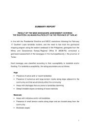
<strong>SUMMARY</strong> <strong>REPORT</strong><br />
RESULTS OF THE <strong>MGB</strong> GEOHAZARD ASSESSMENT COVERING<br />
THIRTY TWO (32) MUNICIPALITIES/CITIES IN THE PROVINCE OF NUEVA ECIJA<br />
In line with the recent Presidential Directive and NDCC resolutions following the<br />
February 17 Southern Leyte landslide incident, and the need to fast track the geohazard<br />
mapping program along the eastern seaboard of the Philippines, geologists from the<br />
Mines and Geosciences Bureau-<strong>Region</strong>al Office <strong>III</strong> (<strong>MGB</strong>-R3) conducted a geohazard<br />
assessment of the barangays in the municipalities/cities in the province of Nueva Ecija.<br />
Each barangay was classified according to their susceptibility to landslide and/or<br />
flooding. For landslide susceptibility, the rating parameters are as follows:<br />
High<br />
• Presence of active and/ or recent landslides<br />
• Presence of numerous and large tension cracks along slope adjacent to the<br />
community and that would directly affect the community<br />
• Areas with drainages that are prone to landslides damming<br />
• Steep/Unstable slopes consisting of loose materials<br />
Moderate<br />
• Areas with indicative and/or old landslides<br />
• Presence of small tension cracks along slope and are located away from the<br />
community<br />
• Moderate slopes<br />
Low<br />
• Low to gently sloping<br />
• No presence of tension cracks<br />
1
Each barangay was rated into low, moderate or high for flooding susceptibility with the<br />
rating parameters as follows:<br />
Low<br />
• 0 – 0.5 meter depth of floodwaters<br />
Moderate<br />
• 0.51 – 1 meter depth of floodwaters<br />
High<br />
• > 1 meter depth of floodwaters<br />
With regards to landslide susceptibility, the barangays assessed include areas that are<br />
located on and/or near slopes and riverbanks and have the potential for landslide<br />
occurrence. The rating of each barangay presented herein particularly refers to the<br />
barangay proper since majority of the population is located there. It should be noted,<br />
however, that the rating does not necessarily reflect those of the sitios. These<br />
barangays were presented with a Landslide Threat Advisory informing their<br />
susceptibility to landslides and the corresponding recommendations particular to the<br />
barangay.<br />
The flood susceptibility of the barangays in the ten (10) municipalities/city was also<br />
assessed. Barangays classified with moderate to high susceptibility to flooding are<br />
located in identified low portions of the barangay, in topographically low-lying areas<br />
and/or near a major river system. These barangays were presented with a Geohazard<br />
Threat Advisory informing their susceptibility to flooding and the corresponding<br />
recommendations particular to the barangay.<br />
2
Table 1. Number of Assessed Barangays<br />
Municipality/City Total<br />
Number of<br />
Barangays<br />
Barangays<br />
Assessed<br />
1. Aliaga 26 26<br />
2. Bongabon 28 28<br />
3. Cabanatuan City* 89 89<br />
4. Carranglan 17 17<br />
5. Cuyapo 51 51<br />
6. Gabaldon 16 16<br />
7. City of Gapan 23 23<br />
8. Gen. M. Natividad 20 20<br />
9. Gen. Tinio 12 12<br />
10. Guimba 64 64<br />
11. Laur 17 17<br />
12. Licab 11 11<br />
13. Llanera 22 22<br />
14. Lupao 24 24<br />
15. Science City of Muñoz 37 37<br />
16. Nampicuan 21 21<br />
17. Palayan City* 20 20<br />
18. Pantabangan 14 14<br />
19. Peñaranda 10 10<br />
20. Quezon 16 16<br />
21. Rizal 22 22<br />
22. San Jose City 38 38<br />
23. San Leonardo 15 15<br />
24. Sta. Rosa 33 33<br />
25. Sto. Domingo 24 24<br />
26. Talavera 53 53<br />
27. Talugtug 28 28<br />
28. Zaragosa 19 19<br />
29. Cabiao** 23 23<br />
30. Jaen** 27 27<br />
31. San Antonio** 16 16<br />
32. San Isidro** 9 9<br />
TOTAL<br />
845<br />
845<br />
*- UNDP 2005 (<strong>MGB</strong>CO), updating of hazard maps conducted by the <strong>MGB</strong>R3<br />
**- conducted during the 2004-2005 hazard mapping along Pampanga River<br />
3
<strong>SUMMARY</strong> OF THE ASSESSMENT:<br />
1. Municipality of Aliaga<br />
• In terms of landslide susceptibility, no barangays in Aliaga have the potential for<br />
landslide occurrence.<br />
• Active riverbank erosion is observed in three (3) barangays (Sta. Monica, San<br />
Eustacio and San Emiliano).<br />
• There are ten (10) barangays with none to low susceptibility to flooding<br />
(Magsaysay, Santiago, San Felipe (Bata), Umangan, San Eustacio, Sto. Tomas,<br />
Macabucod, San Pablo (Matanda), Poblacion Centro and Poblacion West)<br />
• There are ten (10) barangays with low to moderate susceptibility to flooding.<br />
Most of the residential area has low flooding susceptibility. Agricultural areas of<br />
the barangay has moderate to high susceptibility (Sto. Rosario, Bucot, San Pablo<br />
Bata, Poblacion East I, Poblacion East II, Poblacion West <strong>III</strong>, San Carlos, Betes,<br />
Pantok and Sunson).<br />
• There are three (3) barangays with moderate to high susceptibility to flooding.<br />
These barangays have portions adjacent to active creeks and river channel (Sta.<br />
Monica, San Juan and San Felipe Matanda).<br />
• There are two (2) barangays with low, moderate to high susceptibility to flooding.<br />
The barangay has naturally low-lying areas and portions located near active<br />
creeks and river channel (San Emiliano and La Purisima).<br />
2. Municipality of Bongabon<br />
• There is one (1) barangay with high landslide and debris flow susceptibility (Labi)<br />
• There are four (4) barangays with low flood susceptibility (Magtanggol Palomaria,<br />
Sinipit and Olivete).<br />
• There are two (2) barangays with low to moderatye flood susceptibility (Antipolo<br />
and Makabaklay)<br />
• There are five (5) barangays with moderate flood susceptibility (Pesa, Tugatog,<br />
Larcon, Cruz and Santor).<br />
• There are three (3) barangays with moderate to high flood susceptibility (Vega,<br />
Ariendo and Lusok).<br />
4
• There are four (4) barangays with portions susceptible to high level floods. These<br />
barangays are located near active creeks and Digmala River and with portions<br />
that are located in generally low-lying areas. (Labi, Curva and Caingin).<br />
• Riverbank erosion is identified in four (4) barangays (Calaanan, Pesa,Tugatog<br />
and Larcon)<br />
3. Cabanatuan City<br />
• Updating of the 2005 Hazard Maps (UNDP 2005)<br />
• Location of the barangay centers included in the geohazard data base<br />
• Hazard identified is mostly related to flooding from the overflow of major rivers<br />
including Pampanga River, Cabu River and creeks traversing the area.<br />
• Majority of the city has a low susceptibility to flooding. Barangays with moderate<br />
to high susceptibility are those located adjacent to the river and located in the<br />
generally low-lying areas. With historical moderate to high susceptibility to<br />
flooding and flashflooding particularly in the areas influenced by Pampanga River<br />
and Cabu River, and flash flood coming from the adjacent mountainous<br />
municipalities and with natural drainage draining towards the city.<br />
4. Municipality of Carranglan<br />
• There are two (2) barangays with low landslide susceptibility (Salazar and<br />
Burgos)<br />
• There are six (6) barangays with moderate to high landslide susceptibility (Gen.<br />
Luna, Capintalan, Minuli, Putlan, Piut and Joson(Digdig) )<br />
• Active riverbank erosion is observed in two (2) barangays (Piut and Puncan)<br />
• There are four (4) barangays with low susceptibility to flooding (T. L. Padilla, F. C<br />
Otic, Bunga and Putlan)<br />
• There are six (6) barangays with low to moderate susceptibility to flooding. Most<br />
areas of the barangay are low susceptible. Agricultural lands and portions near<br />
creek/river are moderately susceptible to flooding. (D. L. Maglanoc, G. S.<br />
Rosario, R. A. Padilla, San Agustin, Puncan and Bantug)<br />
• There are two (2) barangays with portions susceptible to high level floods. These<br />
barangays are located near active creeks and Carranglan River and with portions<br />
that are located in generally low-lying areas. (Bantug and Gen. Luna)<br />
5
• There are six (6) barangays with landslide susceptibility due to faulting and<br />
seismicity (Capintalan, Minuli, Putlan, Piut, Joson (Digdig) and Puncan)<br />
5. Municipality of Cuyapo<br />
• There are thirty five (35) barangays with low susceptibility to flooding (barangay<br />
centers and populated areas) in the municipality of Gerona (Sta. Clara,<br />
Nagmisaan, Burgos, Cabileo, Curva, Simimbaan, Sabit, Bued, Malineng, Sta.<br />
Cruz, Cacapasan, Colosboa, Rizal, Salagusog, Columbitin, Paitan Sur, Paitan<br />
Norte, Nagcuralan, San Juan, Landig, Bonifacio, Baloy, Tutuloy, Calancuasan<br />
Sur, Calancuasan Norte, Luna, Maycaban, Landig, Cabatuan, Malbeg, Bantog,<br />
Latap, Pugo, District 1,2 and 6). Most of the purok affected with localized flooding<br />
are located in the low-lying portion of the barangay, do not have sufficient<br />
drainage and located near the creek/river systems traversing the barangay.<br />
• The are sixteen (16) barangays experiencing different susceptibility to flooding<br />
from low, moderate to high depending on the topographic location<br />
(Tagtagumbao, Ungab, Districts [4, 5, 7, 8], San Antonio, Loob, Bentigan, San<br />
Jose, Bulala, Bibiclat, Matindeg, Bambanaba, Piglisan, Villa Flores). These are<br />
low-lying areas affected by the overflow from the creek/rivers and excessive<br />
surface run-off coming from the adjacent barangays and municipalities.<br />
Backflooding results from the inadequate drainage and exit points during<br />
unusually heavy rainy day and typhoon periods. Structurally controlled flooding<br />
such as elevated roads and road system with insufficient drainage, irrigation<br />
canals and excessive release of water from dams in the nearby municipalities of<br />
Nueva Ecija and Pangasinan is also a possible cause.<br />
• The agricultural areas/farm lots have a moderate to high susceptibility to flooding.<br />
• Localized flooding that usually subside after the rains can be attributed to<br />
inadequate drainage system during periods of unusually heavy precipitation.<br />
• For landslide susceptibility, there are five barangays with low to moderate<br />
susceptibility to landslides. The topography is generally gently sloping and no<br />
tension cracks were observed (Paitan Sur, Paitan Norte, Nagcuralan, San Juan<br />
and Landig).<br />
6. Municipality of Gabaldon<br />
• There are three (3) barangays with high landslide susceptibility (Cuyapa,<br />
Pinamalisan, and Sawmill).<br />
6
• There are six (6) barangays with moderate landslide susceptibility (Calabasa,<br />
Macasandal, Malinao, Pantoc, South Poblacion, and Tagumpay).<br />
• There are four (4) barangays with low landslide susceptibility (Bagong Sikat,<br />
Bagting, Bantug, and Bitulog – North Poblacion).<br />
• There are three (3) barangays with no landslide susceptibility (Bugnan,<br />
Camachile, and Ligaya).<br />
• In terms of flood and flashflood susceptibility, all assessed barangays were found<br />
to be susceptible to flooding. These barangays are located in low-lying areas<br />
and/or lie near a major river system.<br />
7. City of Gapan<br />
• In terms of landslide susceptibility, no barangays in the City of Gapan have the<br />
potential for landslide occurrence.<br />
• Active riverbank erosion is observed in four (4) barangays (Parcutela, Marelo,<br />
San Lorenzo and Kapalangan).<br />
• There is one (1) barangay with low to high susceptibility to flooding (Mangino)<br />
• There are twenty one (21) barangays with moderate to high susceptibility to<br />
flooding. These barangays have portions adjacent to active creeks and river<br />
channel (Parcutela, Marelo, San Roque, Malimba, Sto. Cristo Sur, Sto. Cristo<br />
Norte, Bayanihan, San Nicolas, Pambuan, San Lorenzo, San Vicente, Sta. Cruz,<br />
Maburak, Mabuga, Putting Tubig, Bungo, Mahipon, Kapalangan, Bulak, Sto. Niño<br />
and Balante).<br />
• There is one (1) barangay with high susceptibility to flooding. The barangay has<br />
portions located near active creeks and river channel (Makabaklay).<br />
8. Municipality of Gen. M. Natividad<br />
• There are six (6) barangays with low susceptibility to flooding (barangay centers<br />
and populated areas) in the municipality of Gen. Natividad (Pinahan, Platero,<br />
Natividad, Magasawang Sampaloc, Balangkare Norte and Balangkare Sur).<br />
• There are four (4) barangays with low susceptibility to flooding in most areas of<br />
the barangay but there are purok/sitio that have moderate susceptibility to<br />
flooding. Most of the areas affected with localized flooding are located in the lowlying<br />
portion of the barangay, agricultural areas, no sufficient drainage, located<br />
7
near the creek/river/irrigation channels traversing the barangay and backflooding<br />
(Manarog, Talabutab Norte, Belen and Poblacion).<br />
• There are ten (10) barangays with low susceptibility to flooding in most areas but<br />
there are purok/sitio that have moderate to high susceptibility to flooding. Most of<br />
the areas affected with flooding are located near the Pampanga River, generally<br />
locate in the low-lying portion of the barangay, agricultural areas, no sufficient<br />
drainage, located near the creek/river/irrigation channels traversing the barangay<br />
and backflooding (Sapang Bato, Kabuluan, Mataas na Kahoy, Burol, Balaring,<br />
Pulong Singkamas, Picaleon, Panacsac, Talabutab Sur and Bravo)<br />
• The agricultural areas/farm lots have a moderate to high susceptibility to flooding.<br />
• Localized flooding that usually subside after the drains can be attributed to<br />
inadequate drainage system during periods of unusually heavy precipitation.<br />
9. Municipality of Gen. Tinio<br />
• In terms of landslide susceptibility, no barangays in Gen. Tinio have the potential<br />
for landslide occurrence.<br />
• Active riverbank erosion is observed in seven (7) barangays (Pias, Rio Chico,<br />
Poblacion East, Poblacion Centro, Poblacion West, Bago and Padolina).<br />
• There are four (4) barangays with low susceptibility to flooding (Nazareth, San<br />
Pedro, Sampaguita and Pulong Matong).<br />
• There is one (1) barangay with low to moderate susceptibility to sheet flooding<br />
(Concepcion)<br />
• There are four (4) barangays with portions susceptible to moderate to high level<br />
floods. These barangays have portions adjacent to active creeks and river<br />
channel (Pias, Rio Chico, Bago and Padolina).<br />
• There are three (3) barangays with portions susceptible to high level floods.<br />
These barangays have portions located near active creeks and river channel<br />
(Poblacion East, Poblacion Centro and Poblacion West).<br />
10. Municipality of Guimba<br />
• In terms of landslide susceptibility, no barangays in Guimba have the potential for<br />
landslide occurrence.<br />
8
• Active riverbank erosion is observed in twenty six (26) barangays (Sta. Cruz, San<br />
Bernardino, Caballero, Triala, Culong, Bagong Barrio, Pasong Inchic, San<br />
Rafael, Casongsong, Bacayao, Macamias, Guiset, San Andres, Ayos Lomboy,<br />
Macapabellag, Faigal, Cavite, Sta. Lucia, San Miguel, Manacsac, Caingin-Tabing<br />
Ilog, Calem, Partida II, Macatcatuit, Narvacan II and Sta. Veronica.<br />
• There are sixteen (16) barangays with none to low susceptibility to flooding<br />
(Tampac I, Tampac II, Tampac <strong>III</strong>, Sta. Cruz, San Bernardino, Caballero, Triala,<br />
Consuelo, San Roque, Manggang Marikit, San Rafael, Naglabrahan, Cardinal,<br />
Magpandayan, Catimon and Banitan).<br />
• There are thirteen (14) barangays with low to moderate susceptibility to flooding.<br />
Most of the residential area has low flooding susceptibility. Identified low-lying<br />
and agricultural areas of the barangay has moderate to high susceptibility<br />
(Bagong Barrio, Pasong Inchic, Casongsong, Guiset, San Andres, Camiling,<br />
Cabaruan, Lamorito, Maybubon, San Agustin, Magpandayan, Balingog East,<br />
Bantug and Sto. Cristo).<br />
• There are twelve (12) barangays with moderate to high susceptibility to flooding.<br />
The barangay has naturally low-lying areas and portions adjacent to active<br />
creeks and river channel (Culong, Cawayan Bugtong, Narvacan I, Macamias,<br />
Ayos Lomboy, San Miguel, Galvan, Yuzon, Agcano, Partida I, Macatcatuit and<br />
Saranay).<br />
• There are sixteen (16) barangays with low, moderate to high susceptibility to<br />
flooding. The barangay has naturally low-lying areas and portions located near<br />
active creeks and river channel (Pacac, Bacayao, Balbalino, San Marcelino,<br />
Saint John (Poblacion), Macapabellag, Sta. Ana, Faigal, Sinulatan, Sta. Lucia,<br />
Bulakid, Escano, Manacsac, Balingog West, Subol and Maturanoc).<br />
• There are eight (7) barangays with high susceptibility to flooding. These<br />
barangays have portions adjacent to active creeks and river channel, and has<br />
naturally low-lying areas (Cavite, Caingin-Tabing Ilog, Calem, Partida II, Lennec,<br />
Narvacan II and Sta. Veronica).<br />
11. Municipality of Laur<br />
• There is one (1) barangay with moderate landslide susceptibility (Bayug)<br />
• There are four (4) barangays with low landslide susceptibility (Bacao, Burac,<br />
Pantoc and San Fernando).<br />
• There are twelve (12) barangays with low flood susceptibility (Poblacion I, II, <strong>III</strong>,<br />
San Felipe, San Juan. Paludpod, Pintol, Bacao, Pantoc, Bayug, San Isidro and<br />
San Fernando).<br />
9
• There is one (1) barangay with moderate flood susceptibility (Pinagbayanan)<br />
• There are nine (9) barangays with low to moderate flood susceptibility (Poblacion<br />
IV, Siclong, San Vicente, Canantong, San Josef, Sagana, Labi, Casa Real and<br />
Burac).<br />
• There are five (5) barangays and one (1) sitio with portions susceptible to high<br />
level floods. These barangays are located near active creeks and Coronel River<br />
and with portions that are located in generally low-lying areas. (Pacarso,<br />
Kamuning, Panaulo, Betania, San Antonio and Sitio Pangarulong)<br />
• There are two (2) barangays and one (1) sitio with portions prone to liquefaction<br />
(Panaulo, Betania and Sitio Pangarulong)<br />
12. Municipality of Licab<br />
• In terms of landslide susceptibility, no barangays in Licab have the potential for<br />
landslide occurrence.<br />
• Active riverbank erosion is observed in three (3) barangays (Tabing Ilog,<br />
Villarosa and San Cristobal).<br />
• There are three (3) barangays with low to moderate susceptibility to flooding.<br />
Most of the residential area has low flooding susceptibility. Agricultural areas of<br />
the barangay has moderate to high susceptibility (San Casimiro, Sta. Maria and<br />
San Jose).<br />
• There are seven (7) barangays with moderate to high susceptibility to flooding.<br />
These barangays have portions adjacent to active creeks and river channel<br />
(Poblacion, Poblacion Norte, San Juan, Tabing Ilog, Linao, Villarosa and San<br />
Cristobal).<br />
• There is one (1) barangay with high susceptibility to flooding. The barangay has<br />
naturally low-lying areas and portions located near active creeks and river<br />
channel (Aquino).<br />
13. Municipality of Llanera<br />
• There are eighteen (18) barangays with low susceptibility to flooding (barangay<br />
centers and populated areas) in the municipality of Llanera (Gomez, Florida<br />
Blanca, Villa Veniegas, Sta. Barbara, Ligaya, San Nicolas, Caridad Norte, Casile,<br />
10
Gen Luna, Murcon, Gen. Ricarte, Mabini, Inanama, A. Bonifdacio Sur, A.<br />
Bonifacio Norte, Victoria, Bagumbayan and Plaridel).<br />
• There are four (4) barangays with low susceptibility to flooding in most areas but<br />
there are purok/sitio that have moderate to high susceptibility to flooding. Most of<br />
the areas affected with localized flooding are located in the low-lying portion of<br />
the barangay, agricultural areas, no sufficient drainage, located near the<br />
creek/river/irrigation channels traversing the barangay and backflooding (Caridad<br />
Sur, San Felipe, San Vicente and Basque).<br />
• The agricultural areas/farm lots have a moderate to high susceptibility to flooding.<br />
• Localized flooding that usually subside after the rains can be attributed to<br />
inadequate drainage system during periods of unusually heavy precipitation.<br />
14. Municipality of Lupao<br />
• In terms of landslide susceptibility, there are six (6) barangays in Lupao that are<br />
located on and/or near slopes and have potential for landslide occurrence. The<br />
rating of each barangay presented herein particularly refers to the barangay<br />
proper since majority of the population is located there.<br />
• Most of the barangays in the municipality of Lupao has a low flood and flashflood<br />
susceptibility. For this rapid geohazard assessment and mapping, flooding had<br />
been classified into flash, sheet, channel confined or river flooding and urban<br />
flooding. Since the municipality is generally located at a higher elevation than the<br />
nearby municipalities, there is a low incidence of the creeks and rivers<br />
overtopping its banks. However, there are barangays that are possible landslide<br />
debris accumulation zones based on past events such as the North Luzon<br />
Earthquake of 1990.<br />
• The twenty four (24) barangays in the municipality of Lupao have low<br />
susceptibility to flooding.<br />
• One barangay (1), Tienzo has a low susceptibility in most area of the barangay;<br />
however, Purok 3 has a moderate to high susceptibility to flooding.<br />
• Other hazards identified include river flooding or channel confined flooding,<br />
active river bank erosion and siltation. Riverbank erosion was observed in the<br />
active creeks/river and natural channels traversing the municipality (Arimal<br />
Creek, Panabcan River, Agupalo River, Balibago Creek, Alimutong Creek,<br />
Macanawed River). Siltation will result to shallow riverbeds.<br />
15. Science City of Muñoz<br />
11
• There are twenty four (24) barangays with low susceptibility to flooding (Bantug,<br />
Cabisuculan, Calabalabaan, Calisitan, Curva, Gabaldon, Labney, Licaong,<br />
Linglingay, Magtanggol, Maligaya, Mangandingay, Maragol, Mapangpang,<br />
Naglabrahan, Poblacion East, Poblacion South, Poblacion West, Rang-ayan,<br />
Rizal, San Andres, Villa Quizon, Villa Isla and Villa Nati).<br />
• There are seven (7) barangays with low to moderate susceptibility to flooding.<br />
Agricultural areas of the barangay, identified low-lying areas and those located<br />
near the creek/river channel has moderate susceptibility (Balante, Bical,<br />
Palusapis, Poblacion North, San Antonio, San Felipe and Sapang Cauayan).<br />
• There are four (4) barangays with moderate to high susceptibility to flooding.<br />
The barangay has naturally low-lying areas and portions located near active<br />
creeks and river channel (Bagong Sikat, Catalanacan, Franza and Matingkis).<br />
• Riverbank erosion was observed in the active creeks/river and natural channels<br />
traversing the municipality such as Ilog Baliwag, Calisitan Creek, Sinulatan<br />
Creek and Napnitan Creek.<br />
• Siltation is evident along the active channels traversing the municipality.<br />
• The Casecnan irrigation system passes through several barangays of the city.<br />
To date, the effect of the Casecnan canals with regard to flooding is not evident<br />
yet.<br />
16. Municipality of Nampicuan<br />
• All twenty one (21) barangays experience varying degrees of flooding.<br />
• There are ten (10) barangays with low to moderate susceptibility to flooding (Edy,<br />
Tony, Maeling, Medico, Cabawangan, East Central Poblacion, South West<br />
Poblacion, West Poblacion, North West Poblacion and West Central Poblacion).<br />
• Nine (9) barangays with moderate to high susceptibility to flooding (Recuerdo,<br />
Mayantoc, Alemania, Cabaducan East, Amb. Alzate Village, Cabaducan West,<br />
South East Poblacion, Estacion and South Central Poblacion)<br />
• Only one (1) barangay has a moderate susceptibility to flooding.<br />
• The agricultural areas/farm lots have a moderate to high susceptibility to flooding.<br />
• Localized flooding that usually subside after the rains can be attributed to<br />
inadequate drainage system during periods of unusually heavy precipitation.<br />
12
17. Palayan City<br />
• Updating of the 2005 Hazard Map (UNDP 2005)<br />
• Barangay locations are included in the geohazard database.<br />
• Landslide and flooding hazards are present in the city.<br />
• Barangays with susceptibility to flooding are influenced by the Pampanga River<br />
and creeks traversing the barangays. There are generally low lying portions with<br />
moderate to high susceptibility to flooding.<br />
• The mountainous areas have moderate to high susceptibility to landslides.<br />
18. Municipality of Pantabangan<br />
• There are three (3) barangays with low landslide susceptibility (East Poblacion,<br />
Malbang and Fatima).<br />
• There are three (3) barangays with low to moderate landslide susceptibility<br />
especially along the highway and road shoulders (BLISS-San Juan, Naponnapon<br />
and Conversion).<br />
• There is one (1) barangay with moderate to high landslide susceptibility. There<br />
are indications of old landslides in the barangay (Marikit).<br />
• Active riverbank erosion is observed in three (3) barangays (Fatima, Cambitala<br />
and BLISS-San Juan).<br />
• There are two (2) barangays with portions susceptible to moderate to high level<br />
floods. These barangays are located near active creeks/river and with portions<br />
that are located in generally low-lying areas. (Ganduz and Cadaclan).<br />
19. Municipality of Peñaranda<br />
• In terms of landslide susceptibility, no barangays in Peñaranda have the potential<br />
for landslide occurrence.<br />
• Active riverbank erosion is observed in seven (7) barangays (Callos, San Josef,<br />
Sinasajan, Las Piñas, Sto. Tomas, Poblacion 3 and Poblacion 4).<br />
13
• There are three (3) barangays with low susceptibility to flooding (San Mariano,<br />
Poblacion 1 and Poblacion 2).<br />
• There are seven (7) barangays with portions susceptible to moderate to high<br />
level floods. These barangays have areas located near active creeks and river<br />
channel (Callos, San Josef, Sinasajan, Las Piñas, Sto. Tomas, Poblacion 3 and<br />
Poblacion 4)).<br />
• In terms of landslide susceptibility, no barangays in Sasmuan have the potential<br />
for landslide occurrence.<br />
• There are seven (7) barangays with moderate to high susceptibility to flooding<br />
(Sta. Lucia, Sta. Monica, San Antonio, San Nicolas 1 st , San Nicolas 2 nd , Sto.<br />
Tomas and San Pedro).<br />
• There are five (5) barangays with high susceptibility to flooding. These barangays<br />
have portions that are adjacent to active creeks and river channel and are<br />
generally located in the low-lying areas (Batang 1 st , Batang 2 nd , Mabuanbuan,<br />
Sebitanan and Malusak).<br />
• Liquefaction is possible in all barangays.<br />
20. Municipality of Quezon<br />
• In terms of landslide susceptibility, no barangays in Quezon have the potential for<br />
landslide occurrence.<br />
• Active riverbank erosion is observed in seven (7) barangays (San Alejandro, Sta.<br />
Rita, Ilog Baliwag, Sta. Clara, Sto. Cristo, San Andres I and San Andres II).<br />
• There are four (4) barangays with low susceptibility to flooding (Sto. Tomas<br />
Feria, San Miguel, San Manuel and Doña Lucia)<br />
• There are seven (7) barangays with low to moderate susceptibility to flooding.<br />
Most of the residential area has low flooding susceptibility. Agricultural areas of<br />
the barangay has moderate to high susceptibility (Bertese, Sta. Rita, Sta. Clara,<br />
Brgy. I (Poblacion), Brgy. II (Poblacion), Dulong Bayan and San Andres I).<br />
• There are two (2) barangays with low, moderate to high susceptibility to flooding.<br />
The barangay has naturally low-lying areas and portions located near active<br />
creeks and river channel (San Alejandro and Ilog Baliwag).<br />
• There are three (3) barangays with high susceptibility to flooding. These<br />
barangays have portions adjacent to active creeks and river channel, and has<br />
naturally low-lying areas (Pulong Bahay, Sto. Cristo and San Andres II).<br />
14
21. Municipality of Rizal<br />
• There is one (1) barangay with high landslide susceptibility (Sta. Monica).<br />
• There are three (3) barangays with low landslide susceptibility (Casilagan, Villa<br />
Paraiso and Villa Labrador).<br />
• Active riverbank erosion is observed in one (1) barangay (Canaan East).<br />
• These barangays are with low susceptibility to flooding (Portal, Balasing, Del<br />
Pilar, Aglipay, Bicos, Maligaya, Agbannawag, Pag-asa, Paco Roman,<br />
Cabucbucan, Canaan East, Canaan West, Gen. Luna, Casilagan, Villa Paraiso,<br />
Villa Labrador)<br />
• Although most of the populated areas of the barangay have low susceptibility to<br />
flooding, there are barangays with portions susceptible to moderate to high level<br />
floods. These barangays have populated portions located near active creeks and<br />
the Pampanga River and with portions that are located in generally low-lying<br />
areas. (,Estrella/Subdivision, Calaocan, San Gregorio, San Esteban,<br />
Cabucbucan, Macapsing, Canaan East and Gen. Luna).<br />
22. City of San Jose<br />
• There is one barangay with low landslide susceptibility (Tayabo)<br />
• There is one barangay with low to moderate landslide susceptibility (Floresta)<br />
• There are twenty five (25) barangays with low flooding susceptibility. Isolated and<br />
localized flooding are structurally controlled and due to drainage problems. (Sto.<br />
Niño 3 rd , Sto. Niño 2 nd , Manikla, Tayabo, Malasin, Porais, Villa Joson, San Juan,<br />
Villa Marina, Kaliwanagan, Culaylay, Palestina, Pinili, Bagong Sikat,<br />
Kamanagsakan, Calaocan, Sibut, San Agustin, Abar 1 st , Sto. Tomas, Rafael<br />
Rueda, Crisanto Sanchez, Canuto Ramos, Raymundo Eugenio, F. E. Marcos)<br />
• There are four (4) barangays with low to moderate flooding susceptibility.<br />
Localized flooding is due to absence of drainage system and overflow from silted<br />
river channels. Moderately flooded are agricultural areas and identified low<br />
portion of the barangay. (Tulat, Dizol, Abar 2 nd and Caanawan)<br />
• There are six (6) barangays with moderate to high flooding susceptibility.<br />
Flooding is due to insufficient and clogged drainage system, overflow from silted<br />
river channels and identified low-lying areas compared to the rest of the city.<br />
(Sto. Niño 1 st , Kita-Kita, Tabulak, Parang Mangga, A. Pascual and San Mauricio)<br />
15
• Active riverbank erosion is observed in three (3) barangays (Tulat, Tabulak and<br />
Parang Mangga).<br />
23. Municipality of San Leonardo<br />
• In terms of landslide susceptibility, no barangays in San Leonardo have the<br />
potential for landslide occurrence.<br />
• Active riverbank erosion is observed in seven (7) barangays (Pias, Rio Chico,<br />
Poblacion East, Poblacion Centro, Poblacion West, Bago and Padolina).<br />
• There are four (4) barangays with low susceptibility to flooding (Nazareth, San<br />
Pedro, Sampaguita and Pulong Matong).<br />
• There is one (1) barangay with low to moderate susceptibility to sheet flooding<br />
(Concepcion)<br />
• There are four (4) barangays with portions susceptible to moderate to high level<br />
floods. These barangays have portions adjacent to active creeks and river<br />
channel (Pias, Rio Chico, Bago and Padolina).<br />
• There are three (3) barangays with portions susceptible to high level floods.<br />
These barangays have portions located near active creeks and river channel<br />
(Poblacion East, Poblacion Centro and Poblacion West).<br />
24. Municipality of Sta. Rosa<br />
• In terms of landslide susceptibility, no barangays in Sta. Rosa have the potential<br />
for landslide occurrence.<br />
• There are ten (10) barangays with low susceptibility to flooding (Mapalad,<br />
Malacañang, Liwayway, Tagpos, Soledad, Rajal Centro, Rajal Sur, Rajal Norte,<br />
Inspector, Sto. Rosario).<br />
• There are fifteen (15) barangays with moderate to high susceptibility to flooding<br />
(San Isidro, San Pedro, San Joseph, Maliolio, Sta. Teresita, Zamora, Gomez,<br />
San Mariano, Luna, Valenzuela, Mabini, Aguinaldo, Burgos, Tramo and<br />
Cojuangco).<br />
• There are four (4) barangays with high susceptibility to flooding. These<br />
barangays have portions that are adjacent to active creeks and river channel and<br />
16
are generally located in the low-lying areas (La Fuente, Lourdes, Isla and<br />
Berang).<br />
• There are four (4) barangays susceptible to low, moderate to high flooding.<br />
These barangays are adjacent to creek and are with identified low-lying areas<br />
(Sapsap, Rizal, Del Pilar and San Gregorio)<br />
• .Active riverbank erosion is present in six (6) barangays (Mapalad, Malacañang,<br />
Sto. Rosario, Sapsap, Isla and Tramo).<br />
• There is possible liquefaction in one (1) barangay (Isla).<br />
25. Municipality of Sto. Domingo<br />
• There are sixteen (16) barangays with low susceptibility to flooding (Baloc,<br />
Buasao, Burgos, Cabugao, Casulucan, Comitang, Gen. Luna, Malasin,<br />
Malayantok, Mambarao, Poblacion, Pulong Buli, Sagaba, San Francisco, San<br />
Pascual and Sta. Rita). Brgy. Comitang has portions that are susceptible to<br />
moderate to high flooding.<br />
• There are two (2) barangays with low to moderate susceptibility to flooding (Hulo<br />
and Sto. Rosario).<br />
• There are five (5) barangays with moderate to high susceptibility to flooding. The<br />
barangay has naturally low-lying areas and portions located near active creeks<br />
and river channel (Concepcion, Maligaya, Dolores, San Agustin and San<br />
Fabian).<br />
• Brgy. Mabini has portions that are susceptible to low to moderate and moderate<br />
to high level floods.<br />
• Riverbank erosion was observed in the active creeks/river and natural channels<br />
traversing the municipality such as Talavera River, Sapang Cauayan, Papaya<br />
River and Ilog Baliwag.<br />
• Siltation is evident along the active channels traversing the municipality.<br />
26. Municipality of Talavera<br />
• There are forty two (42) barangays with low susceptibility to flooding (San<br />
Pascual, Lomboy, Campos, Burnay, Valle, Calipahan, Andal Alino, Esguerra,<br />
Marcos, Mamandil, Bantug, Dinarayat, Bacal I, Bacal II, Bacal <strong>III</strong>, Matingkis,<br />
Baluga, San Miguel na Munti, Sicsican Matanda, Casulucan Este, Tabacao,<br />
Basang Hamog, Pantoc Bulac, Tagaytay, Cabubulaunan, Caputian, Mabuhay,<br />
Collado, Kinalanguyan, Sibul, Bugtong na Buli, Dimasalang Norte, Dimasalang<br />
Sur, Bantug Hacienda, Gulod, Sampaloc, Paludpod, San Ricardo, Bagong<br />
Sikat, Homestead I, Homestead II and Pinagpanaan).<br />
17
• There are four (4) barangays with low to moderate susceptibility to flooding.<br />
Agricultural areas of the barangay, identified low-lying areas and those located<br />
near the creek/river channel has moderate susceptibility (Pulong San Miguel,<br />
Maestrang Kikay, La Torre, Caaminaplahan and Pula).<br />
• There are four (4) barangays with low, moderate to high susceptibility to<br />
flooding. The barangay has naturally low-lying areas and portions located near<br />
active creeks and river channel. There are also purok of the barangays that are<br />
located below the road level, such that when the river overflows, unusually high<br />
level floods had been experienced (Matias, Poblacion Sur, Pulong San Miguel<br />
and Bulac).<br />
• There are three (3) barangays with moderate to high susceptibility to flooding<br />
(Bagong Silang, Pagasa and Minabuyok). Silted creek channels, topographic<br />
and structure control, and being adjacent to the creek/rivers are the factors that<br />
influence flooding in the vicinity.<br />
• Riverbank erosion was observed in the active creeks/river and natural channels<br />
traversing the municipality. Talavera River is the main drainage in the<br />
municipality. Other natural drainage include Siksikan River, Sapang Mangga,<br />
Pantoc Bulac Creek, Balasiwa Creek, Vaca Creek and Pinagpanaan Creek.<br />
• Siltation is evident along the active channels traversing the municipality.<br />
27. Municipality of Talugtog<br />
• There are eighteen (18) barangays with low susceptibility to flooding (barangay<br />
centers and populated areas) in the municipality of Talugtug (Alula, Sampaloc,<br />
Maasin, Villa Rosario, Calisitan, Culiat, Saguing, Buted, Tibag, Patola, Sto.<br />
Domingo, Sta. Catalina, Osmeña, Roxas, Quirino, Magsaysay, Quezon and<br />
Cabiangan).<br />
• There are five (5) barangays with low susceptibility to flooding in most areas but<br />
there are purok/sitio that have moderate to high susceptibility to flooding. Most of<br />
the areas affected with localized flooding are located in the low-lying portion of<br />
the barangay, agricultural areas, do not have sufficient drainage and located near<br />
the creek/river/irrigation channels traversing the barangay (Saverona, Fronda,<br />
Villa Rosenda, Villa Boado and Mayamot II).<br />
• The are 5 (5) barangays experiencing different susceptibility to flooding from low,<br />
moderate to high depending on the topographic location (Nangabulan, Cinense,<br />
Tandoc, Mayamot and Baybayabas). These are low-lying areas affected by the<br />
overflow from the creek/rivers and excessive surface run-off coming from the<br />
18
adjacent barangays and municipalities. Backflooding results from the inadequate<br />
drainage and exit points during unusually heavy rainy day and typhoon periods.<br />
Structurally controlled flooding such as elevated roads and road system with<br />
insufficient drainage, irrigation canals and excessive release of water from dams<br />
and temporary water impoundments are also common factors.<br />
• The agricultural areas/farm lots have a moderate to high susceptibility to flooding.<br />
• Localized flooding that usually subside after the rains can be attributed to<br />
inadequate drainage system during periods of unusually heavy precipitation.<br />
28. Municipality of Zaragosa<br />
• In terms of landslide susceptibility, no barangays in Zaragosa have the<br />
potential for landslide occurrence.<br />
• There are seven (7) barangays with moderate to high susceptibility to flooding<br />
(San Vicente, Carmen, Pantoc, Concepcion, San Isidro, Sta. Cruz and San<br />
Rafael).<br />
• There are twelve (12) barangays with high susceptibility to flooding. These<br />
barangays have portions that are adjacent to active creeks and river channel<br />
and are generally located in the low-lying areas (Sta. Lucia Young, Sta. Lucia<br />
Old, Del Pilar, Sto. Rosario Young, Sto. Rosario Old, Macarse, Mayamot,<br />
Veleriana, Batitang, Manaol, H. Romero and Gen. Luna).<br />
It should be noted that these susceptibility ratings were arrived at as of the field<br />
assessment. However the rating could advance (e.g., from low to moderate, moderate<br />
to high) due to changing physical conditions. Hence, the <strong>MGB</strong> constantly recommends<br />
strict and continuous monitoring of the affected barangays.<br />
Attached herewith are the matrices of the municipalities included in the assessment.<br />
The geohazard assessment in the municipalities of Cabiao, Jaen, San Antonio and San<br />
Isidro was conducted in 2004-2005 during the Hazard Assessment along the Pampanga<br />
River. The location of the barangays was included in the geohazard data base. The<br />
data collected during this period was incorporated in the 1:50,000 Flood Susceptibility<br />
Map of the Province of Nueva Ecija.<br />
The hazard maps of Cabanatuan City and Palayan City was initially prepared by the<br />
<strong>MGB</strong>CO-UNDP 2005 and updated during this hazard mapping and assessment project.<br />
The location of the barangays was included in the geohazard data base. The data<br />
collected during this period was also incorporated in the 1:50,000 Flood Susceptibility<br />
Map of the Province of Nueva Ecija.<br />
19
<strong>MGB</strong>-R<strong>III</strong> Assessment Team<br />
Cecil G. Martinez Carolyn V. Sacdalan<br />
Supervising Geologist Senior Science Research Specialist<br />
Bryan Noel Mallare Rick Rodell Luis Clarissa G. Villanueva<br />
Senior Geologist Senior Geologist Senior Geologist<br />
Noted by:<br />
Noel B. Lacadin<br />
OIC, Geosciences Division<br />
20